Cof Cymru: National Historic Assets of Wales · Wales
Priory Hill House, including Railings & Service Wing at West End
Brecon, Powys, Wales
A Grade II listed building in Brecon, Powys, designated on 16 January 1952.
The record
- Designation
- Listed building, Grade II
- Broad class
- Domestic
- Date of designation
- 16 January 1952
- Town
- Brecon
- Community
- Brecon
- Unitary authority
- Powys
- Country
- Wales
- Coordinates
- 51.95039, -3.39164
- Cadw reference
- 7008
Slide toward Today to fade the historical sheet and see the modern map underneath.
David Rumsey Map Collection, Stanford LibrariesDavid Rumsey Map Collection, Stanford LibrariesDavid Rumsey Map Collection, Stanford LibrariesDavid Rumsey Map Collection, Stanford LibrariesDavid Rumsey Map Collection, Stanford Libraries
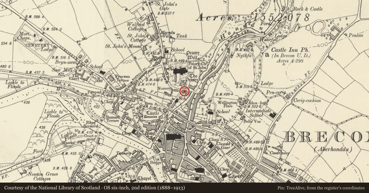
5 historical maps cover this location, the earliest the 1608 map "(13) Cambriae Typus." (David Rumsey Map Collection, Stanford Libraries).
Historical maps covering this location
- 1608 · (13) Cambriae Typus. (David Rumsey Map Collection, Stanford Libraries)
- 1636 · Cornubia : Devonia, Somersetus, Dorcestria, Wiltonia, Glocestria ... (David Rumsey Map Collection, Stanford Libraries)
- 1856 · 42. Brecon. (David Rumsey Map Collection, Stanford Libraries)
- 1898 · 213 Brecon (Hills) (David Rumsey Map Collection, Stanford Libraries)
- 1901 · Sheet 14. (David Rumsey Map Collection, Stanford Libraries)
Cadw's description
Location
On corner with The Postern.
History
House of around 1800.
Exterior
Three-storey house. Stucco. Eaves band, giant Corinthian pilasters at corners and bands at second and first floor levels. Slate hipped roof with overhanging eaves. North elevation of three bays with central projecting bay. Twelve-pane sash windows but with square 6-pane sashes on second floor. In centre, round-headed and pedimented doorcase with fielded panelled reveals, fielded panelled door and semi-circular fanlight with contemporary lampholder. East elevation of two bays.
At W end of house, a two-storey service wing with half-hipped slate roof and pebbledash cladding. Street elevation with attic window and with9-pane hopper window below it.
C19 area railings to Priory Hill and to E.
Interior
Good interior with original cornices, chimney pieces, panelled doors and staircase.
Reason for designation
Early C19 house and service wing retaing its external character and railings.
Nearby in the register
- 11 Priory HillDomesticunder 1 mi
- 13 Priory HillDomesticunder 1 mi
- 12 Priory HillNo class recordedunder 1 mi
- 14 Priory HillNo class recordedunder 1 mi
Other entries of the same register within about three miles of this one, by straight line.