Cof Cymru: National Historic Assets of Wales · Wales
The Almonry
Brecon, Powys, Wales
A Grade II listed building in Brecon, Powys, designated on 16 January 1952.
The record
- Designation
- Listed building, Grade II
- Broad class
- Health and Welfare
- Date of designation
- 16 January 1952
- Town
- Brecon
- Community
- Brecon
- Unitary authority
- Powys
- Country
- Wales
- Coordinates
- 51.95138, -3.39254
- Cadw reference
- 7000
Slide toward Today to fade the historical sheet and see the modern map underneath.
David Rumsey Map Collection, Stanford LibrariesDavid Rumsey Map Collection, Stanford LibrariesDavid Rumsey Map Collection, Stanford LibrariesDavid Rumsey Map Collection, Stanford LibrariesDavid Rumsey Map Collection, Stanford Libraries
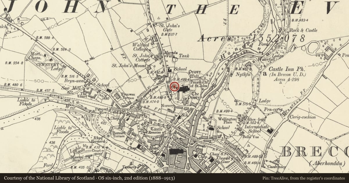
5 historical maps cover this location, the earliest the 1608 map "(13) Cambriae Typus." (David Rumsey Map Collection, Stanford Libraries).
Historical maps covering this location
- 1608 · (13) Cambriae Typus. (David Rumsey Map Collection, Stanford Libraries)
- 1636 · Cornubia : Devonia, Somersetus, Dorcestria, Wiltonia, Glocestria ... (David Rumsey Map Collection, Stanford Libraries)
- 1856 · 42. Brecon. (David Rumsey Map Collection, Stanford Libraries)
- 1898 · 213 Brecon (Hills) (David Rumsey Map Collection, Stanford Libraries)
- 1901 · Sheet 14. (David Rumsey Map Collection, Stanford Libraries)
Cadw's description
Location
On NW side of Cathedral precinct, near N gateway.
History
Medieval origins, perhaps incorporating parts of the Priory almonry. Secularised after Dissolution. Only the N and W walls incorporate medieval masonry, the building was largely rebuilt in late C18. Extended to S in C19. Restored about 1936 after the building became part of Cathedral; early C20 photos show R bay with lower roof line.
Exterior
South-west elevation of two storeys, 3 windows. Stone; roof of small stone slates; tall chimneys to centre, and R end. On first floor, three casement windows set at eaves. On ground floor, 3 casement windows in cambered heads. Gabled weatherboarded porch. Right return of 2 windows. Left return with window on each floor, and blocked medieval (?) doorway. To rear, irregular fenestration with, on ground floor, medieval lancet window.
Reason for designation
A building with medieval origins with Group Value with all the other listed buildings in the Cathedral precinct.
Nearby in the register
- Lychgate and Flanking WallsDomesticunder 1 mi
- Priory Walls, including North, West and Postern GatewaysReligious, Ritual and Funeraryunder 1 mi
- Tithe Barn, Brecon CathedralAgriculture and Subsistenceunder 1 mi
- 1 Priory HillDomesticunder 1 mi
Other entries of the same register within about three miles of this one, by straight line.