Cof Cymru: National Historic Assets of Wales · Wales
Postern House
Brecon, Powys, Wales
A Grade II listed building in Brecon, Powys, designated on 16 December 1976.
The record
- Designation
- Listed building, Grade II
- Broad class
- Civil
- Date of designation
- 16 December 1976
- Town
- Brecon
- Community
- Brecon
- Unitary authority
- Powys
- Country
- Wales
- Coordinates
- 51.94979, -3.39239
- Cadw reference
- 6991
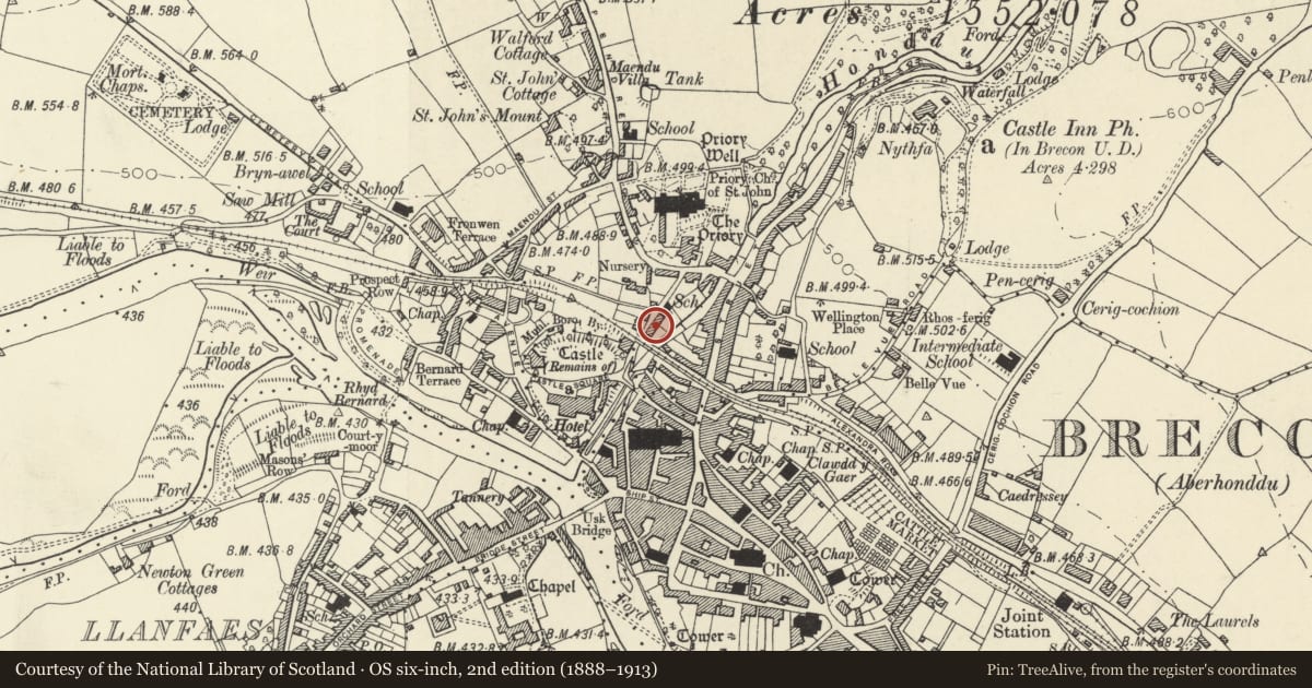
Slide toward Today to fade the historical sheet and see the modern map underneath.
David Rumsey Map Collection, Stanford LibrariesDavid Rumsey Map Collection, Stanford LibrariesDavid Rumsey Map Collection, Stanford LibrariesDavid Rumsey Map Collection, Stanford LibrariesDavid Rumsey Map Collection, Stanford Libraries
5 historical maps cover this location, the earliest the 1608 map "(13) Cambriae Typus." (David Rumsey Map Collection, Stanford Libraries).
Historical maps covering this location
- 1608 · (13) Cambriae Typus. (David Rumsey Map Collection, Stanford Libraries)
- 1636 · Cornubia : Devonia, Somersetus, Dorcestria, Wiltonia, Glocestria ... (David Rumsey Map Collection, Stanford Libraries)
- 1856 · 42. Brecon. (David Rumsey Map Collection, Stanford Libraries)
- 1898 · 213 Brecon (Hills) (David Rumsey Map Collection, Stanford Libraries)
- 1901 · Sheet 14. (David Rumsey Map Collection, Stanford Libraries)
Cadw's description
Location
Opposite Nos.9 & 10 The Postern.
History
Built in 1842 as the Borough Gaol. Lower block to R a little later.
Exterior
Former prison converted to house. Two-storey, 2-window front to The Postern, but rear elevation drops down a further level to river. Coursed red-brown stone. Pyramidal hipped roof with large square stone chimney. Two windows with semi-circular heads on the first floor, the northern one (to L) smaller with iron catches. On ground floor, a semi-circular headed doorway to left hand, overlight with iron grille and door with cover strips; a sash window without glazing bars to the right hand. R return of 3 windows, but only rear bay visible; semi-circular window to top floor; below this round-arched recess with rectangular casement window; below this small camber-headed cell window. Two-window elevation to rear, facing river; round-arched windows, blind to L.
To R of 2-storey block, a lower block in snecked stone with slate roof, hipped to R. Right return with camber-headed cell window. Rear elevation to river of 4 windows has camber-headed cell windows, and doorway in 3rd bay.
Reason for designation
Well-preserved early example of this building type. Group Value with other listed structures in The Postern.
Nearby in the register
- Garden Retaining Walls & Railings to Nos.9 & 10 The PosternDomesticunder 1 mi
- Garden Retaining Wall to Nos.11 & 12 The PosternDomesticunder 1 mi
- 8 The Postern, including Forecourt Wall and RailingsNo class recordedunder 1 mi
- 7 The Postern, including Forecourt Wall and RailingsNo class recordedunder 1 mi
Other entries of the same register within about three miles of this one, by straight line.