Cof Cymru: National Historic Assets of Wales · Wales
Former Bethel Chapel (Boots), including Re-built Wall to rear
Brecon, Powys, Wales
A Grade II listed building in Brecon, Powys, designated on 31 May 1961.
The record
- Designation
- Listed building, Grade II
- Broad class
- Religious, Ritual and Funerary
- Date of designation
- 31 May 1961
- Town
- Brecon
- Community
- Brecon
- Unitary authority
- Powys
- Country
- Wales
- Coordinates
- 51.94801, -3.38973
- Cadw reference
- 6953
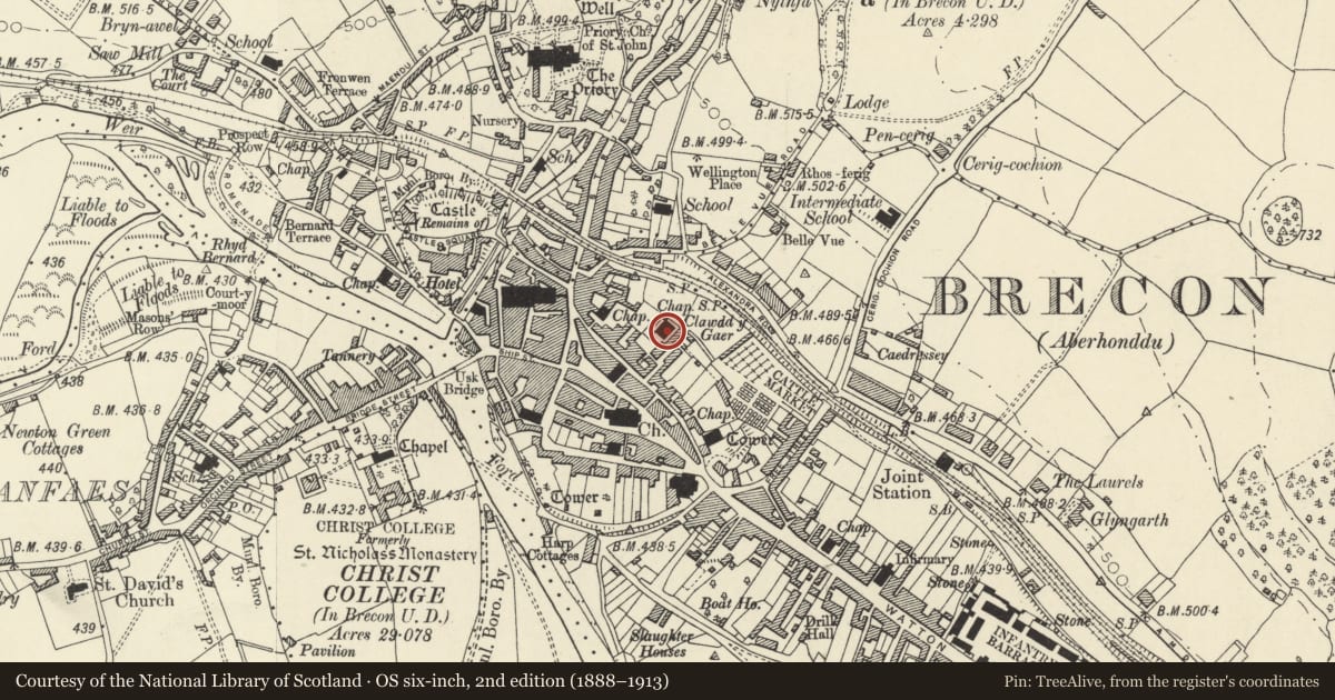
Slide toward Today to fade the historical sheet and see the modern map underneath.
David Rumsey Map Collection, Stanford LibrariesDavid Rumsey Map Collection, Stanford LibrariesDavid Rumsey Map Collection, Stanford LibrariesDavid Rumsey Map Collection, Stanford LibrariesDavid Rumsey Map Collection, Stanford Libraries
5 historical maps cover this location, the earliest the 1608 map "(13) Cambriae Typus." (David Rumsey Map Collection, Stanford Libraries).
Historical maps covering this location
- 1608 · (13) Cambriae Typus. (David Rumsey Map Collection, Stanford Libraries)
- 1636 · Cornubia : Devonia, Somersetus, Dorcestria, Wiltonia, Glocestria ... (David Rumsey Map Collection, Stanford Libraries)
- 1856 · 42. Brecon. (David Rumsey Map Collection, Stanford Libraries)
- 1898 · 213 Brecon (Hills) (David Rumsey Map Collection, Stanford Libraries)
- 1901 · Sheet 14. (David Rumsey Map Collection, Stanford Libraries)
Cadw's description
Location
At NE end of Bethel Square.
History
Circa 1850-52, with the interior containing seating for 800 people. Converted to commercial use in 1990s
Exterior
Former chapel. Stone building in classical style Slate hipped roof. The symmetrical entrance front consists of a wide central projection with pilasters, surmounted by a large open pediment with a circular field with inscription in its tympanum. Below the pediment, a broad elliptical arch encloses large modern shop window. To each side of this, a doorway with pointed head and dripstone and 2-leaf fielded panelled doors. Central projection flanked to each side by a narrow pilastered bay marked by a tall round-headed sash window with intersecting tracery. Returns with five similar sash windows. To rear, 2 round-headed windows with intersecting tracery, in end bays round-headed doorways with overlights.
Also to rear, the re-built former forecourt wall and railings.
Interior
Interior has been converted to commercial use but retains panelled ceiling, and rear of front arch has relief decoration.
Reason for designation
Mid C19 chapel with strong design which has retained its overall form in conversion.
Nearby in the register
- No.1 Bethel SquareDomesticunder 1 mi
- Rear Garden Wall to No.5 Lion StreetDomesticunder 1 mi
- 9 Lion StreetDomesticunder 1 mi
- 20 Bethel SquareNo class recordedunder 1 mi
Other entries of the same register within about three miles of this one, by straight line.