Cof Cymru: National Historic Assets of Wales · Wales
46 High Street Inferior
Brecon, Powys, Wales
A Grade II* listed building in Brecon, Powys, designated on 16 January 1952.
The record
- Designation
- Listed building, Grade II*
- Broad class
- Commercial
- Date of designation
- 16 January 1952
- Town
- Brecon
- Community
- Brecon
- Unitary authority
- Powys
- Country
- Wales
- Coordinates
- 51.94744, -3.39128
- Cadw reference
- 6933
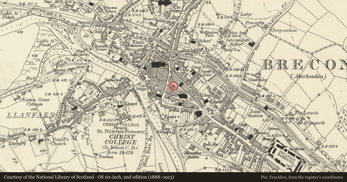
Slide toward Today to fade the historical sheet and see the modern map underneath.
David Rumsey Map Collection, Stanford LibrariesDavid Rumsey Map Collection, Stanford LibrariesDavid Rumsey Map Collection, Stanford LibrariesDavid Rumsey Map Collection, Stanford LibrariesDavid Rumsey Map Collection, Stanford Libraries
5 historical maps cover this location, the earliest the 1608 map "(13) Cambriae Typus." (David Rumsey Map Collection, Stanford Libraries).
Historical maps covering this location
- 1608 · (13) Cambriae Typus. (David Rumsey Map Collection, Stanford Libraries)
- 1636 · Cornubia : Devonia, Somersetus, Dorcestria, Wiltonia, Glocestria ... (David Rumsey Map Collection, Stanford Libraries)
- 1856 · 42. Brecon. (David Rumsey Map Collection, Stanford Libraries)
- 1898 · 213 Brecon (Hills) (David Rumsey Map Collection, Stanford Libraries)
- 1901 · Sheet 14. (David Rumsey Map Collection, Stanford Libraries)
Cadw's description
Location
Set slightly forward from buildings to R.
History
Late C18 to early C19 re-fronting of a late C16 to C17 town house; panel dated 1589 on the main facade possibly refers to construction of main fabric on lower floors. Originally, probably a "three-quarter house", with side and rear walls of stone and front wall timber-framed. The dated panel is not visible in photos until the early C20. The very fine shopfront appears in photos of the building dating from the 1840s, and has parallels with similar shopfronts in Bath datable to the C18.
Exterior
High Street front of 4 storeys, 2 windows; stucco; end pilaster strips. Slate roof. Windows with moulded architraves. Six-pane inward opening windows on third floor. Twelve-pane sash windows on first and second floors. Panels with decorative surrounds at second and first floor levels. Exceptional double-fronted shopfront with central wood doorcase with fluted Corinthian columns; semi-circular headed windows either side with keystones; enriched dentil entablature overall with fluted Corinthian pilasters.
Gabled rear elevation to Church Lane; scribed render, and modern windows. Doorway with shaped hood and 4-panelled door.
Interior
Corinthian columns within shop; 4-centred stone doorway with chamfered jambs in E wall.
Reason for designation
Graded II* as building with C16/C17 origins and good C19 character with exceptional late C18 or early C19 shopfront. Group Value with adjacent listed buildings in High Street.
Nearby in the register
- Sarah Siddons PHCommercialunder 1 mi
- 45 High Street InferiorNo class recordedunder 1 mi
- 48 High Street InferiorCommercialunder 1 mi
- 44 High Street InferiorCommercialunder 1 mi
Other entries of the same register within about three miles of this one, by straight line.