Cof Cymru: National Historic Assets of Wales · Wales
Lloyd's TSB
Brecon, Powys, Wales
A Grade II listed building in Brecon, Powys, designated on 31 May 1961.
The record
- Designation
- Listed building, Grade II
- Broad class
- Commercial
- Date of designation
- 31 May 1961
- Town
- Brecon
- Community
- Brecon
- Unitary authority
- Powys
- Country
- Wales
- Coordinates
- 51.94768, -3.39148
- Cadw reference
- 6927
Slide toward Today to fade the historical sheet and see the modern map underneath.
David Rumsey Map Collection, Stanford LibrariesDavid Rumsey Map Collection, Stanford LibrariesDavid Rumsey Map Collection, Stanford LibrariesDavid Rumsey Map Collection, Stanford LibrariesDavid Rumsey Map Collection, Stanford Libraries
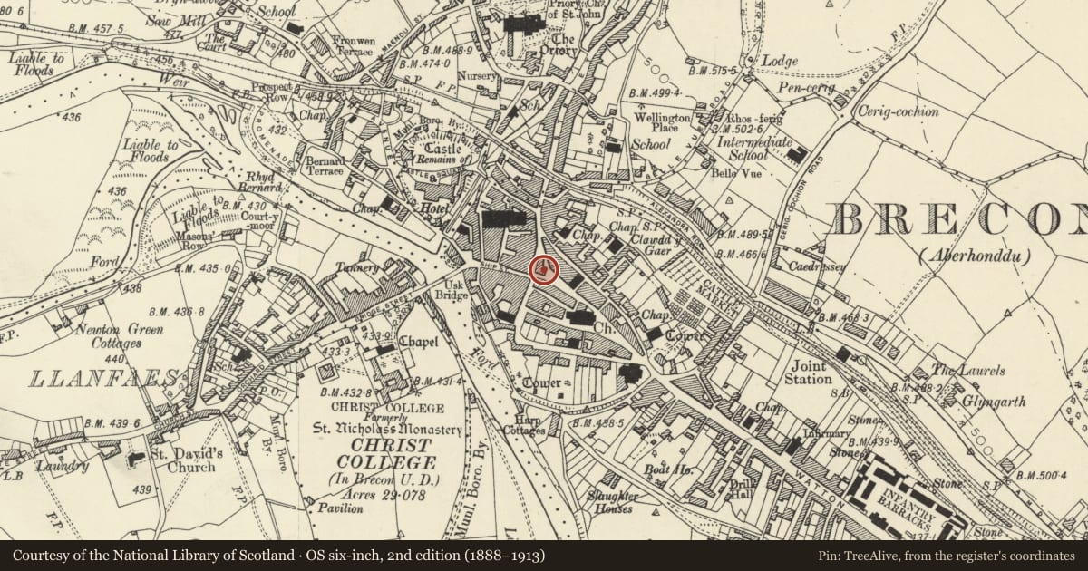
5 historical maps cover this location, the earliest the 1608 map "(13) Cambriae Typus." (David Rumsey Map Collection, Stanford Libraries).
Historical maps covering this location
- 1608 · (13) Cambriae Typus. (David Rumsey Map Collection, Stanford Libraries)
- 1636 · Cornubia : Devonia, Somersetus, Dorcestria, Wiltonia, Glocestria ... (David Rumsey Map Collection, Stanford Libraries)
- 1856 · 42. Brecon. (David Rumsey Map Collection, Stanford Libraries)
- 1898 · 213 Brecon (Hills) (David Rumsey Map Collection, Stanford Libraries)
- 1901 · Sheet 14. (David Rumsey Map Collection, Stanford Libraries)
Cadw's description
Location
Makes up S end of island block in High Street.
History
C18. Formerly the Brecon Old Bank of Wilkins and Co which was founded in 1778; on John Wood’s "Plan of Brecknock of 1834 ". The rear of the building only was shown as banking premises.
Exterior
Bank with elevations to High Street Superior (W), High Street Inferior (S), and main entrance to the broad open part of High Street Inferior (E). Three storeys, stucco; hipped slate roof. West elevation to High Street Superior of 2 windows, band above ground floor. Six-pane sashes to top floor; 12-pane sashes to first floor; 2 modern windows to ground floor, and to L, Doric pedimented doorcase with fluted pilasters, panelled door and plain semi-circular fanlight. South elevation (to High Street Inferior) of 4 bays width with widely spaced window openings. Main entrance facing E of 3 windows; 6-pane sashes to top floor; 12-pane sashes to first floor; on ground floor (channelled stucco), 4 windows, and to L, pedimented Ionic doorcase.
Reason for designation
An important C18 building at the centre of the old town; the NW elevation stands at the top of Ship Street and the SE elevation stands at the top of High Street Inferior. Group Value with adjacent listed buildings.
Nearby in the register
- 41 High Street InferiorCommercialunder 1 mi
- 39 High Street InferiorDomesticunder 1 mi
- 34 High Street SuperiorCommercialunder 1 mi
- 35 High Street SuperiorCommercialunder 1 mi
Other entries of the same register within about three miles of this one, by straight line.