Cof Cymru: National Historic Assets of Wales · Wales
12 High Street
Llandrillo, Denbighshire, Wales
A Grade II listed building in Llandrillo, Denbighshire, designated on 20 October 1966.
The record
- Designation
- Listed building, Grade II
- Broad class
- Domestic
- Date of designation
- 20 October 1966
- Locality
- Llandrillo
- Community
- Llandrillo
- Unitary authority
- Denbighshire
- Country
- Wales
- Coordinates
- 52.92261, -3.43809
- Cadw reference
- 691
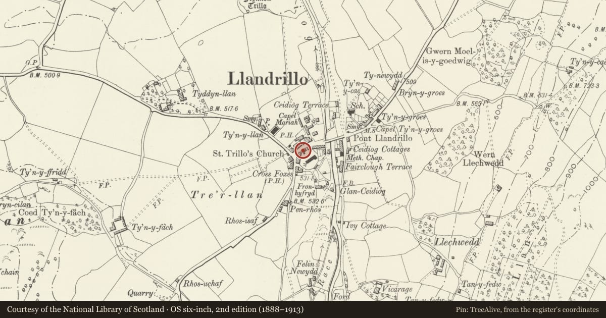
Slide toward Today to fade the historical sheet and see the modern map underneath.
David Rumsey Map Collection, Stanford LibrariesDavid Rumsey Map Collection, Stanford LibrariesLlyfrgell Genedlaethol Cymru – The National Library of WalesDavid Rumsey Map Collection, Stanford LibrariesDavid Rumsey Map Collection, Stanford Libraries
5 historical maps cover this location, the earliest the 1795 map "To Sir Watkin Williams-Wynn Bart ... the map of the six counties of North Wales is most humbly inscribed by his obedient humble servant" (Llyfrgell Genedlaethol Cymru – The National Library of Wales).
Historical maps covering this location
- 1795 · To Sir Watkin Williams-Wynn Bart ... the map of the six counties of North Wales is most… (Llyfrgell Genedlaethol Cymru – The National Library of Wales)
- 1830 · V.3:11-15:XV. Britisches Reich. A. Kon: England. b. Frstenthum Wales: Shire: 37-40 (David Rumsey Map Collection, Stanford Libraries)
- 1883 · Watershed map England, Wales 3. (David Rumsey Map Collection, Stanford Libraries)
- 1898 · 120 Corwen (Hills) (David Rumsey Map Collection, Stanford Libraries)
- 1901 · Sheet 9 and 10. (David Rumsey Map Collection, Stanford Libraries)
Cadw's description
Location
Located in the centre of the village, backing onto the churchyard.
History
Probably late C18 or early C19.
Exterior
Two-storey 2-window cottage constructed of white-washed rubble stone with rendered end stack to L; doorway offset to R, with wide boarded door. This is flanked by 2-light wooden casement windows with flat heads and stone sills. Similar casements above, immediately beneath eaves, the R-hand window not aligned. Roughcast W gable end. Lean-to against E gable end, with C20 wooden window under segmental brick head to front elevation; boundary wall continues to its L with boarded door under brick head leading to garden. Upper storey of rear has 2-light wooden casement to L of centre, and C20 window to its L; lower storey not seen.
Interior
No access to interior at time of inspection.
Reason for designation
Listed as a cottage retaining good vernacular character, which contributes to the Conservation Area. Group value with other listed buildings in the village.
Nearby in the register
- Entrance gates and piers to Church of St TrilloReligious, Ritual and Funeraryunder 1 mi
- 5 High StreetDomesticunder 1 mi
- 4 High StreetDomesticunder 1 mi
- 6 High StreetDomesticunder 1 mi
Other entries of the same register within about three miles of this one, by straight line.