Cof Cymru: National Historic Assets of Wales · Wales
Brynich Farmhouse
Brecon, Powys, Wales
A Grade II listed building in Brecon, Powys, designated on 16 December 1976.
The record
- Designation
- Listed building, Grade II
- Broad class
- Domestic
- Date of designation
- 16 December 1976
- Town
- Brecon
- Community
- Brecon
- Unitary authority
- Powys
- Country
- Wales
- Coordinates
- 51.94180, -3.35342
- Cadw reference
- 6804
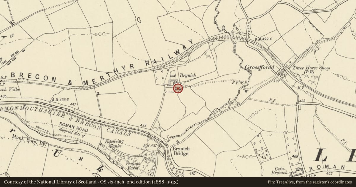
Slide toward Today to fade the historical sheet and see the modern map underneath.
David Rumsey Map Collection, Stanford LibrariesDavid Rumsey Map Collection, Stanford LibrariesDavid Rumsey Map Collection, Stanford LibrariesDavid Rumsey Map Collection, Stanford LibrariesDavid Rumsey Map Collection, Stanford Libraries
5 historical maps cover this location, the earliest the 1608 map "(13) Cambriae Typus." (David Rumsey Map Collection, Stanford Libraries).
Historical maps covering this location
- 1608 · (13) Cambriae Typus. (David Rumsey Map Collection, Stanford Libraries)
- 1636 · Cornubia : Devonia, Somersetus, Dorcestria, Wiltonia, Glocestria ... (David Rumsey Map Collection, Stanford Libraries)
- 1856 · 42. Brecon. (David Rumsey Map Collection, Stanford Libraries)
- 1898 · 213 Brecon (Hills) (David Rumsey Map Collection, Stanford Libraries)
- 1901 · Sheet 14. (David Rumsey Map Collection, Stanford Libraries)
Cadw's description
Location
Ar East end of Brecon Community, near roundabout at junction of A40 and A470
History
Rebuilt possibly in early C19, possibly retaining remnants of an older house at E end and also incorporating a later C19 wing at W end. Covered in repair scaffolding at time of inspection.
Exterior
House aligned E-W, with front facing garden to S. Stuccoed with slate roof. Garden elevation of main part of house of 2 storeys, 3 windows (Small-pane sashes originally, but also modern units), with end chimney stacks. Central doorway with pilasters;flat-roofed porch; 6-panelled door with panelled reveals. Later wing adjoins at west end; this has stuccoed south-facing projecting gabled bay with 3-light sash window with glazing bars on each floor. stone stack; stone walls; slate roof. To east again, a 1-storey structure. On N side, tall staircase sash. Further entrances to all wings of house in north elevation.
Interior
Hallway has contemporary wooden staircase with stick balusters and turned newels; contemporary panelled doors.
Reason for designation
Listed as part of a group of former farm buildings, including Brynich Farmhouse, barn and two wings of outbuildings. All with with mutual Group Value.
Nearby in the register
- Former Barn, now Restaurant and Accommodation at Brynich Caravan ParkAgriculture and Subsistenceunder 1 mi
- Canal Bridge on S side of A40Transportunder 1 mi
- Tunnel carrying Brynich stream under Brecon & Abergavenny Canal (partly in Brecon community)Transportunder 1 mi
- Cefn-Brynich Roman FortFortunder 1 mi
Other entries of the same register within about three miles of this one, by straight line.