Cof Cymru: National Historic Assets of Wales · Wales
Pigeon house at Abercamlais
Trallong, Powys, Wales
A Grade II* listed building in Abercamlais, Brecon, Trallong, Powys, designated on 17 January 1963.
The record
- Designation
- Listed building, Grade II*
- Broad class
- Agriculture and Subsistence
- Date of designation
- 17 January 1963
- Locality
- Abercamlais
- Town
- Brecon
- Community
- Trallong
- Unitary authority
- Powys
- Country
- Wales
- Coordinates
- 51.94997, -3.50812
- Cadw reference
- 6787
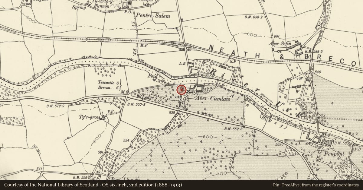
Slide toward Today to fade the historical sheet and see the modern map underneath.
David Rumsey Map Collection, Stanford LibrariesDavid Rumsey Map Collection, Stanford LibrariesDavid Rumsey Map Collection, Stanford LibrariesDavid Rumsey Map Collection, Stanford LibrariesDavid Rumsey Map Collection, Stanford Libraries
5 historical maps cover this location, the earliest the 1636 map "Cornubia : Devonia, Somersetus, Dorcestria, Wiltonia, Glocestria ..." (David Rumsey Map Collection, Stanford Libraries).
Historical maps covering this location
- 1636 · Cornubia : Devonia, Somersetus, Dorcestria, Wiltonia, Glocestria ... (David Rumsey Map Collection, Stanford Libraries)
- 1830 · V.3:11-15:XV. Britisches Reich. A. Kon: England. b. Frstenthum Wales: Shire: 37-40 (David Rumsey Map Collection, Stanford Libraries)
- 1856 · 42. Brecon. (David Rumsey Map Collection, Stanford Libraries)
- 1898 · 213 Brecon (Hills) (David Rumsey Map Collection, Stanford Libraries)
- 1901 · Sheet 14. (David Rumsey Map Collection, Stanford Libraries)
Cadw's description
Location
Situated W of the house at Abercamlais on a bridge over the Camlais.
History
C18 stone octagonal dovecote or pigeon house set on a square base straddling the Camlais brook, the base formerly a privy.
Exterior
Dovecote, rubble stone, two storeys. The square base has segmental arched opposed E and W entries, with stone voussoirs, and an iron gate in the W entry. Small window on S, blocked N window. The tall octagonal dovecote is windowless with octagonal stone-tiled roof, louvred octagonal lantern, and ogee curved octagonal dome, with fox weathervane. The wall face is stepped in on E and W between base and octagon, but rises sheer on the N and S, the step clad in stone tiles. The dovecote is set on a bridge over the Camlais with broad low segmental arch and stone voussoirs.
Interior
Interior is open right up, the ground floor with oak lintels carrying the inset E and W
walls, and diagonal beams carrying the diagonal faces, which have some timber framing.
Reason for designation
Graded II* for its exceptional interest as an elaborate architectural dovecote of the C18.
Nearby in the register
- Bridge over Camlais to N of the Pigeon House at AbercamlaisTransportunder 1 mi
- Abercamlais including Dovecote CottageDomesticunder 1 mi
- Abercamlais Bridge/ Pont Abercamlais and door in attached wall to NETransportunder 1 mi
- Stable Court at AbercamlaisDomesticunder 1 mi
Other entries of the same register within about three miles of this one, by straight line.