Cof Cymru: National Historic Assets of Wales · Wales
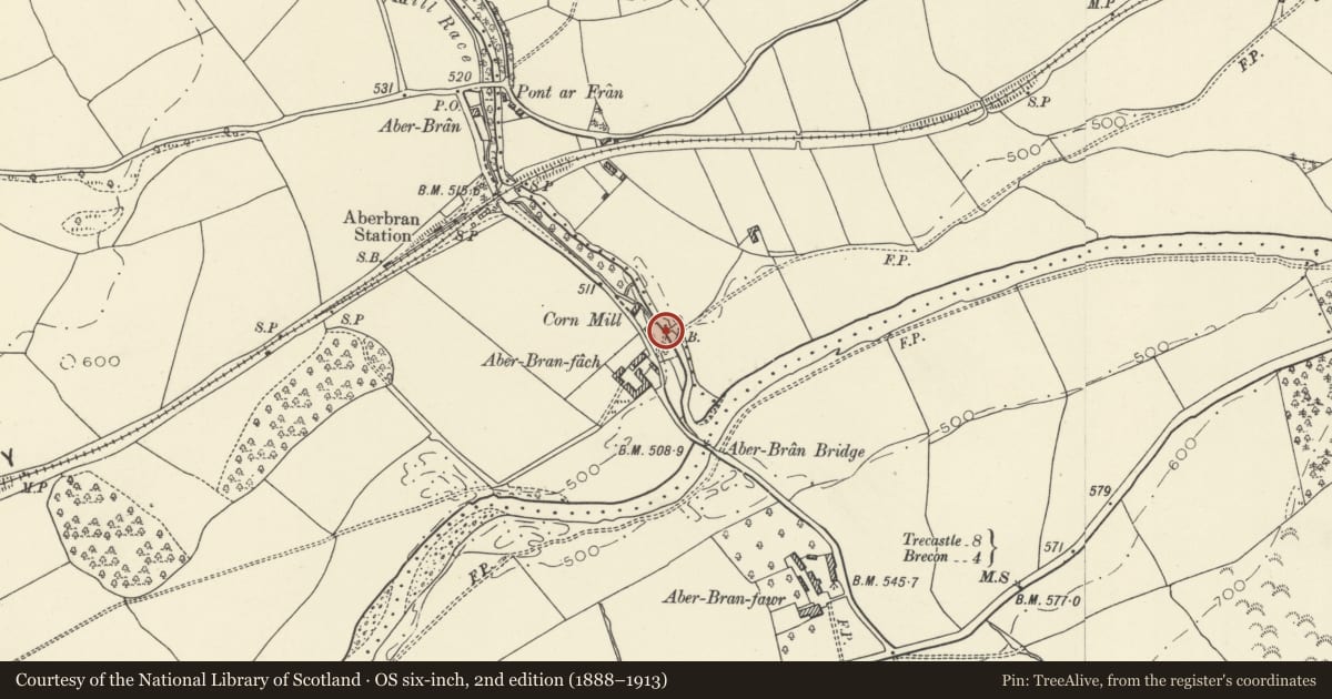
Bridge over Nant Bran near Aberbran-fach Farm (partly in Yscir community)
Trallong, Powys, Wales
A Grade II listed building in Aberbran, Brecon, Trallong, Powys, designated on 14 April 1966.
The record
- Designation
- Listed building, Grade II
- Broad class
- Transport
- Date of designation
- 14 April 1966
- Locality
- Aberbran
- Town
- Brecon
- Community
- Trallong
- Unitary authority
- Powys
- Country
- Wales
- Coordinates
- 51.95315, -3.47557
- Cadw reference
- 6719
Slide toward Today to fade the historical sheet and see the modern map underneath.
David Rumsey Map Collection, Stanford LibrariesDavid Rumsey Map Collection, Stanford LibrariesDavid Rumsey Map Collection, Stanford LibrariesDavid Rumsey Map Collection, Stanford LibrariesDavid Rumsey Map Collection, Stanford Libraries
5 historical maps cover this location, the earliest the 1636 map "Cornubia : Devonia, Somersetus, Dorcestria, Wiltonia, Glocestria ..." (David Rumsey Map Collection, Stanford Libraries).
Historical maps covering this location
- 1636 · Cornubia : Devonia, Somersetus, Dorcestria, Wiltonia, Glocestria ... (David Rumsey Map Collection, Stanford Libraries)
- 1830 · V.3:11-15:XV. Britisches Reich. A. Kon: England. b. Frstenthum Wales: Shire: 37-40 (David Rumsey Map Collection, Stanford Libraries)
- 1856 · 42. Brecon. (David Rumsey Map Collection, Stanford Libraries)
- 1898 · 213 Brecon (Hills) (David Rumsey Map Collection, Stanford Libraries)
- 1901 · Sheet 14. (David Rumsey Map Collection, Stanford Libraries)
Cadw's description
Location
Crossing the Nant Bran some 50m NE of Aberbran-fach Farm.
History
Field bridge from Aberbran Fach and mill, probably C18, steeply humped with cobbled surface to narrow roadway, a C18 type now very rare.
Exterior
Field bridge over the Nant Bran, rubble stone, single arch, steeply humped with thin crown and long thin stone voussoirs to arch. No parapet, just alternately higher and lower square coping stones. Narrow cobbled roadway.
Reason for designation
Included for its special historic interest as a rare example of a C18 steeply humped bridge for passage of animals across river.
Nearby in the register
- Bridge over Nant Bran near Aberbran-fach Farm (partly in Trallong community)Transportunder 1 mi
- Mill CottageDomesticunder 1 mi
- Aberbran FachDomesticunder 1 mi
- Farm courtyard at Aberbran FachAgriculture and Subsistenceunder 1 mi
Other entries of the same register within about three miles of this one, by straight line.