Cof Cymru: National Historic Assets of Wales · Wales
Yerbeston Farmhouse
Hundleton, Pembrokeshire, Wales
A Grade II listed building in Yerbeston, Hundleton, Pembrokeshire, designated on 14 May 1970.
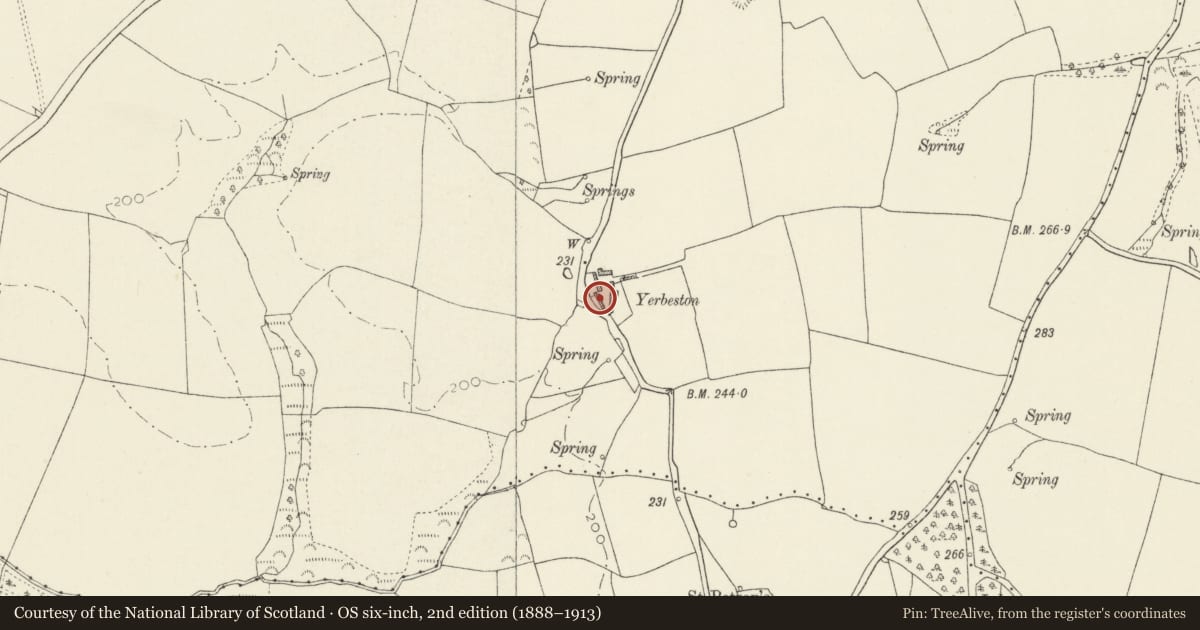
The record
- Designation
- Listed building, Grade II
- Broad class
- Domestic
- Date of designation
- 14 May 1970
- Locality
- Yerbeston
- Community
- Hundleton
- Unitary authority
- Pembrokeshire
- Country
- Wales
- Coordinates
- 51.64449, -4.93760
- Cadw reference
- 6602
Slide toward Today to fade the historical sheet and see the modern map underneath.
David Rumsey Map Collection, Stanford LibrariesDavid Rumsey Map Collection, Stanford LibrariesDavid Rumsey Map Collection, Stanford LibrariesDavid Rumsey Map Collection, Stanford LibrariesDavid Rumsey Map Collection, Stanford Libraries
5 historical maps cover this location, the earliest the 1636 map "Cornubia : Devonia, Somersetus, Dorcestria, Wiltonia, Glocestria ..." (David Rumsey Map Collection, Stanford Libraries).
Historical maps covering this location
- 1636 · Cornubia : Devonia, Somersetus, Dorcestria, Wiltonia, Glocestria ... (David Rumsey Map Collection, Stanford Libraries)
- 1865 · England and Wales. England No. 6. (David Rumsey Map Collection, Stanford Libraries)
- 1891 · Sheet 10. Ordnance Survey of England and Wales. . (David Rumsey Map Collection, Stanford Libraries)
- 1898 · 245 Pembroke (Hills) (David Rumsey Map Collection, Stanford Libraries)
- 1901 · Sheet 13. (David Rumsey Map Collection, Stanford Libraries)
Cadw's description
Location
Situated on E side of road from St Petrox to Maiden Wells, some 500m N of St Petrox.
Exterior
1793 farmhouse with older origins. Rubble stone, formerly roughcast, with slate eaves roof, formerly grouted, and roughcast end stacks. Two-storey three-window main front of C20 windows replacing sashes, centre door in gabled stone porch with arched entry and impost bands. Datestone over: 'Built by Geo Seale 1793'. Added S end lean-to, later raised, with curved SE corner. N end service range (probably of earlier date) has lower roof, one upper window, window and door below. Massive square W end outside stack, tapered from wider base with bread oven.
Rear of house has dove-holes to left, lean-to to right, and lean-to to service range.
Reason for designation
One of the best surviving outside chimneys in Hundleton area. Since 1970 windows have been altered and front cladding removed.
Nearby in the register
- St. Petrox ChurchReligious, Ritual and Funeraryunder 1 mi
- North Lodge PiersDomesticunder 1 mi
- Gate at the North LodgeDomesticunder 1 mi
- Gilead Old ChapelReligious, Ritual and Funeraryunder 1 mi
Other entries of the same register within about three miles of this one, by straight line.