Cof Cymru: National Historic Assets of Wales · Wales
Pont Corwen Bridge
Corwen, Denbighshire, Wales
A Grade II* listed building in Corwen, Denbighshire, designated on 4 June 1952.
The record
- Designation
- Listed building, Grade II*
- Broad class
- Transport
- Date of designation
- 4 June 1952
- Locality
- Corwen
- Community
- Corwen
- Unitary authority
- Denbighshire
- Country
- Wales
- Coordinates
- 52.97952, -3.38749
- Cadw reference
- 656
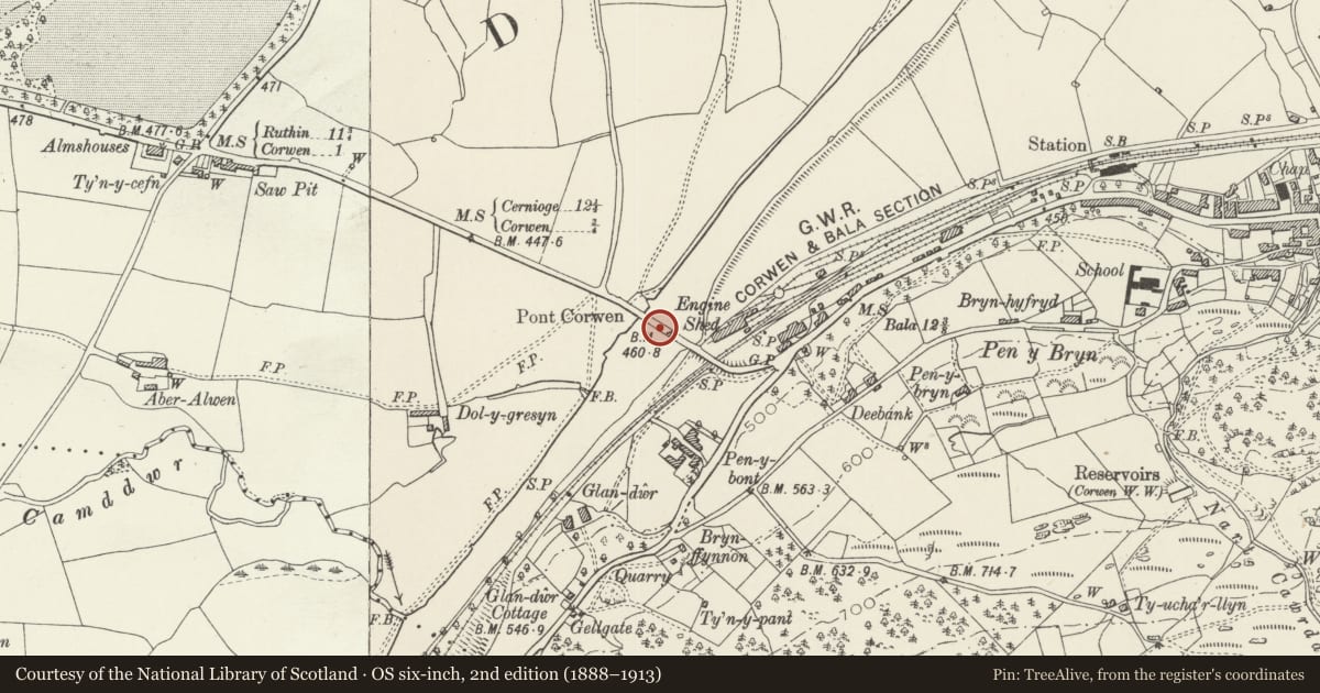
Slide toward Today to fade the historical sheet and see the modern map underneath.
David Rumsey Map Collection, Stanford LibrariesDavid Rumsey Map Collection, Stanford LibrariesLlyfrgell Genedlaethol Cymru – The National Library of WalesDavid Rumsey Map Collection, Stanford LibrariesDavid Rumsey Map Collection, Stanford Libraries
5 historical maps cover this location, the earliest the 1795 map "To Sir Watkin Williams-Wynn Bart ... the map of the six counties of North Wales is most humbly inscribed by his obedient humble servant" (Llyfrgell Genedlaethol Cymru – The National Library of Wales).
Historical maps covering this location
- 1795 · To Sir Watkin Williams-Wynn Bart ... the map of the six counties of North Wales is most… (Llyfrgell Genedlaethol Cymru – The National Library of Wales)
- 1830 · V.3:11-15:XV. Britisches Reich. A. Kon: England. b. Frstenthum Wales: Shire: 37-40 (David Rumsey Map Collection, Stanford Libraries)
- 1883 · Watershed map England, Wales 3. (David Rumsey Map Collection, Stanford Libraries)
- 1898 · 120 Corwen (Hills) (David Rumsey Map Collection, Stanford Libraries)
- 1901 · Sheet 9 and 10. (David Rumsey Map Collection, Stanford Libraries)
Cadw's description
Location
Carries the main A5 road over the River Dee 1km approx. west of the town centre.
History
A stone dated 1704 has been recorded, a date which appears to be consistent with the present structure, though it almost certainly represents the reconstruction of an earlier bridge at the site.
Exterior
Roughly coursed and squared stonework, the river is spanned by 4 main arches, with an additional lower arch to the S, and very low side arches at either end (that to N dry). The segmental arches have roughly shaped voussoirs and rough projecting hood moulds. Cutwaters between the principal arches. Parapet formed from a smaller grade of stone, with rough flat copings. A long retaining wall with stacked stone copings supports the road bed on the SW side.
Reason for designation
An excellent example of an early C18 masonry bridge, one of a series of important early bridges across the Rivers Alwen and Dee.
Nearby in the register
- Dee Bank, Pen-y-BrynDomesticunder 1 mi
- Pentre GwynDomesticunder 1 mi
- BryntirionNo class recordedunder 1 mi
- Rug ChapelReligious, Ritual and Funeraryunder 1 mi
Other entries of the same register within about three miles of this one, by straight line.