Cof Cymru: National Historic Assets of Wales · Wales
Old Stable Block at Gwindy
Llanddewi Velfrey, Pembrokeshire, Wales
A Grade II listed building in Gwindy, Llanddewi Velfrey, Pembrokeshire, designated on 28 October 1980.
The record
- Designation
- Listed building, Grade II
- Broad class
- Agriculture and Subsistence
- Date of designation
- 28 October 1980
- Locality
- Gwindy
- Community
- Llanddewi Velfrey
- Unitary authority
- Pembrokeshire
- Country
- Wales
- Coordinates
- 51.82141, -4.66753
- Cadw reference
- 6542
Slide toward Today to fade the historical sheet and see the modern map underneath.
David Rumsey Map Collection, Stanford LibrariesDavid Rumsey Map Collection, Stanford LibrariesDavid Rumsey Map Collection, Stanford LibrariesDavid Rumsey Map Collection, Stanford LibrariesDavid Rumsey Map Collection, Stanford Libraries
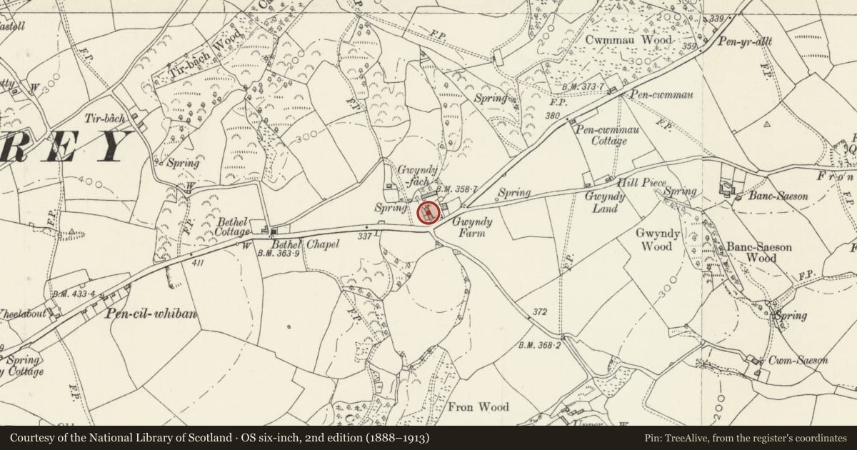
5 historical maps cover this location, the earliest the 1636 map "Cornubia : Devonia, Somersetus, Dorcestria, Wiltonia, Glocestria ..." (David Rumsey Map Collection, Stanford Libraries).
Historical maps covering this location
- 1636 · Cornubia : Devonia, Somersetus, Dorcestria, Wiltonia, Glocestria ... (David Rumsey Map Collection, Stanford Libraries)
- 1830 · V.3:11-15:XV. Britisches Reich. A. Kon: England. b. Frstenthum Wales: Shire: 37-40 (David Rumsey Map Collection, Stanford Libraries)
- 1891 · Sheet 10. Ordnance Survey of England and Wales. . (David Rumsey Map Collection, Stanford Libraries)
- 1898 · 228 Haverfordwest (Hills) (David Rumsey Map Collection, Stanford Libraries)
- 1901 · Sheet 13. (David Rumsey Map Collection, Stanford Libraries)
Cadw's description
Location
A range of buildings to the W of the farmhouse.
History
Late C18 stable block and coach-house, the coach-house with a slightly higher roof level but evidently all of one build. The coach-house arches have recently been restored by the removal of modern inserted masonry.
Exterior
A range of buildings of two storeys, facing E to the farmyard and farmhouse. Two-arched coach-house at left (S) and four-bay stable range at right. Both parts have lofts above. Stone walls with traces of limewash on the front. Slate roofs, with gutterless eaves. Rear outshuts. At the right of the coach-house part is a small chimney. The stable block to the right has its roof about 0.3 m lower. In the latter block there are five ground-storey door-openings alternating with four small brick-arched lunettes, with a loft aperture centred above each lunette. The first of the set of five main openings is round-arched, the others have flat arches or lintels. Two of the openings have been half-blocked for conversion into windows.
There are similar lunette openings on the rear (W) elevation.
Reason for designation
Listed for group value with Gwindy farmhouse and as a range of vernacular farm buildings of unusual architectural distinction.
Nearby in the register
- Gwindy Farmhouse with walls and railings to gardenDomesticunder 1 mi
- FronDomesticunder 1 mi
- Pengawse Ring CairnRing Barrowunder 1 mi
- Waundwrgi farmhouseDomesticunder 1 mi
Other entries of the same register within about three miles of this one, by straight line.