Cof Cymru: National Historic Assets of Wales · Wales
Blaen Marlais
Narberth, Pembrokeshire, Wales
A Grade II listed building in Narberth, Pembrokeshire, designated on 21 June 1971.
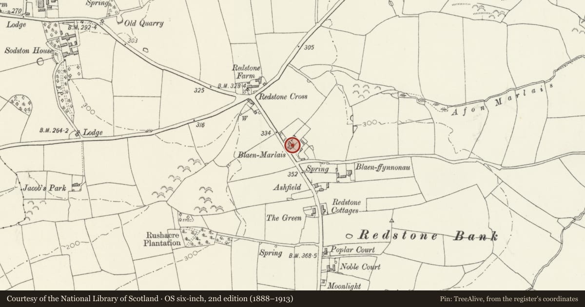
The record
- Designation
- Listed building, Grade II
- Broad class
- Domestic
- Date of designation
- 21 June 1971
- Community
- Narberth
- Unitary authority
- Pembrokeshire
- Country
- Wales
- Coordinates
- 51.81068, -4.74350
- Cadw reference
- 6508
Slide toward Today to fade the historical sheet and see the modern map underneath.
David Rumsey Map Collection, Stanford LibrariesDavid Rumsey Map Collection, Stanford LibrariesDavid Rumsey Map Collection, Stanford LibrariesDavid Rumsey Map Collection, Stanford LibrariesDavid Rumsey Map Collection, Stanford Libraries
5 historical maps cover this location, the earliest the 1636 map "Cornubia : Devonia, Somersetus, Dorcestria, Wiltonia, Glocestria ..." (David Rumsey Map Collection, Stanford Libraries).
Historical maps covering this location
- 1636 · Cornubia : Devonia, Somersetus, Dorcestria, Wiltonia, Glocestria ... (David Rumsey Map Collection, Stanford Libraries)
- 1830 · V.3:11-15:XV. Britisches Reich. A. Kon: England. b. Frstenthum Wales: Shire: 37-40 (David Rumsey Map Collection, Stanford Libraries)
- 1891 · Sheet 10. Ordnance Survey of England and Wales. . (David Rumsey Map Collection, Stanford Libraries)
- 1898 · 228 Haverfordwest (Hills) (David Rumsey Map Collection, Stanford Libraries)
- 1901 · Sheet 13. (David Rumsey Map Collection, Stanford Libraries)
Cadw's description
Location
Located some 300 yds SE of the junction of Redstone Road with the A40.
Exterior
Early C19 with C18 origins, 3 storey 3 window front, whitewashed roughcast on rubble. Later moderately pitched slate roof, plain bargeboards. Red brick stacks.
Symmetric features offset to right. 12 pane sash windows to 1st and 2nd floors. Plain reveals, slate sills. Similar slightly larger windows to ground floor flanking doorway.
Round arched doorway, with arched fanlight ‘Gothic’ glazing bars. Later C19 door, half glazed.
Later C19 portico, flat hood plain Tuscan columns; modern concrete columns flank entrance.
Outshot (later C19?) extension at rear with Gothic head to 12 small pane sash stair window.
Various later windows inserted to end walls, fire escape to left end.
Cross range to right rear; 2 storey, whitewashed roughcast, slate roof, mainly modern fenestration. 2 stage outshot to its rear.
Garden forecourt; pair of roughcast gatepiers. Stone pineapple finial to right - missing on left. C19 Ornamental wrought iron gates set in rebates.
Former orchard wall to N, 10ft high rubblestone wall.
Interior
Interior buffet-recess to drawing room. Broad segmental arch with acanthae on reeded pilasters, interesting moulded cornice with pellet ornaments. Panelled doors.
Nearby in the register
- Barn in Grounds of Blaen MarlaisAgriculture and Subsistenceunder 1 mi
- Blaen FfynnonauDomesticunder 1 mi
- Stable attached to Blaen FfynnonauDomesticunder 1 mi
- Redstone Cross Round BarrowsRound Barrowunder 1 mi
Other entries of the same register within about three miles of this one, by straight line.