Cof Cymru: National Historic Assets of Wales · Wales
14 Market Square
Narberth, Pembrokeshire, Wales
A Grade II listed building in Narberth, Pembrokeshire, designated on 17 May 1988.
The record
- Designation
- Listed building, Grade II
- Broad class
- Domestic
- Date of designation
- 17 May 1988
- Locality
- Narberth
- Community
- Narberth
- Unitary authority
- Pembrokeshire
- Country
- Wales
- Coordinates
- 51.79784, -4.74293
- Cadw reference
- 6492
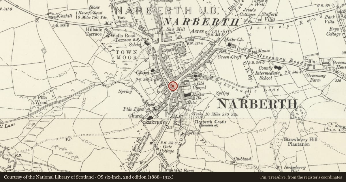
Slide toward Today to fade the historical sheet and see the modern map underneath.
David Rumsey Map Collection, Stanford LibrariesDavid Rumsey Map Collection, Stanford LibrariesDavid Rumsey Map Collection, Stanford LibrariesDavid Rumsey Map Collection, Stanford LibrariesDavid Rumsey Map Collection, Stanford Libraries
5 historical maps cover this location, the earliest the 1636 map "Cornubia : Devonia, Somersetus, Dorcestria, Wiltonia, Glocestria ..." (David Rumsey Map Collection, Stanford Libraries).
Historical maps covering this location
- 1636 · Cornubia : Devonia, Somersetus, Dorcestria, Wiltonia, Glocestria ... (David Rumsey Map Collection, Stanford Libraries)
- 1830 · V.3:11-15:XV. Britisches Reich. A. Kon: England. b. Frstenthum Wales: Shire: 37-40 (David Rumsey Map Collection, Stanford Libraries)
- 1891 · Sheet 10. Ordnance Survey of England and Wales. . (David Rumsey Map Collection, Stanford Libraries)
- 1898 · 228 Haverfordwest (Hills) (David Rumsey Map Collection, Stanford Libraries)
- 1901 · Sheet 13. (David Rumsey Map Collection, Stanford Libraries)
Cadw's description
Location
Across the slope on the Street line and opposite the War Memorial.
Exterior
Early-mid C19, 3 storey, 3 window house. Colour washed roughcast on rubble. Steeply pitched tile roof, oversailing eaves on paired brackets. Short rendered brick stacks.
2 light small paned casement windows to 2nd floor. 16 pane sash windows to 1st floor, cement architraves, stone sills. ground floor slightly asymmetric, similar windows to 1st floor.
Plain doorcase with flat hood on simple brackets. Plain rectangular fanlight over broad 6 panel door.
Reason for designation
Group value with other listed items on the Square.
Nearby in the register
- 15 Market SquareCommercialunder 1 mi
- 16 Market SquareCommercialunder 1 mi
- Telephone Call-box by War MemorialCommunicationsunder 1 mi
- Lamp Standard by War MemorialGardens, Parks and Urban Spacesunder 1 mi
Other entries of the same register within about three miles of this one, by straight line.