Cof Cymru: National Historic Assets of Wales · Wales
Plas Farmhouse
Narberth, Pembrokeshire, Wales
A Grade II listed building in Narberth, Pembrokeshire, designated on 15 February 1985.
The record
- Designation
- Listed building, Grade II
- Broad class
- Domestic
- Date of designation
- 15 February 1985
- Community
- Narberth
- Unitary authority
- Pembrokeshire
- Country
- Wales
- Coordinates
- 51.79678, -4.74463
- Cadw reference
- 6476
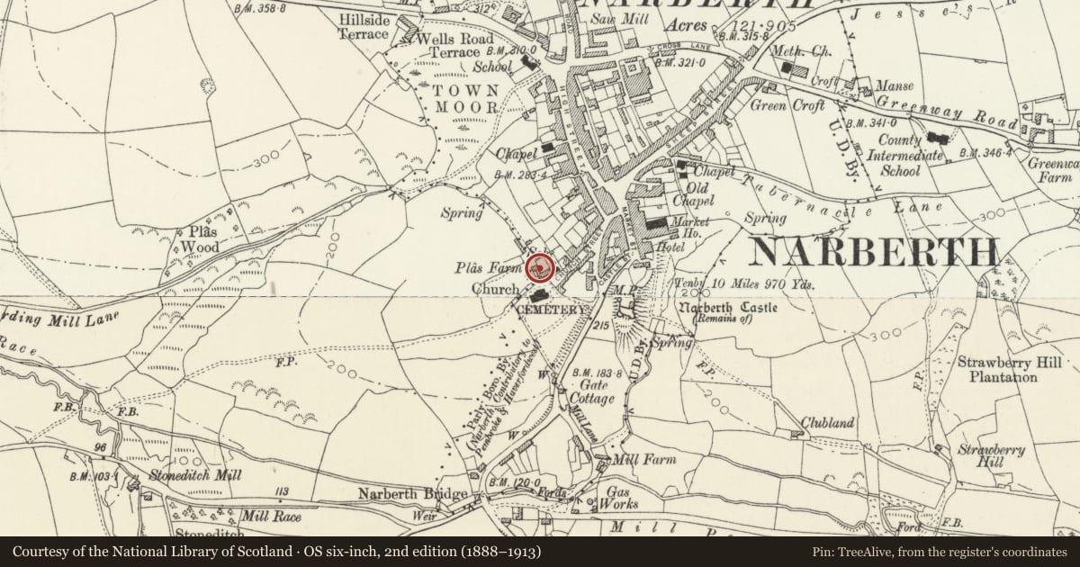
Slide toward Today to fade the historical sheet and see the modern map underneath.
David Rumsey Map Collection, Stanford LibrariesDavid Rumsey Map Collection, Stanford LibrariesDavid Rumsey Map Collection, Stanford LibrariesDavid Rumsey Map Collection, Stanford LibrariesDavid Rumsey Map Collection, Stanford Libraries
5 historical maps cover this location, the earliest the 1636 map "Cornubia : Devonia, Somersetus, Dorcestria, Wiltonia, Glocestria ..." (David Rumsey Map Collection, Stanford Libraries).
Historical maps covering this location
- 1636 · Cornubia : Devonia, Somersetus, Dorcestria, Wiltonia, Glocestria ... (David Rumsey Map Collection, Stanford Libraries)
- 1830 · V.3:11-15:XV. Britisches Reich. A. Kon: England. b. Frstenthum Wales: Shire: 37-40 (David Rumsey Map Collection, Stanford Libraries)
- 1891 · Sheet 10. Ordnance Survey of England and Wales. . (David Rumsey Map Collection, Stanford Libraries)
- 1898 · 228 Haverfordwest (Hills) (David Rumsey Map Collection, Stanford Libraries)
- 1901 · Sheet 13. (David Rumsey Map Collection, Stanford Libraries)
Cadw's description
Location
Reached by a lane running west from Church Street; the farmhouse facing west has its lower gable end towards St Andrew's Church.
History
C18/early C19 frontage to earlier building incorporating late medieval detailing in rear wall.
Exterior
2 storey colourwashed rubble frontage, long slate roof with rear pitch lower than the south gable end parapet, end stacks with uphill gable built out square with set off and downhill tapering stack corbelled over lean-to.
4 windows (higher to left) brick heads, sashes with glazing bars to one upper window only, one bipartite, 3 doors, 2 under corrugated hood in angle of small slate and rubble extension forward to left walled forecourt.
Rear ruble elevation with parts of 3-light stone mullioned windows with dripmoulds to left, lateral chimney breast at setback in wall plane, a further chimney with corbelled base to right.
Nearby in the register
- Parish Church of St AndrewReligious, Ritual and Funeraryunder 1 mi
- Milestone by entrance to New CemeteryTransportunder 1 mi
- 12 Market SquareDomesticunder 1 mi
- The Former CourthouseDomesticunder 1 mi
Other entries of the same register within about three miles of this one, by straight line.