Cof Cymru: National Historic Assets of Wales · Wales
The Coach and Horses Public House
Tenby, Pembrokeshire, Wales
A Grade II listed building in Tenby, Pembrokeshire, designated on 26 April 1977.
The record
- Designation
- Listed building, Grade II
- Broad class
- Commercial
- Date of designation
- 26 April 1977
- Town
- Tenby
- Community
- Tenby
- Unitary authority
- Pembrokeshire
- Country
- Wales
- Coordinates
- 51.67258, -4.70141
- Cadw reference
- 6306
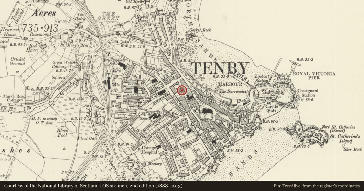
Slide toward Today to fade the historical sheet and see the modern map underneath.
David Rumsey Map Collection, Stanford LibrariesDavid Rumsey Map Collection, Stanford LibrariesDavid Rumsey Map Collection, Stanford LibrariesDavid Rumsey Map Collection, Stanford LibrariesDavid Rumsey Map Collection, Stanford Libraries
5 historical maps cover this location, the earliest the 1636 map "Cornubia : Devonia, Somersetus, Dorcestria, Wiltonia, Glocestria ..." (David Rumsey Map Collection, Stanford Libraries).
Historical maps covering this location
- 1636 · Cornubia : Devonia, Somersetus, Dorcestria, Wiltonia, Glocestria ... (David Rumsey Map Collection, Stanford Libraries)
- 1865 · England and Wales. England No. 6. (David Rumsey Map Collection, Stanford Libraries)
- 1891 · Sheet 10. Ordnance Survey of England and Wales. . (David Rumsey Map Collection, Stanford Libraries)
- 1898 · 245 Pembroke (Hills) (David Rumsey Map Collection, Stanford Libraries)
- 1901 · Sheet 13. (David Rumsey Map Collection, Stanford Libraries)
Cadw's description
Location
On the W side of Upper Frog Street some 60m S of the junction with White Lion Street.
History
C19 inn, possibly of early C19 date rebuilt later in C19. Listed in 1844 directory, John Williams, proprietor, and marked on 1849 Hughes map.
Exterior
Inn, painted stucco with imitation slate close-eaved roof and end stacks. Two storeys, double-fronted with 4-pane horned sashes and C20 centre door with overlight. Ground floor left window is wider with C20 plate glass glazing. Ground floor openings have hoodmoulds. Thin C20 mock timber framing applied.
Interior
Pine joists, rear wing has low fireplace and recesses each side, much altered.
Reason for designation
Included as earlier C19 stuccoed house of group value in the street scene.
Nearby in the register
- Pavement setts in front of Brychan YardDomesticunder 1 mi
- Cobbled pavement in Brychan YardDomesticunder 1 mi
- Ashley CourtCommercialunder 1 mi
- 6 High StreetDomesticunder 1 mi
Other entries of the same register within about three miles of this one, by straight line.