Cof Cymru: National Historic Assets of Wales · Wales
Pont-faen (continued into England)
Chirk, Wrexham, Wales
A Grade II listed building in Ceiriog, Wrexham, Chirk, designated on 4 January 1966.
The record
- Designation
- Listed building, Grade II
- Broad class
- Transport
- Date of designation
- 4 January 1966
- Locality
- Ceiriog
- Town
- Wrexham
- Community
- Chirk
- Unitary authority
- Wrexham
- Country
- Wales
- Coordinates
- 52.92623, -3.07220
- Cadw reference
- 625
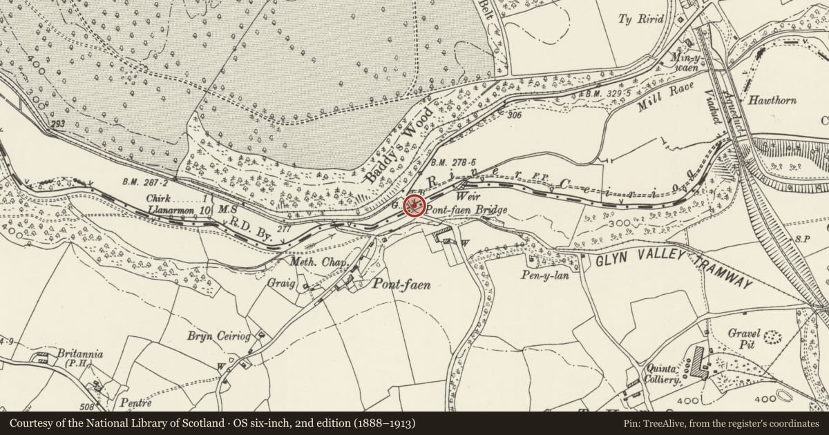
Slide toward Today to fade the historical sheet and see the modern map underneath.
David Rumsey Map Collection, Stanford LibrariesDavid Rumsey Map Collection, Stanford LibrariesDavid Rumsey Map Collection, Stanford LibrariesLlyfrgell Genedlaethol Cymru – The National Library of WalesDavid Rumsey Map Collection, Stanford Libraries
5 historical maps cover this location, the earliest the 1608 map "(13) Cambriae Typus." (David Rumsey Map Collection, Stanford Libraries).
Historical maps covering this location
- 1608 · (13) Cambriae Typus. (David Rumsey Map Collection, Stanford Libraries)
- 1795 · To Sir Watkin Williams-Wynn Bart ... the map of the six counties of North Wales is most… (Llyfrgell Genedlaethol Cymru – The National Library of Wales)
- 1883 · Watershed map England, Wales 3. (David Rumsey Map Collection, Stanford Libraries)
- 1898 · 121 Wrexham (Hills) (David Rumsey Map Collection, Stanford Libraries)
- 1901 · Sheet 9 and 10. (David Rumsey Map Collection, Stanford Libraries)
Cadw's description
Location
The bridge carries the road from Chirk to Weston Rhyn across the Afon Ceiriog.
History
An earlier masonry bridge was recorded on this site in 1602 joining the lordships of Chirkland and Oswestry. Repairs are recorded in 1691, in 1720s, and again in 1759, when Shropshire and Denbighshire jointly spent £5. The present bridge appears to be the result of a major repair or rebuilding later in the C18 although the tie bars inserted in the 1720's remain.
Exterior
Built of sandstone ashlar between rubble embankments, the ashlar courses dipping slightly to the arch. A single span segmental arch of c12.5m (41ft), the apex rising c4.33m above flood water level. The arch consists of two rings, the inner one of voussoirs set back from the upper regulating course which is flush with the spandrels. The soffit width is 3.25m. Orthostatic parapets above a flat string course, originally cramped together. They narrow the slightly sloping carriageway to 2.7m.
Reason for designation
Included as a handsome and well built C18 masonry bridge, which has not been significantly altered.
Nearby in the register
- Deerpark LodgeGardens, Parks and Urban Spacesunder 1 mi
- Deer Park WallGardens, Parks and Urban Spacesunder 1 mi
- Chirk Castle Gates, Screen and PiersGardens, Parks and Urban Spacesunder 1 mi
- Town ReservoirWater Supply and Drainageunder 1 mi
Other entries of the same register within about three miles of this one, by straight line.