Cof Cymru: National Historic Assets of Wales · Wales
The Spinning Wheel Cafe
Tenby, Pembrokeshire, Wales
A Grade II listed building in Tenby, Pembrokeshire, designated on 3 March 1961.
The record
- Designation
- Listed building, Grade II
- Broad class
- Domestic
- Date of designation
- 3 March 1961
- Town
- Tenby
- Community
- Tenby
- Unitary authority
- Pembrokeshire
- Country
- Wales
- Coordinates
- 51.67163, -4.69671
- Cadw reference
- 6243
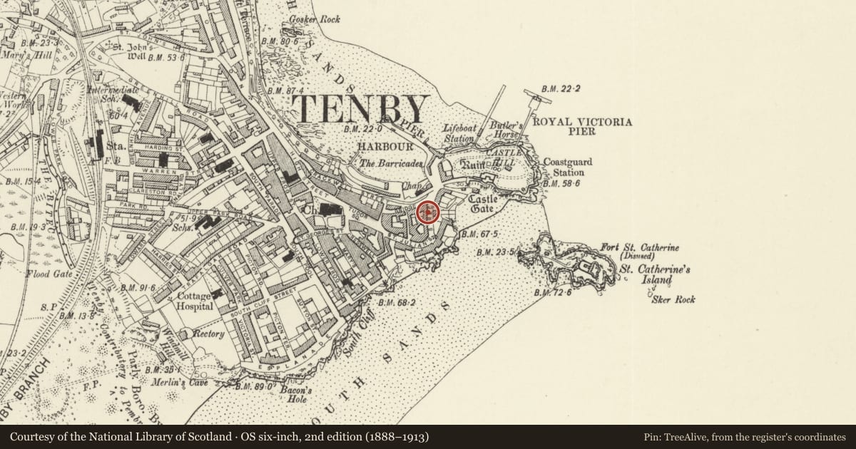
Slide toward Today to fade the historical sheet and see the modern map underneath.
David Rumsey Map Collection, Stanford LibrariesDavid Rumsey Map Collection, Stanford LibrariesDavid Rumsey Map Collection, Stanford LibrariesDavid Rumsey Map Collection, Stanford LibrariesDavid Rumsey Map Collection, Stanford Libraries
5 historical maps cover this location, the earliest the 1636 map "Cornubia : Devonia, Somersetus, Dorcestria, Wiltonia, Glocestria ..." (David Rumsey Map Collection, Stanford Libraries).
Historical maps covering this location
- 1636 · Cornubia : Devonia, Somersetus, Dorcestria, Wiltonia, Glocestria ... (David Rumsey Map Collection, Stanford Libraries)
- 1865 · England and Wales. England No. 6. (David Rumsey Map Collection, Stanford Libraries)
- 1891 · Sheet 10. Ordnance Survey of England and Wales. . (David Rumsey Map Collection, Stanford Libraries)
- 1898 · 245 Pembroke (Hills) (David Rumsey Map Collection, Stanford Libraries)
- 1901 · Sheet 13. (David Rumsey Map Collection, Stanford Libraries)
Cadw's description
Location
Situated on the W side of St Julian's Street approximately 35m S of the junction with Bridge Street.
History
Early C19 3-storey small house, one of a terraced row with Nos 2 and 1 to right.
Exterior
House, painted lined stucco with slate roof and nogged brick eaves. Rendered left end stack. Three storeys, 1 window bay with doorway to right. Raised plinth, small-paned hornless sashes restored since 1977. 12-pane sash to upper floor, first floor canted oriel window with 4-12-4-pane sashes and timber cornice, over ground floor 12-pane sash. To right on ground floor, an arched doorway with moulded stuccoed surround, with pilasters, moulded capitals, and moulded arch with raised keystone and springing blocks. Half-glazed C20 door with unusual traceried fanlight. Basement grille under ground floor window. Rendered left end wall.
Interior
Ground floor altered into one room with C20 stairs on left.
Reason for designation
Included as part of a good early C19 terrace with Nos 1 and 2.
Nearby in the register
- WindermereDomesticunder 1 mi
- 1 St Julian's StreetCommercialunder 1 mi
- Kemendine and area railingsDomesticunder 1 mi
- SeagarthDomesticunder 1 mi
Other entries of the same register within about three miles of this one, by straight line.