Cof Cymru: National Historic Assets of Wales · Wales
Stable block at the Old Rectory
Tenby, Pembrokeshire, Wales
A Grade II listed building in Tenby, Pembrokeshire, designated on 26 April 1977.
The record
- Designation
- Listed building, Grade II
- Broad class
- Domestic
- Date of designation
- 26 April 1977
- Town
- Tenby
- Community
- Tenby
- Unitary authority
- Pembrokeshire
- Country
- Wales
- Coordinates
- 51.67661, -4.70402
- Cadw reference
- 6216
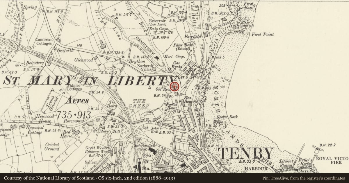
Slide toward Today to fade the historical sheet and see the modern map underneath.
David Rumsey Map Collection, Stanford LibrariesDavid Rumsey Map Collection, Stanford LibrariesDavid Rumsey Map Collection, Stanford LibrariesDavid Rumsey Map Collection, Stanford LibrariesDavid Rumsey Map Collection, Stanford Libraries
5 historical maps cover this location, the earliest the 1636 map "Cornubia : Devonia, Somersetus, Dorcestria, Wiltonia, Glocestria ..." (David Rumsey Map Collection, Stanford Libraries).
Historical maps covering this location
- 1636 · Cornubia : Devonia, Somersetus, Dorcestria, Wiltonia, Glocestria ... (David Rumsey Map Collection, Stanford Libraries)
- 1865 · England and Wales. England No. 6. (David Rumsey Map Collection, Stanford Libraries)
- 1891 · Sheet 10. Ordnance Survey of England and Wales. . (David Rumsey Map Collection, Stanford Libraries)
- 1898 · 245 Pembroke (Hills) (David Rumsey Map Collection, Stanford Libraries)
- 1901 · Sheet 13. (David Rumsey Map Collection, Stanford Libraries)
Cadw's description
Location
Situated to the W of The Old Rectory on the W side of the Norton.
History
Lofted stable to the former Rectory, probably earlier to mid C19. The buildings marked on the 1849 Tenby map, to a U-plan may include this range, but it may be rebuilt in the 1850s when work was done on the rectory. Building accounts of 1813 refer to reroofing barn and granary, but may not refer to this building.
Exterior
Lofted stable range with attached garage, rubble stone with close-eaved slate roofs and red tile ridges. On the first floor, a paired casement each side of an off-centre ledged loft door, reached via an external stone stair. The stair is arched beneath, giving access to the ground floor ledged door. A 12-pane sash window with red brick head to right, and a low ledged door closely adjoining to right. C20 inserted triple casement in left gable end, small loft light in right gable end over roof of attached single-storey garage with slate close-eaved roof and double timber doors.
Reason for designation
Included as a small lofted stable, of group value with the Old Rectory.
Nearby in the register
- The Old RectoryDomesticunder 1 mi
- Garden walls and gate at The Old RectoryDomesticunder 1 mi
- Bell-Tree HouseCommercialunder 1 mi
- Former Tenby Market Cross and well-chamberGardens, Parks and Urban Spacesunder 1 mi
Other entries of the same register within about three miles of this one, by straight line.