Cof Cymru: National Historic Assets of Wales · Wales
Cefn (Newbridge) Railway Viaduct (partly in Chirk Community)
Cefn, Wrexham, Wales
A Grade II* listed building in Newbridge, Cefn, Wrexham, designated on 4 January 1966.
The record
- Designation
- Listed building, Grade II*
- Broad class
- Transport
- Date of designation
- 4 January 1966
- Locality
- Newbridge
- Community
- Cefn
- Unitary authority
- Wrexham
- Country
- Wales
- Coordinates
- 52.96308, -3.06534
- Cadw reference
- 619
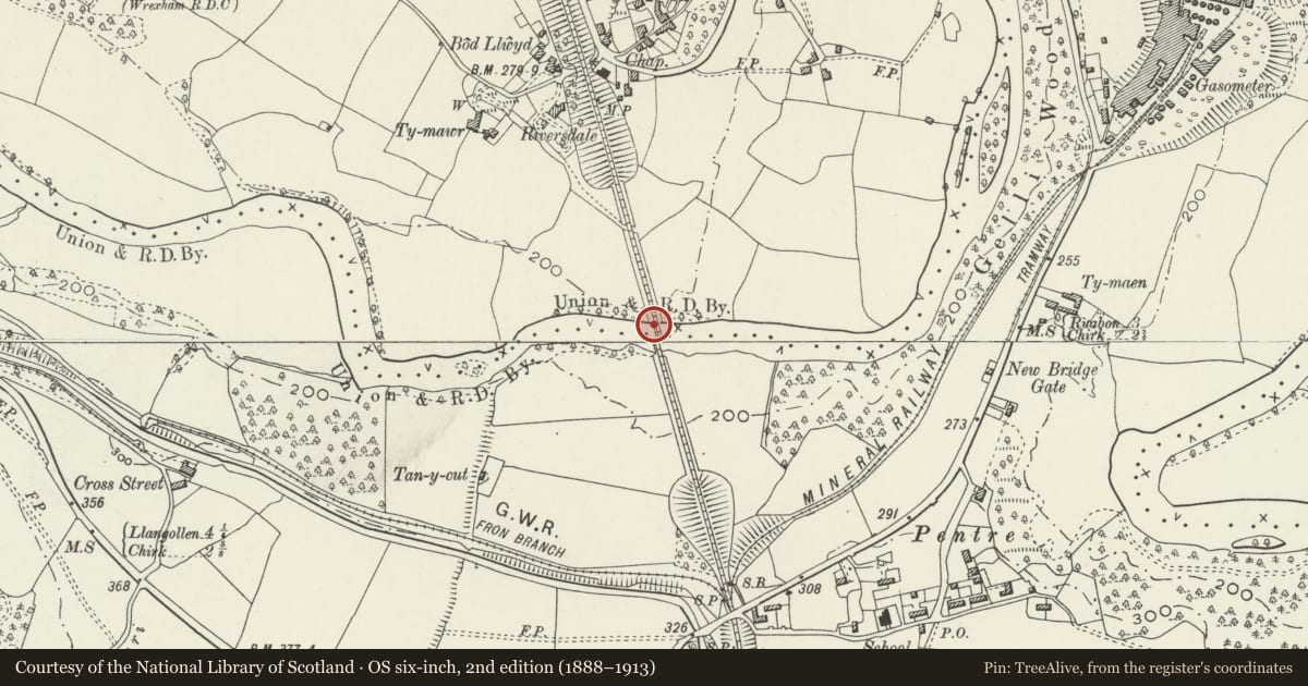
Slide toward Today to fade the historical sheet and see the modern map underneath.
David Rumsey Map Collection, Stanford LibrariesDavid Rumsey Map Collection, Stanford LibrariesDavid Rumsey Map Collection, Stanford LibrariesDavid Rumsey Map Collection, Stanford LibrariesLlyfrgell Genedlaethol Cymru – The National Library of Wales
5 historical maps cover this location, the earliest the 1795 map "To Sir Watkin Williams-Wynn Bart ... the map of the six counties of North Wales is most humbly inscribed by his obedient humble servant" (Llyfrgell Genedlaethol Cymru – The National Library of Wales).
Historical maps covering this location
- 1795 · To Sir Watkin Williams-Wynn Bart ... the map of the six counties of North Wales is most… (Llyfrgell Genedlaethol Cymru – The National Library of Wales)
- 1883 · Watershed map England, Wales 3. (David Rumsey Map Collection, Stanford Libraries)
- 1898 · 121 Wrexham (Hills) (David Rumsey Map Collection, Stanford Libraries)
- 1898 · 121 Wrexham (Outline) (David Rumsey Map Collection, Stanford Libraries)
- 1901 · Sheet 9 and 10. (David Rumsey Map Collection, Stanford Libraries)
Cadw's description
Location
Carries the railway over the River Dee between Newbridge and Cefn-Bychan
History
Built for the Shrewsbury and Chester Railway, by the railway's engineer, Henry Robertson, in 1846-8.
Exterior
Coursed and squared stone. 19-arch span, and 150 feet high. The arches are carried on slender piers, with continuous chamfered mouldings. Modillion cornice below ashlar parapet. Terminal piers are pedimented with stepped blocking course above arched recesses with keystones.
Reason for designation
A highly impressive and architecturally elegant example of mid C19 railway engineering.
Nearby in the register
- Cefn (Newbridge) Railway Viaduct (partly in Cefn Community)Transportunder 1 mi
- Offa's Dyke: Section N & S of Tan-y-CutLinear Earthworkunder 1 mi
- Cefn Bychan Baptist ChapelReligious, Ritual and Funeraryunder 1 mi
- Irishman's Bridge on the Llangollen CanalTransportunder 1 mi
Other entries of the same register within about three miles of this one, by straight line.