Cof Cymru: National Historic Assets of Wales · Wales
Stretton House
Tenby, Pembrokeshire, Wales
A Grade II listed building in Tenby, Pembrokeshire, designated on 26 April 1977.
The record
- Designation
- Listed building, Grade II
- Broad class
- Domestic
- Date of designation
- 26 April 1977
- Town
- Tenby
- Community
- Tenby
- Unitary authority
- Pembrokeshire
- Country
- Wales
- Coordinates
- 51.67058, -4.69944
- Cadw reference
- 6186
Slide toward Today to fade the historical sheet and see the modern map underneath.
David Rumsey Map Collection, Stanford LibrariesDavid Rumsey Map Collection, Stanford LibrariesDavid Rumsey Map Collection, Stanford LibrariesDavid Rumsey Map Collection, Stanford LibrariesDavid Rumsey Map Collection, Stanford Libraries
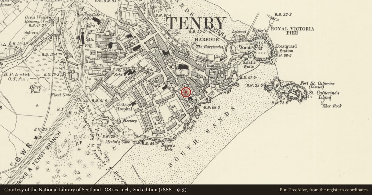
5 historical maps cover this location, the earliest the 1636 map "Cornubia : Devonia, Somersetus, Dorcestria, Wiltonia, Glocestria ..." (David Rumsey Map Collection, Stanford Libraries).
Historical maps covering this location
- 1636 · Cornubia : Devonia, Somersetus, Dorcestria, Wiltonia, Glocestria ... (David Rumsey Map Collection, Stanford Libraries)
- 1865 · England and Wales. England No. 6. (David Rumsey Map Collection, Stanford Libraries)
- 1891 · Sheet 10. Ordnance Survey of England and Wales. . (David Rumsey Map Collection, Stanford Libraries)
- 1898 · 245 Pembroke (Hills) (David Rumsey Map Collection, Stanford Libraries)
- 1901 · Sheet 13. (David Rumsey Map Collection, Stanford Libraries)
Cadw's description
Location
On the NE side of Lower Frog Street approximately half way between St George's Street and the Paragon.
History
Earlier to mid C19 two-storey terraced house, larger than the others in the row, perhaps of slightly earlier date.
Exterior
Terraced house, with painted rendered elevation of 2 storeys and 3 well-spaced bays. Close-eaved slate gabled roof and red brick end-wall stacks. Raised plinth. 4-pane horned sash windows in all window openings except in 1st floor right hand bay which has a timber canted oriel window with fixed 4-12-4-pane glazing, renewed in late C20. Ground floor central arched doorway with stuccoed surround, recessed door with 2 long panels and fanlight with C20 radiating bars.
Interior
Centre hall with dog-leg staircase, closed string thin bulbous turned newel, stick balusters.
Reason for designation
Included as a little altered mid C19 terraced house within the medieval town walls.
Nearby in the register
- No 1 St David's CottagesDomesticunder 1 mi
- No 2 St David's CottagesDomesticunder 1 mi
- Winkle CottageDomesticunder 1 mi
- Gumfreston CottageDomesticunder 1 mi
Other entries of the same register within about three miles of this one, by straight line.