Cof Cymru: National Historic Assets of Wales · Wales
Henfache
Llanrhaeadr-ym-Mochnant, Powys, Wales
A Grade II* listed building in Henfache, Llanrhaeadr-ym-Mochnant, Powys, designated on 20 October 1952.
The record
- Designation
- Listed building, Grade II*
- Broad class
- Agriculture and Subsistence
- Date of designation
- 20 October 1952
- Locality
- Henfache
- Community
- Llanrhaeadr-ym-Mochnant
- Unitary authority
- Powys
- Country
- Wales
- Coordinates
- 52.83365, -3.30201
- Cadw reference
- 606
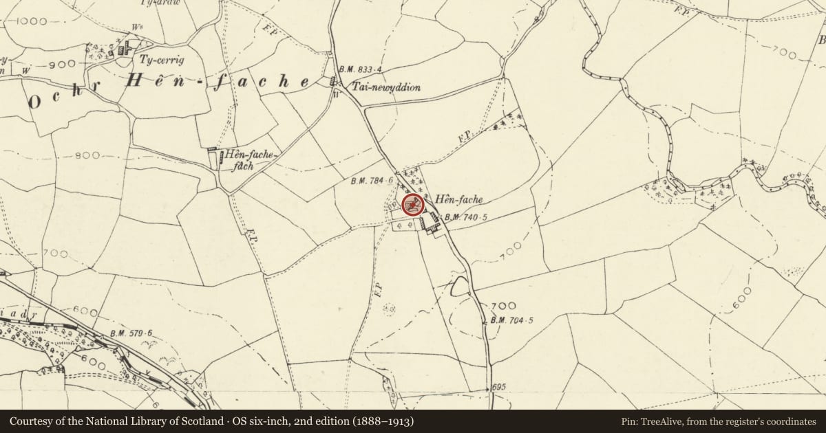
Slide toward Today to fade the historical sheet and see the modern map underneath.
David Rumsey Map Collection, Stanford LibrariesDavid Rumsey Map Collection, Stanford LibrariesLlyfrgell Genedlaethol Cymru – The National Library of WalesDavid Rumsey Map Collection, Stanford LibrariesDavid Rumsey Map Collection, Stanford Libraries
5 historical maps cover this location, the earliest the 1608 map "(13) Cambriae Typus." (David Rumsey Map Collection, Stanford Libraries).
Historical maps covering this location
- 1608 · (13) Cambriae Typus. (David Rumsey Map Collection, Stanford Libraries)
- 1795 · To Sir Watkin Williams-Wynn Bart ... the map of the six counties of North Wales is most… (Llyfrgell Genedlaethol Cymru – The National Library of Wales)
- 1883 · Watershed map England, Wales 3. (David Rumsey Map Collection, Stanford Libraries)
- 1897 · 137 Oswestry (Hills) (David Rumsey Map Collection, Stanford Libraries)
- 1901 · Sheet 9 and 10. (David Rumsey Map Collection, Stanford Libraries)
Cadw's description
Location
To the north of the farmyard of Henfache, about 1 km north of the village of Llanrhaeadr-ym-Mochnant.
History
A house associated with the Maurice family, considerably enlarged in 1702; the date-stone carries the initials SM and EM. The core is the north/south range, sited downslope, with an irregular roof line. To this have been added both east and west wings. The west wing is of brickwork and is C17 and part C19; the east wing is of stone and is the dated part. The Royal Commission refers to 'open timber work with clay filling; this has been faced with brick'.
The farmhouse is marked on the Tithe Survey (1839) as Plas Henfache, when it was the property of Frances Roberts and occupied by Henry Ellis with about 167 acres (67.64 hectares).
Exterior
A large farmhouse partly in brick and partly in stone, painted white, with restored slate roofs; brick end-chimneys, stone mid-chimneys.
The enlargements of c.1700 have given Henfache a large irregular south-facing front of considerable character including two main gables. The central gabled part (apparently replacing or concealing the gable end of the original downslope range) is in brickwork, and consists of two storeys and an attic, marked by decorative string courses. To the right of this but set about 3 m back is the second gable, part of the east wing in stone. There is a two-storey brickwork wing to left in two phases of construction. The wing to the right incorporating the second gable is of two storeys and an attic and has a large single storey low-pitched lean-to at the end.
The fenestration of this south elevation (including the right return wall of the main gable) consists of 12-pane sash-windows, some horned, some hornless. The windows to the right of the right wing are of 16 panes, hornless. The attic windows in each of the two gables consist of pairs of casements. In the angle formed by the return part and the right wing is a modern glazed porch sheltering a modern semi-glazed door.
To the rear of the house is a very large lateral chimney serving the east wing; replaced windows throughout.
Interior
Not re-inspected at time of resurvey, but interior features are reported to include a timber half-newel staircase, solid oak stair treads, some internal timber framing, exposed ceiling beams and panelling.
Reason for designation
Listed at grade II* as a fine farmhouse in the architectural character of the end of the C17.
Nearby in the register
- Bryn TirionDomesticunder 1 mi
- ArwelfaDomesticunder 1 mi
- BodawelDomesticunder 1 mi
- Lloran HouseDomesticunder 1 mi
Other entries of the same register within about three miles of this one, by straight line.