Cof Cymru: National Historic Assets of Wales · Wales
Limekiln
Stackpole and Castlemartin, Pembrokeshire, Wales
A Grade II listed building in Stackpole Quay, Stackpole and Castlemartin, Pembrokeshire, designated on 14 May 1970.
The record
- Designation
- Listed building, Grade II
- Broad class
- Industrial
- Date of designation
- 14 May 1970
- Locality
- Stackpole Quay
- Community
- Stackpole and Castlemartin
- Unitary authority
- Pembrokeshire
- Country
- Wales
- Coordinates
- 51.62541, -4.90139
- Cadw reference
- 6024
Slide toward Today to fade the historical sheet and see the modern map underneath.
David Rumsey Map Collection, Stanford LibrariesDavid Rumsey Map Collection, Stanford LibrariesDavid Rumsey Map Collection, Stanford LibrariesDavid Rumsey Map Collection, Stanford LibrariesDavid Rumsey Map Collection, Stanford Libraries
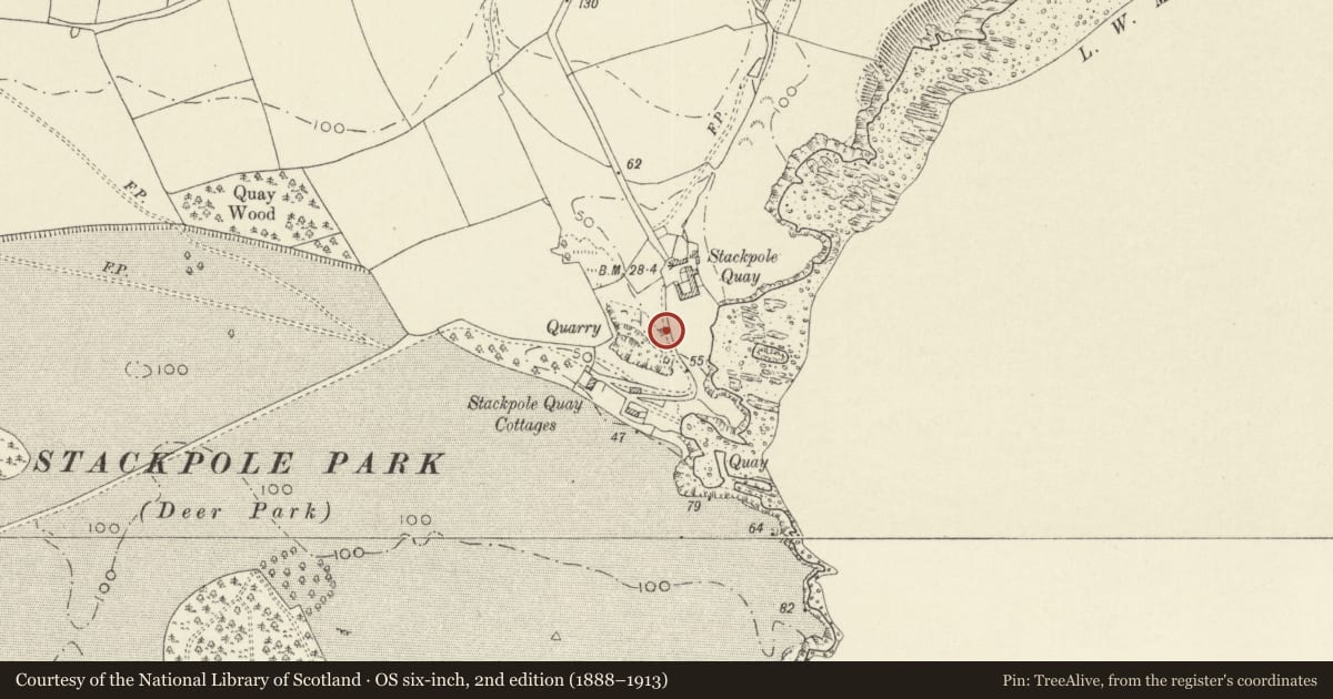
5 historical maps cover this location, the earliest the 1636 map "Cornubia : Devonia, Somersetus, Dorcestria, Wiltonia, Glocestria ..." (David Rumsey Map Collection, Stanford Libraries).
Historical maps covering this location
- 1636 · Cornubia : Devonia, Somersetus, Dorcestria, Wiltonia, Glocestria ... (David Rumsey Map Collection, Stanford Libraries)
- 1637 · The fourth table of England. Cornub. Devonia, Somerset etc. (David Rumsey Map Collection, Stanford Libraries)
- 1865 · England and Wales. England No. 6. (David Rumsey Map Collection, Stanford Libraries)
- 1891 · Sheet 10. Ordnance Survey of England and Wales. . (David Rumsey Map Collection, Stanford Libraries)
- 1898 · 245 Pembroke (Hills) (David Rumsey Map Collection, Stanford Libraries)
Cadw's description
Location
At W side of approach road to Stackpole Quay.
History
Stackpole Quay quarry was opened c.1690, and the kiln is thought to date from 1694.
Exterior
Large square single limekiln with a brick-lined bowl increasing to 3 m diameter at the top platform level. Built against high ground at its W side. Path up to the platform from the quarry at W. Working openings level with the road at the E.
The kiln has buttresses at the N, S and E sides. Draw-arches of corbelled construction at N and S, with top slabs spanning up to 1 m. Within each arch an upper inspection hole approx. 20 cm square, and a lower draw hole approx. 80 cm wide.
The bowl is lined in [modern] firebricks in header bond. The lining survives to the full height of the kiln and there are marks indicating that it rose above the present kiln platform level. The kiln and its buttresses in limestone, with traces of render. The top of the kiln has been made safe for public access. Small parapet wall.
Reason for designation
Listed as a well preserved limekiln of early date, in an area of public access.
Nearby in the register
- Stackpole EarthworkEnclosureunder 1 mi
- Old School houseEducationunder 1 mi
- SchoolroomEducationunder 1 mi
- Armstrong ArmsCommunicationsunder 1 mi
Other entries of the same register within about three miles of this one, by straight line.