Cof Cymru: National Historic Assets of Wales · Wales
Shute Cottage
Manorbier, Pembrokeshire, Wales
A Grade II listed building in Manorbier Village, Manorbier, Pembrokeshire, designated on 14 May 1970.
The record
- Designation
- Listed building, Grade II
- Broad class
- Domestic
- Date of designation
- 14 May 1970
- Locality
- Manorbier Village
- Community
- Manorbier
- Unitary authority
- Pembrokeshire
- Country
- Wales
- Coordinates
- 51.64472, -4.79744
- Cadw reference
- 5978
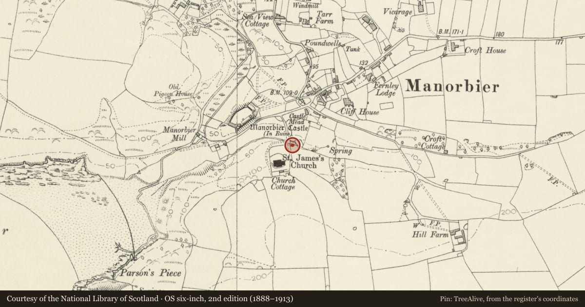
Slide toward Today to fade the historical sheet and see the modern map underneath.
David Rumsey Map Collection, Stanford LibrariesDavid Rumsey Map Collection, Stanford LibrariesDavid Rumsey Map Collection, Stanford LibrariesDavid Rumsey Map Collection, Stanford LibrariesDavid Rumsey Map Collection, Stanford Libraries
5 historical maps cover this location, the earliest the 1636 map "Cornubia : Devonia, Somersetus, Dorcestria, Wiltonia, Glocestria ..." (David Rumsey Map Collection, Stanford Libraries).
Historical maps covering this location
- 1636 · Cornubia : Devonia, Somersetus, Dorcestria, Wiltonia, Glocestria ... (David Rumsey Map Collection, Stanford Libraries)
- 1865 · England and Wales. England No. 6. (David Rumsey Map Collection, Stanford Libraries)
- 1891 · Sheet 10. Ordnance Survey of England and Wales. . (David Rumsey Map Collection, Stanford Libraries)
- 1898 · 245 Pembroke (Hills) (David Rumsey Map Collection, Stanford Libraries)
- 1901 · Sheet 13. (David Rumsey Map Collection, Stanford Libraries)
Cadw's description
Location
At left of the road o the approach to Manorbier Church from the village, beside a stream.
History
A 2-room single-storey cottage with a central chimney, facing N. The design is C19 picturesque, but the cottage does not appear on the Tithe Map of 1840. (At that date the site was a field belonging to Hill farm, owned by George Millar. At Hill Farm there are also outbuildings with pointed-arch windows).
Exterior
Walls 0.6 m thick in rubble stonework, painted white. Gabled roof of modern tiles with deep verge and eaves overhangs. At the centre is a rendered octagonal chimney stack of moderate height but about one metre breadth, with stone capping and dripstones at the foot. The square base of the chimney is visible above the tiles.
Central door with equilateral pointed arch. The window also have pointed arches but with a smaller span. There are pointed windows at rear also.
At the left gable (E) is a scullery extension in similar masonry under a low-pitched lean-to roof, which is not original.
Reason for designation
Listed as a mid-C19 picturesque cottage and for group value with St James’ Church.
Nearby in the register
- St James' ChurchReligious, Ritual and Funeraryunder 1 mi
- Ruins adjacent to Church Hill Cottage, Ruin ADomesticunder 1 mi
- Church Hill CottageDomesticunder 1 mi
- Ruins adjacent to Church Hill Cottage, Ruin CDomesticunder 1 mi
Other entries of the same register within about three miles of this one, by straight line.