Cof Cymru: National Historic Assets of Wales · Wales
Hodgeston Hall
Lamphey, Pembrokeshire, Wales
A Grade II listed building in Hodgeston Village, Lamphey, Pembrokeshire, designated on 14 May 1970.
The record
- Designation
- Listed building, Grade II
- Broad class
- Domestic
- Date of designation
- 14 May 1970
- Locality
- Hodgeston Village
- Community
- Lamphey
- Unitary authority
- Pembrokeshire
- Country
- Wales
- Coordinates
- 51.65790, -4.85108
- Cadw reference
- 5960
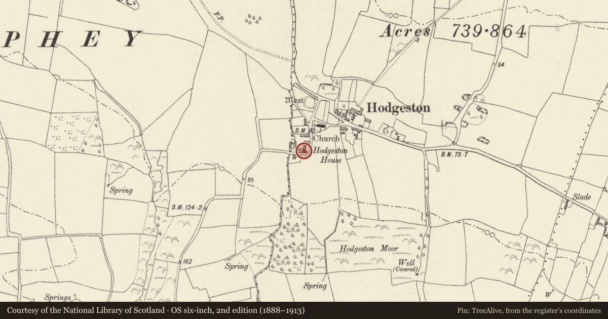
Slide toward Today to fade the historical sheet and see the modern map underneath.
David Rumsey Map Collection, Stanford LibrariesDavid Rumsey Map Collection, Stanford LibrariesDavid Rumsey Map Collection, Stanford LibrariesDavid Rumsey Map Collection, Stanford LibrariesDavid Rumsey Map Collection, Stanford Libraries
5 historical maps cover this location, the earliest the 1636 map "Cornubia : Devonia, Somersetus, Dorcestria, Wiltonia, Glocestria ..." (David Rumsey Map Collection, Stanford Libraries).
Historical maps covering this location
- 1636 · Cornubia : Devonia, Somersetus, Dorcestria, Wiltonia, Glocestria ... (David Rumsey Map Collection, Stanford Libraries)
- 1865 · England and Wales. England No. 6. (David Rumsey Map Collection, Stanford Libraries)
- 1891 · Sheet 10. Ordnance Survey of England and Wales. . (David Rumsey Map Collection, Stanford Libraries)
- 1898 · 245 Pembroke (Hills) (David Rumsey Map Collection, Stanford Libraries)
- 1901 · Sheet 13. (David Rumsey Map Collection, Stanford Libraries)
Cadw's description
Location
At SW corner of Hodgeston village, 100 m from the church.
Exterior
History: House of c.1800. In 1787 the ownership of the estate was held in three shares, the largest being that of the Rev. Arthur Owen. In 1840 the same share was owned by Griffith Owen, and the occupant of Hodgeston Hall was John Owen. The house may possibly have served as a rectory: Thomas Owen MA was Rector of Hodgeston from 1829. It is now a farmhouse.
Exterior: The main range containg the front entrance and best reception room faces E, and there is a large cross-wing at the left which projects at both the front and the rear. At the rear of the main range are what appear to have been servants' quarters.
The main range and the cross-wing have roofs rising to the same height but the cross-wing has a lower eaves level. Smooth-rendered rubble limestone masonry, with the render lightly scored to imitate stone courses. Slate roofs. End-chimneys at the right of the main range and at front and rear ends of the cross-wing. One intermediate chimney in the cross-wing.
At front: main door with four panels, the top ones sunk, the bottom ones flush. Narrow side-lights with boxed shutters inside. Flat-roofed porch with two columns. Windows generally have exposed frames. In front elevation, above: sashes of three and six panes. Below: four and four panes. In wing: old sashes mostly replaced with modern single-pane sashes. The reception room at the right (N) in the main range is of good proportions. It has a tripartite window with mullions and narrow side sashes, and boxed shutters. The wing has a range of three windows but no door to its S elevation.
Interior: The entrance hall contains a dogleg staircase with close-string and swept handrail. Turned newels, square balusters. In the best room, to right of the entrance, the fireplace position appears to have been altered from the gable wall to the rear lateral wall. The rear premises have their upper floor about 50 cm lower than those of the other parts of the house. In a lobby leading to the present kitchen is an extraordinarily steep back-staircase. Further modern additions at W. The cross-wing contains three rooms, the rear room (W) being the old kitchen with a large chimney and bread-oven. Rubble stone garden wall and wrought-iron gate.
Listed as a gentleman's residence of c.1800 which has retained its character.
References: Estates of Edward Loveden (1787) NLW MS Maps vol 39
West Wales Hist Soc II (1912) 204. Hodgeston Tithe Survey (1840) parcel 71
Nearby in the register
- Hodgeston Parish ChurchReligious, Ritual and Funeraryunder 1 mi
- Hodgeston Moated SiteMoated Siteunder 1 mi
- Lime kiln at Cleggars FarmIndustrialunder 1 mi
- West Moor FarmhouseDomesticunder 1 mi
Other entries of the same register within about three miles of this one, by straight line.