Cof Cymru: National Historic Assets of Wales · Wales
Barn at Plas Glasgwm
Bro Machno, Conwy, Wales
A Grade II listed building in Glasgwm, Bro Machno, Conwy, designated on 17 July 1992.
The record
- Designation
- Listed building, Grade II
- Broad class
- Agriculture and Subsistence
- Date of designation
- 17 July 1992
- Locality
- Glasgwm
- Community
- Bro Machno
- Unitary authority
- Conwy
- Country
- Wales
- Coordinates
- 53.03668, -3.83056
- Cadw reference
- 5899
Slide toward Today to fade the historical sheet and see the modern map underneath.
David Rumsey Map Collection, Stanford LibrariesDavid Rumsey Map Collection, Stanford LibrariesLlyfrgell Genedlaethol Cymru – The National Library of WalesDavid Rumsey Map Collection, Stanford LibrariesDavid Rumsey Map Collection, Stanford Libraries
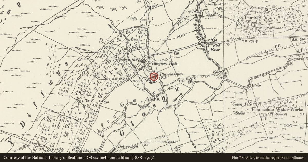
5 historical maps cover this location, the earliest the 1795 map "To Sir Watkin Williams-Wynn Bart ... the map of the six counties of North Wales is most humbly inscribed by his obedient humble servant" (Llyfrgell Genedlaethol Cymru – The National Library of Wales).
Historical maps covering this location
- 1795 · To Sir Watkin Williams-Wynn Bart ... the map of the six counties of North Wales is most… (Llyfrgell Genedlaethol Cymru – The National Library of Wales)
- 1830 · V.3:11-15:XV. Britisches Reich. A. Kon: England. b. Frstenthum Wales: Shire: 37-40 (David Rumsey Map Collection, Stanford Libraries)
- 1883 · Watershed map England, Wales 3. (David Rumsey Map Collection, Stanford Libraries)
- 1899 · 119 Snowdon (Hills) (David Rumsey Map Collection, Stanford Libraries)
- 1901 · Sheet 9 and 10. (David Rumsey Map Collection, Stanford Libraries)
Cadw's description
Location
Below Glasgwm Road, immediately to W of Plas Glasgwm farmhouse.
History
C18 barn.
Exterior
Slate roof, hipped to N. Rubble walls, roughly squared and roughly coursed on plinth of heavy flat stones. S gable end truncated and altered to form modern broad entrance for agricultural machinery but barn not 'destroyed' as recorded in RCAHM Wales Caernarvonshire Inventory. W elevation has to L, doorway with deep stone lintel, and to R, doorway with re-used C15/C16 doorhead with 4-centred arch. N elevation has square pitching window. Outbuilding to N end of E side.
Interior
Interior has old roof trusses of collar and tie beam type with queen posts, but N truss of different type with curved principals and tie beam only. Two tiers of purlins.
Reason for designation
Included for group value with Plas Glasgwm farmhouse.
Nearby in the register
- Plas GlasgwmDomesticunder 1 mi
- LlugalltDomesticunder 1 mi
- Blaen Glasgwm UchafDomesticunder 1 mi
- Pen-y-Bryn Farmhouse & attached Agricultural RangeDomesticunder 1 mi
Other entries of the same register within about three miles of this one, by straight line.