Cof Cymru: National Historic Assets of Wales · Wales
Lodge at Craig-y-Don
Cwm Cadnant, Isle of Anglesey, Wales
A Grade II listed building in Glyn Garth, Cwm Cadnant, Isle of Anglesey, designated on 19 October 1988.
The record
- Designation
- Listed building, Grade II
- Broad class
- Domestic
- Date of designation
- 19 October 1988
- Locality
- Glyn Garth
- Community
- Cwm Cadnant
- Unitary authority
- Isle of Anglesey
- Country
- Wales
- Coordinates
- 53.23754, -4.14571
- Cadw reference
- 5748
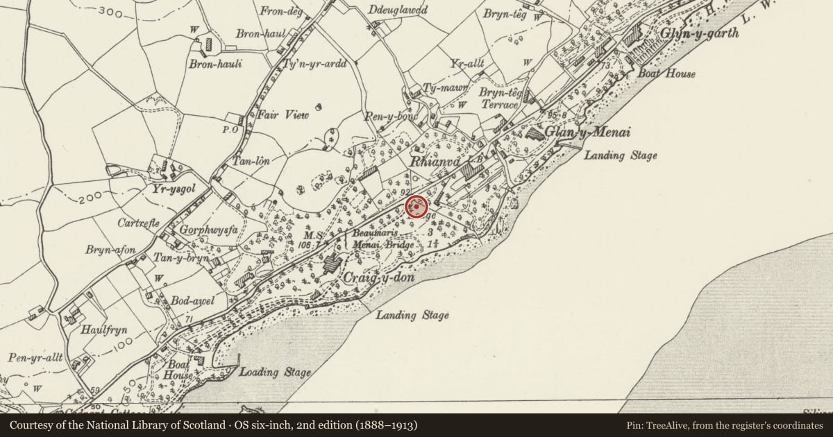
Slide toward Today to fade the historical sheet and see the modern map underneath.
David Rumsey Map Collection, Stanford LibrariesDavid Rumsey Map Collection, Stanford LibrariesDavid Rumsey Map Collection, Stanford LibrariesDavid Rumsey Map Collection, Stanford LibrariesDavid Rumsey Map Collection, Stanford Libraries
5 historical maps cover this location, the earliest the 1896 map "Sheet 7. Ordnance Survey of England and Wales." (David Rumsey Map Collection, Stanford Libraries).
Historical maps covering this location
- 1896 · Sheet 7. Ordnance Survey of England and Wales. (David Rumsey Map Collection, Stanford Libraries)
- 1899 · 106 Bangor (Outline) (David Rumsey Map Collection, Stanford Libraries)
- 1899 · 106 Bangor (Hills) (David Rumsey Map Collection, Stanford Libraries)
- 1901 · Sheet 9 and 10. (David Rumsey Map Collection, Stanford Libraries)
- 1919 · Sheet 41. Anglesey. (David Rumsey Map Collection, Stanford Libraries)
Cadw's description
Location
Set at the SE side of the A545 Beaumaris Road at the entry to the drive to Craig y Don above and to the NE of the house.
History
Early to mid C19.
Exterior
Tudor gothic single storey and attic roughcast lodge with slate roof, overhanging eaves and broad chimney stack. Two and 3-light casement windows, some modernised, with Tudor hoodmoulds and freestone surrounds. The 2-bay front facing SW has attic cross-gable to right and gabled porch to left with trellised detail around a pointed arch.
The rubble boundary walls curve inwards at the drive entry with gate piers and iron gates.
Reason for designation
Included for group value with Craig-y-Don, the boat-house and the coachhouse.
Nearby in the register
- Plas RhianfaDomesticunder 1 mi
- Milestone below Min y TwrTransportunder 1 mi
- Gate-house, with gate-piers and retaining wall to courtyard, Plas RhianfaDomesticunder 1 mi
- Summerhouse and dovecote in garden of Plas RhianfaDomesticunder 1 mi
Other entries of the same register within about three miles of this one, by straight line.