Cof Cymru: National Historic Assets of Wales · Wales
Boat-house at Craig-y-Don
Cwm Cadnant, Isle of Anglesey, Wales
A Grade II listed building in Glyn Garth, Cwm Cadnant, Isle of Anglesey, designated on 19 October 1988.
The record
- Designation
- Listed building, Grade II
- Broad class
- Domestic
- Date of designation
- 19 October 1988
- Locality
- Glyn Garth
- Community
- Cwm Cadnant
- Unitary authority
- Isle of Anglesey
- Country
- Wales
- Coordinates
- 53.23568, -4.14892
- Cadw reference
- 5747
Slide toward Today to fade the historical sheet and see the modern map underneath.
David Rumsey Map Collection, Stanford LibrariesDavid Rumsey Map Collection, Stanford LibrariesDavid Rumsey Map Collection, Stanford LibrariesDavid Rumsey Map Collection, Stanford LibrariesDavid Rumsey Map Collection, Stanford Libraries
5 historical maps cover this location, the earliest the 1896 map "Sheet 7. Ordnance Survey of England and Wales." (David Rumsey Map Collection, Stanford Libraries).
Historical maps covering this location
- 1896 · Sheet 7. Ordnance Survey of England and Wales. (David Rumsey Map Collection, Stanford Libraries)
- 1899 · 106 Bangor (Outline) (David Rumsey Map Collection, Stanford Libraries)
- 1899 · 106 Bangor (Hills) (David Rumsey Map Collection, Stanford Libraries)
- 1901 · Sheet 9 and 10. (David Rumsey Map Collection, Stanford Libraries)
- 1919 · Sheet 41. Anglesey. (David Rumsey Map Collection, Stanford Libraries)
Cadw's description
Location
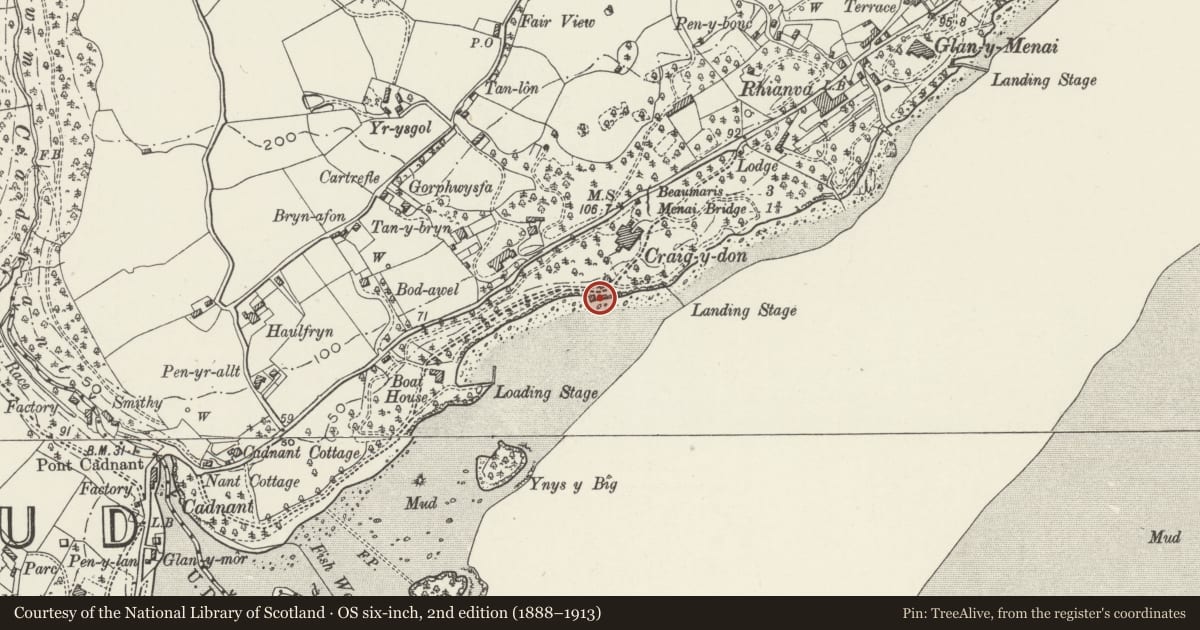
Set back from the SE side of the A545 Beaumaris Road. The boat-house is located at the foreshore of the Menai Straits to SW of the coach-house and stables.
History
Early to mid C19 (contemporary with the coach house and stables and rebuilding of the house).
Exterior
Two-storey rubble square boat house built up on raised platform with battered sides down to the water. Hipped slate roof with cresting and wide boarded eaves; Penmon stone dressings to the main openings. The NE side has boarded double doors with cambered head, opening onto a slipway beside which are steps down to the water. The opening above the broad doorway is louvred as are all those on the 2 ‘window’ SE side and 1 ‘window’ NW side.
Reason for designation
Group value with Craig-y-Don, the Lodge and the Coachhouse.
Nearby in the register
- Coachhouse at Craig-y-DonDomesticunder 1 mi
- Craig-y-DonDomesticunder 1 mi
- Milestone below Min y TwrTransportunder 1 mi
- Garden house at Min y TwrDomesticunder 1 mi
Other entries of the same register within about three miles of this one, by straight line.