Cof Cymru: National Historic Assets of Wales · Wales
Ucheldre Centre (Former Bon Sauveur Convent Chapel),
Holyhead, Isle of Anglesey, Wales
A Grade II listed building in Holyhead, Isle of Anglesey, designated on 4 May 1989.
The record
- Designation
- Listed building, Grade II
- Broad class
- Religious, Ritual and Funerary
- Date of designation
- 4 May 1989
- Community
- Holyhead
- Unitary authority
- Isle of Anglesey
- Country
- Wales
- Coordinates
- 53.30939, -4.63834
- Cadw reference
- 5741
Slide toward Today to fade the historical sheet and see the modern map underneath.
David Rumsey Map Collection, Stanford LibrariesDavid Rumsey Map Collection, Stanford LibrariesDavid Rumsey Map Collection, Stanford LibrariesDavid Rumsey Map Collection, Stanford LibrariesDavid Rumsey Map Collection, Stanford Libraries
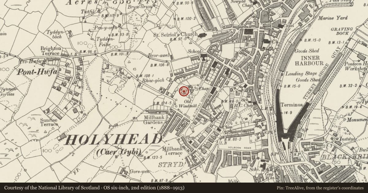
5 historical maps cover this location, the earliest the 1799 map "Ireland." (David Rumsey Map Collection, Stanford Libraries).
Historical maps covering this location
- 1799 · Ireland. (David Rumsey Map Collection, Stanford Libraries)
- 1883 · Watershed map England, Wales 3. (David Rumsey Map Collection, Stanford Libraries)
- 1899 · 93 Holyhead (Hills) (David Rumsey Map Collection, Stanford Libraries)
- 1901 · Sheet 9 and 10. (David Rumsey Map Collection, Stanford Libraries)
- 1919 · Sheet 41. Anglesey. (David Rumsey Map Collection, Stanford Libraries)
Cadw's description
History
Formerly chapel of former Bon Sauveur convent. Romanesque style; 1934-37 by Professor R M Butler, architect, of Dublin. Former attached early C20 school closed and demolished 1980’s. Under conversion to community centre at time of inspection.
Exterior
Grey-green stone with pale stone dressings over inner concrete core, grey-green slate roofs. Romanesque apsidal plan with low aisles, flanking vestry blocks, and saddle entrance tower. Simple round-arched openings to six bay sides. Saddle tower with parapetted gables, twin-arched openings with shafts and linked hood moulds, tall single light with twin nookshafts between clasping buttresses, blind arcade over 3-order doorway. To L of tower, 3 arches to service block with long return in grey stone; doorway flanked by groups of 3 round-headed windows; towards rear, two windows with 7 narrow arched lights; modern block with hipped roof to rear. To R of tower, arched screen wall in exposed stone connects to Ty’n Parc.
Interior
Undivided interior of 6 bays with concrete tunnel vault and semi-dome to apse, half-shafts to transverse ribs. Full-height arched bays interpenetrate main vault; single clerestorey lights over segmental aisle openings. Timber gallery in front of tower arch.
Reason for designation
Group value with Ty’n Parc.
Nearby in the register
- Ty'n ParcDomesticunder 1 mi
- Cybi Building, Holyhead High SchoolEducationunder 1 mi
- Boundary Wall to Cybi Building, Holyhead High SchoolEducationunder 1 mi
- Hyfrydle Chapel (including Forecourt Gates and Railings)Religious, Ritual and Funeraryunder 1 mi
Other entries of the same register within about three miles of this one, by straight line.