Cof Cymru: National Historic Assets of Wales · Wales
Bryn Bela
Beaumaris, Isle of Anglesey, Wales
A Grade II listed building in Twr Hill, Beaumaris, Isle of Anglesey, designated on 20 February 1978.
The record
- Designation
- Listed building, Grade II
- Broad class
- Domestic
- Date of designation
- 20 February 1978
- Locality
- Twr Hill
- Community
- Beaumaris
- Unitary authority
- Isle of Anglesey
- Country
- Wales
- Coordinates
- 53.27532, -4.11928
- Cadw reference
- 5698
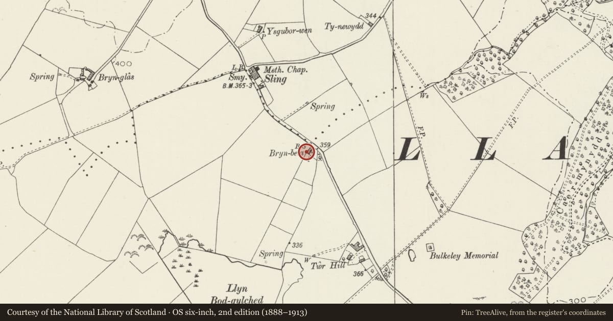
Slide toward Today to fade the historical sheet and see the modern map underneath.
David Rumsey Map Collection, Stanford LibrariesDavid Rumsey Map Collection, Stanford LibrariesDavid Rumsey Map Collection, Stanford LibrariesDavid Rumsey Map Collection, Stanford LibrariesDavid Rumsey Map Collection, Stanford Libraries
5 historical maps cover this location, the earliest the 1883 map "Watershed map England, Wales 3." (David Rumsey Map Collection, Stanford Libraries).
Historical maps covering this location
- 1883 · Watershed map England, Wales 3. (David Rumsey Map Collection, Stanford Libraries)
- 1896 · Sheet 7. Ordnance Survey of England and Wales. (David Rumsey Map Collection, Stanford Libraries)
- 1899 · 94 Beaumaris (Hills) (David Rumsey Map Collection, Stanford Libraries)
- 1901 · Sheet 9 and 10. (David Rumsey Map Collection, Stanford Libraries)
- 1919 · Sheet 41. Anglesey. (David Rumsey Map Collection, Stanford Libraries)
Cadw's description
Location
On the SW side of a minor road between Beaumaris and Llanddona, approximately 2.2km NW of Beaumaris town centre.
History
A mid C19 house shown on the 1866 plan of Beaumaris and 1889 Ordnance Survey.
Exterior
A 2-storey 3-window house of pebble-dashed walls, slate roof and pebble-dashed end stacks. Openings have segmental heads in the lower storey and comprise a central replacement door with overlight and 12-pane horned sash windows. Upper-storey windows are 12-pane hornless sashes. The R gable end also has a 12-pane hornless sash window in the upper storey, offset to the L side. In the rear elevation are inserted windows, except for a 4-pane horned sash window upper R. On the L side of the house is a 1-storey L-shaped range of pebble-dashed walls and slate roof, with replacement windows and door.
Interior
Not inspected.
Reason for designation
Listed for its special architectural interest as a mid C19 house of definite character.
Nearby in the register
- Boundary stone N of Bryn BelaCivilunder 1 mi
- Barn at Twr HillAgriculture and Subsistenceunder 1 mi
- Bulkeley MonumentCommemorativeunder 1 mi
- ElusendaiHealth and Welfareunder 1 mi
Other entries of the same register within about three miles of this one, by straight line.