Cof Cymru: National Historic Assets of Wales · Wales
Gate piers, gates, railings and flanking walls opposite Stanley Street
Beaumaris, Isle of Anglesey, Wales
A Grade II listed building in Beaumaris, Isle of Anglesey, designated on 20 February 1978.
The record
- Designation
- Listed building, Grade II
- Broad class
- Domestic
- Date of designation
- 20 February 1978
- Locality
- Beaumaris
- Town
- Beaumaris
- Community
- Beaumaris
- Unitary authority
- Isle of Anglesey
- Country
- Wales
- Coordinates
- 53.26491, -4.09534
- Cadw reference
- 5691
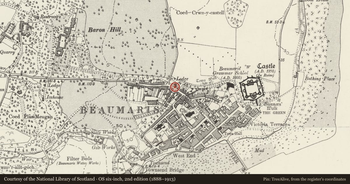
Slide toward Today to fade the historical sheet and see the modern map underneath.
David Rumsey Map Collection, Stanford LibrariesDavid Rumsey Map Collection, Stanford LibrariesDavid Rumsey Map Collection, Stanford LibrariesDavid Rumsey Map Collection, Stanford LibrariesDavid Rumsey Map Collection, Stanford Libraries
5 historical maps cover this location, the earliest the 1883 map "Watershed map England, Wales 3." (David Rumsey Map Collection, Stanford Libraries).
Historical maps covering this location
- 1883 · Watershed map England, Wales 3. (David Rumsey Map Collection, Stanford Libraries)
- 1896 · Sheet 7. Ordnance Survey of England and Wales. (David Rumsey Map Collection, Stanford Libraries)
- 1899 · 94 Beaumaris (Hills) (David Rumsey Map Collection, Stanford Libraries)
- 1901 · Sheet 9 and 10. (David Rumsey Map Collection, Stanford Libraries)
- 1919 · Sheet 41. Anglesey. (David Rumsey Map Collection, Stanford Libraries)
Cadw's description
Location
Set back from the road opposite Stanley Street.
History
Built c1862 at the end of a drive to Baron Hill from Beaumaris Castle along Castle Meadow. The drive continued SW along Stanley Street and beyond (now a housing estate) where it swept round to the NW towards Baron Hill. It is dated by an alternative design (not built) by J.F. Clark and it is shown on the 1889 Ordnance Survey.
Exterior
A gateway semi-circular in plan. Central cast iron gates have spear finials, flanked by square freestone piers with moulded caps. A similar pedestrian gate is to the L. Curving freestone dwarf walls have copings and railings with spear finials, and curve round to terminal square piers with moulded caps.
Reason for designation
Listed for its special interest as a well-detailed mid C19 gateway of definite architectural character, part of a group of estate buildings in Wexham Street and Stanley Street associated with one of the main approaches to Baron Hill, and for its overall contribution to the historical integrity of Wexham Street.
Nearby in the register
- Tunnel LodgeDomesticunder 1 mi
- 10 Wexham StreetNo class recordedunder 1 mi
- 9 Wexham StreetNo class recordedunder 1 mi
- 1 Stanley StreetDomesticunder 1 mi
Other entries of the same register within about three miles of this one, by straight line.