Cof Cymru: National Historic Assets of Wales · Wales
Walled Garden including Stone Piers, Cottage and Vine House E of Leeswood Hall
Leeswood and Pontblyddyn, Flintshire, Wales
A Grade II listed building in Leeswood Hall, Leeswood and Pontblyddyn, Flintshire, designated on 3 April 1987.
The record
- Designation
- Listed building, Grade II
- Broad class
- Domestic
- Date of designation
- 3 April 1987
- Locality
- Leeswood Hall
- Community
- Leeswood and Pontblyddyn
- Unitary authority
- Flintshire
- Country
- Wales
- Coordinates
- 53.14429, -3.11835
- Cadw reference
- 569
Slide toward Today to fade the historical sheet and see the modern map underneath.
David Rumsey Map Collection, Stanford LibrariesDavid Rumsey Map Collection, Stanford LibrariesDavid Rumsey Map Collection, Stanford LibrariesDavid Rumsey Map Collection, Stanford LibrariesLlyfrgell Genedlaethol Cymru – The National Library of Wales
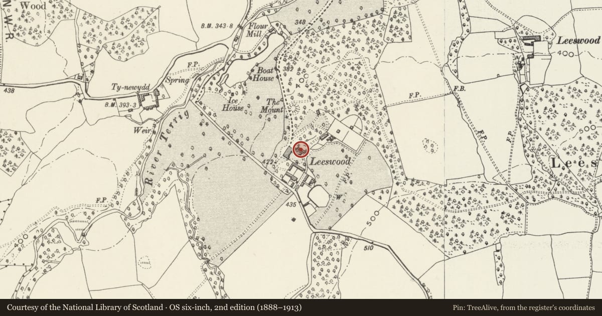
5 historical maps cover this location, the earliest the 1795 map "To Sir Watkin Williams-Wynn Bart ... the map of the six counties of North Wales is most humbly inscribed by his obedient humble servant" (Llyfrgell Genedlaethol Cymru – The National Library of Wales).
Historical maps covering this location
- 1795 · To Sir Watkin Williams-Wynn Bart ... the map of the six counties of North Wales is most… (Llyfrgell Genedlaethol Cymru – The National Library of Wales)
- 1883 · Watershed map England, Wales 3. (David Rumsey Map Collection, Stanford Libraries)
- 1898 · 108 Flint (Hills) (David Rumsey Map Collection, Stanford Libraries)
- 1898 · 108 Flint (Outline) (David Rumsey Map Collection, Stanford Libraries)
- 1901 · Sheet 9 and 10. (David Rumsey Map Collection, Stanford Libraries)
Cadw's description
Location
Situated to the NE of the main house on the southern edge of woodland.
History
Remains of the original early C18 walled kitchen garden. Approximately two thirds of the original garden had been demolished by 1809. c1800 the present gardener's cottage was erected in between an opening in the original walls. This opening was articulated by two stone piers with a projecting cornice topped by stone urns and formed a vista along the south-west/north-east axis of Stephen Switzer's original garden landscape. Early C19 lean-to Vine House.
Exterior
Rectangular red brick walled garden divided into 2 parts and ivy clad. Stone cappings, brick pilasters, stone surrounds to doorways. Cross wall (raised in later brick) with fine recessed ashlar gatepier (urn finial missing) at NE end. 2 similar C18 piers, set in brick wall opposite, flank symmetrical gardener's cottage and twin brick arched doorways (now blocked).
2 storey 1 window pedimented front to brick cottage with end pilasters; ashlar cappings, sills and band course; 2-light windows, arched to ground floor. Later brick extension at rear.
High red brick spur wall extends out from SW corner with lean-to potting sheds on outer face. Badly decayed (early C19) vine house on SE face.
Reason for designation
Listed for group value with Leeswood Hall and other associated garden buildings as part of this exceptionally important landscaped garden.
Nearby in the register
- Leeswood HallDomesticunder 1 mi
- U-shaped Former Stable Blocks and Attached Walls at Leeswood HallDomesticunder 1 mi
- Former Dovecote S of Leeswood HallDomesticunder 1 mi
- Ice House to NW of Leeswood HallDomesticunder 1 mi
Other entries of the same register within about three miles of this one, by straight line.