Cof Cymru: National Historic Assets of Wales · Wales
7 Steeple Lane
Beaumaris, Isle of Anglesey, Wales
A Grade II listed building in Beaumaris, Isle of Anglesey, designated on 20 February 1978.
The record
- Designation
- Listed building, Grade II
- Broad class
- Domestic
- Date of designation
- 20 February 1978
- Locality
- Beaumaris
- Town
- Beaumaris
- Community
- Beaumaris
- Unitary authority
- Isle of Anglesey
- Country
- Wales
- Coordinates
- 53.26355, -4.09516
- Cadw reference
- 5669
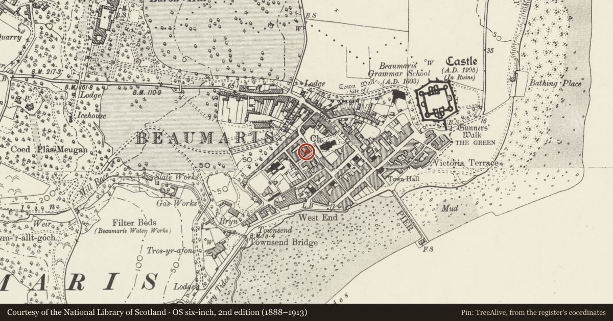
Slide toward Today to fade the historical sheet and see the modern map underneath.
David Rumsey Map Collection, Stanford LibrariesDavid Rumsey Map Collection, Stanford LibrariesDavid Rumsey Map Collection, Stanford LibrariesDavid Rumsey Map Collection, Stanford LibrariesDavid Rumsey Map Collection, Stanford Libraries
5 historical maps cover this location, the earliest the 1883 map "Watershed map England, Wales 3." (David Rumsey Map Collection, Stanford Libraries).
Historical maps covering this location
- 1883 · Watershed map England, Wales 3. (David Rumsey Map Collection, Stanford Libraries)
- 1896 · Sheet 7. Ordnance Survey of England and Wales. (David Rumsey Map Collection, Stanford Libraries)
- 1899 · 94 Beaumaris (Hills) (David Rumsey Map Collection, Stanford Libraries)
- 1901 · Sheet 9 and 10. (David Rumsey Map Collection, Stanford Libraries)
- 1919 · Sheet 41. Anglesey. (David Rumsey Map Collection, Stanford Libraries)
Cadw's description
Location
Set back from the road at the junction with Bunkers Hill, and the L side of the pair forming the old National School.
History
Built as a National School in 1816 (date on building) and shown on the 1829 town plan. The school was superseded by a Board school in the 1870s. The building originally had 2 schoolrooms with end entrances and 4 windows between them. Owned by the Baron Hill estate, it was converted to a laundry after closure, but by 1889 was 2 dwellings. Replacement windows were re-set at a lower level than the original windows and internal partitions were created. It was sold by the Baron Hill estate in 1921.
Interior
The interior is modernised and sub-divided. In the dividing wall between the 2 dwellings is a round-headed plastered arch.
Reason for designation
Listed for its special architectural interest as a former National School retaining C19 character and detail following its conversion to a dwelling.
Nearby in the register
- Hen YsgolNo class recordedunder 1 mi
- Revetment, railings and steps in front of former National SchoolDomesticunder 1 mi
- Shelter in former school yard at rear of 7 Steeple LaneNo class recordedunder 1 mi
- 2 Bunkers HillDomesticunder 1 mi
Other entries of the same register within about three miles of this one, by straight line.