Cof Cymru: National Historic Assets of Wales · Wales
House and shop
Beaumaris, Isle of Anglesey, Wales
A Grade II listed building in Beaumaris, Isle of Anglesey, designated on 20 February 1978.
The record
- Designation
- Listed building, Grade II
- Broad class
- Commercial
- Date of designation
- 20 February 1978
- Locality
- Beaumaris
- Town
- Beaumaris
- Community
- Beaumaris
- Unitary authority
- Isle of Anglesey
- Country
- Wales
- Coordinates
- 53.26325, -4.09243
- Cadw reference
- 5623
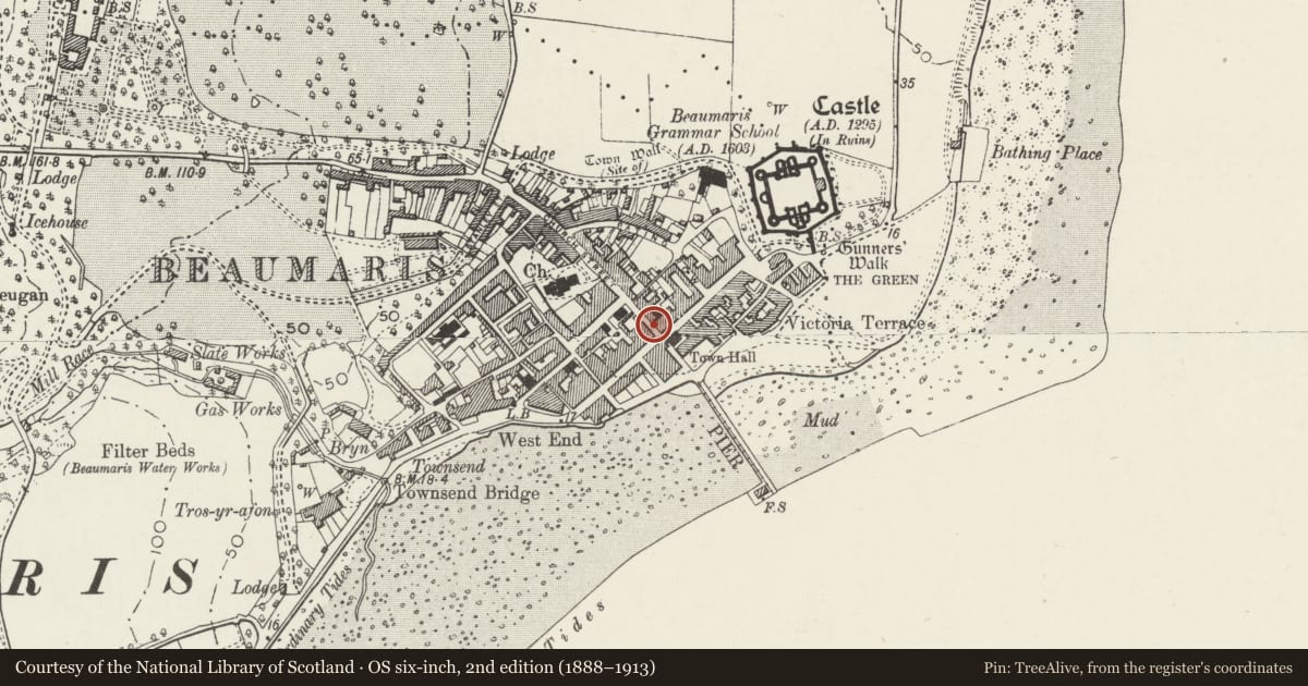
Slide toward Today to fade the historical sheet and see the modern map underneath.
David Rumsey Map Collection, Stanford LibrariesDavid Rumsey Map Collection, Stanford LibrariesDavid Rumsey Map Collection, Stanford LibrariesDavid Rumsey Map Collection, Stanford LibrariesDavid Rumsey Map Collection, Stanford Libraries
5 historical maps cover this location, the earliest the 1883 map "Watershed map England, Wales 3." (David Rumsey Map Collection, Stanford Libraries).
Historical maps covering this location
- 1883 · Watershed map England, Wales 3. (David Rumsey Map Collection, Stanford Libraries)
- 1896 · Sheet 7. Ordnance Survey of England and Wales. (David Rumsey Map Collection, Stanford Libraries)
- 1899 · 94 Beaumaris (Hills) (David Rumsey Map Collection, Stanford Libraries)
- 1901 · Sheet 9 and 10. (David Rumsey Map Collection, Stanford Libraries)
- 1919 · Sheet 41. Anglesey. (David Rumsey Map Collection, Stanford Libraries)
Cadw's description
Location
Near the S end of the street opposite the George and Dragon Hotel.
History
Built in the mid C19 and shown on the 1889 Ordnance Survey. It was a tailor's shop in 1886 and a hairdresser's shop by 1899 and continued to be so in 1910.
Exterior
A 3-storey 3-window house and shop of pebble-dashed walls with smooth-rendered sill bands and angle pilasters, slate roof and roughcast stack to the R. The lower storey has a wide C20 small-pane shop window to the R, with glazed door to its L of similar date. Further L are boarded double doors, replacements of 2004, to a through passage and under a round head with infilled overlight. The middle storey has small-pane windows incorporating top-hung casements, of which the central window is offset to the L. The upper storey has 2 similar windows. Against the L-hand end is a freestone C19 gate pier.
Interior
Not inspected.
Reason for designation
Listed, notwithstanding recent alteration, as one of a pair, with No 2 Church Street, of shops with houses that contribute to the historical integrity of Castle Street.
Nearby in the register
- House and Stanley ButchersCommercialunder 1 mi
- Tudor RoseCommercialunder 1 mi
- House and Canolfan Newyddian Beaumaris News CentreCommercialunder 1 mi
- George and Dragon HotelCommercialunder 1 mi
Other entries of the same register within about three miles of this one, by straight line.