Cof Cymru: National Historic Assets of Wales · Wales
Church of St Ffinan
Llanddyfnan, Isle of Anglesey, Wales
A Grade II listed building in Llanffinan, Llanddyfnan, Isle of Anglesey, designated on 30 January 1968.
The record
- Designation
- Listed building, Grade II
- Broad class
- Religious, Ritual and Funerary
- Date of designation
- 30 January 1968
- Locality
- Llanffinan
- Community
- Llanddyfnan
- Unitary authority
- Isle of Anglesey
- Country
- Wales
- Coordinates
- 53.25519, -4.25678
- Cadw reference
- 5554
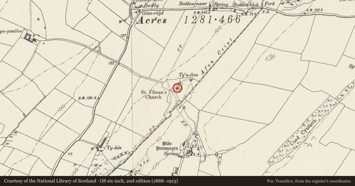
Slide toward Today to fade the historical sheet and see the modern map underneath.
David Rumsey Map Collection, Stanford LibrariesDavid Rumsey Map Collection, Stanford LibrariesDavid Rumsey Map Collection, Stanford LibrariesDavid Rumsey Map Collection, Stanford LibrariesLlyfrgell Genedlaethol Cymru – The National Library of Wales
5 historical maps cover this location, the earliest the 1795 map "To Sir Watkin Williams-Wynn Bart ... the map of the six counties of North Wales is most humbly inscribed by his obedient humble servant" (Llyfrgell Genedlaethol Cymru – The National Library of Wales).
Historical maps covering this location
- 1795 · To Sir Watkin Williams-Wynn Bart ... the map of the six counties of North Wales is most… (Llyfrgell Genedlaethol Cymru – The National Library of Wales)
- 1883 · Watershed map England, Wales 3. (David Rumsey Map Collection, Stanford Libraries)
- 1896 · Sheet 7. Ordnance Survey of England and Wales. (David Rumsey Map Collection, Stanford Libraries)
- 1901 · Sheet 9 and 10. (David Rumsey Map Collection, Stanford Libraries)
- 1919 · Sheet 41. Anglesey. (David Rumsey Map Collection, Stanford Libraries)
Cadw's description
Location
In a rural location, set back from the SE side of a country road leading NE off the B5420 to Talwrn; c2.5km E of the outskirts of Llangefni.
History
There is a church recorded in the Norwich taxation of 1254, though the exact site is uncertain; the present church was erected in 1841, the architect John Welch.
Exterior
Romanesque style church of 3 bays, to a rectangular plan with continuous nave and chancel. Built of coursed roughly dressed masonry with freestone dressings including continuous sill band, plinth and clasping buttresses; slate roof with tiled ridge, E gable cross finial and W gable bellcote. All the openings are round headed, a single window to each bay and a tripartite chancel window. The doorway at the W gable has smaller flanking windows and a gallery window in the gable apex over a stone slab which bears the date 1841.
Interior
Interior not inspected at the time of the survey but said to contain:
A C12 gritstone font, a circular bowl chamfered at the base to fit into a modern square pedestal. The surface decorated with crude interlacing strap ornament.
C18 memorials to: Iohn Llowyd of Hirdre Faig d1705 and Hugh, son of Richard Hugh of Ty Hen d1764.
Reason for designation
Listed as a small rural church, a good essay in a simple Romanesque revival style.
Nearby in the register
- Sundial in churchyard of Church of St FfinanMiscellaneousunder 1 mi
- Plas PenmynyddDomesticunder 1 mi
- Hirdre-Faig Standing StoneStanding Stoneunder 1 mi
- ParcAgriculture and Subsistence1 mi
Other entries of the same register within about three miles of this one, by straight line.