Cof Cymru: National Historic Assets of Wales · Wales
Melin Llidiart
Llanddyfnan, Isle of Anglesey, Wales
A Grade II listed building in Llanfihangel Tre'r Beirdd, Llanddyfnan, Isle of Anglesey, designated on 12 May 1970.
The record
- Designation
- Listed building, Grade II
- Broad class
- Industrial
- Date of designation
- 12 May 1970
- Locality
- Llanfihangel Tre'r Beirdd
- Community
- Llanddyfnan
- Unitary authority
- Isle of Anglesey
- Country
- Wales
- Coordinates
- 53.31245, -4.31638
- Cadw reference
- 5389
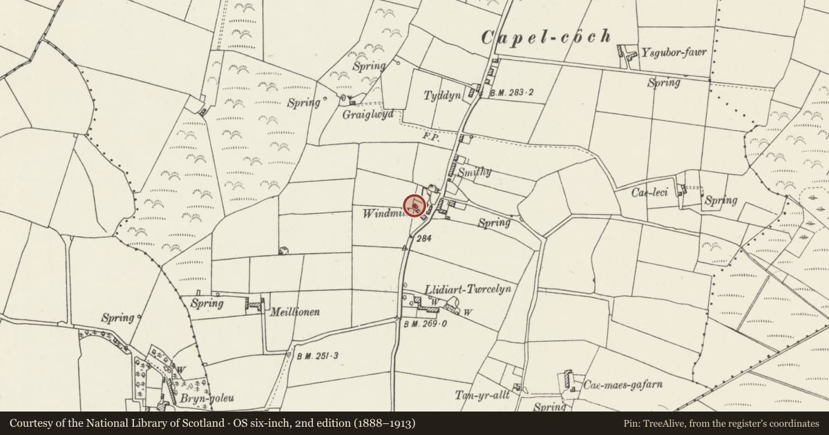
Slide toward Today to fade the historical sheet and see the modern map underneath.
David Rumsey Map Collection, Stanford LibrariesDavid Rumsey Map Collection, Stanford LibrariesDavid Rumsey Map Collection, Stanford LibrariesDavid Rumsey Map Collection, Stanford LibrariesDavid Rumsey Map Collection, Stanford Libraries
5 historical maps cover this location, the earliest the 1883 map "Watershed map England, Wales 3." (David Rumsey Map Collection, Stanford Libraries).
Historical maps covering this location
- 1883 · Watershed map England, Wales 3. (David Rumsey Map Collection, Stanford Libraries)
- 1896 · Sheet 7. Ordnance Survey of England and Wales. (David Rumsey Map Collection, Stanford Libraries)
- 1899 · 93 Holyhead (Hills) (David Rumsey Map Collection, Stanford Libraries)
- 1901 · Sheet 9 and 10. (David Rumsey Map Collection, Stanford Libraries)
- 1919 · Sheet 41. Anglesey. (David Rumsey Map Collection, Stanford Libraries)
Cadw's description
Location
Set back from the W side of the country road running northwards through the village of Capel Coch; the windmill is at the S end of the village.
History
Probably one of the oldest surviving windmills on Anglesey, thought to date to mid C18. Was listed in the Slaters Directory of 1883, with Hugh Pritchard as miller; and by the time of the 1895 directory his wife had taken over. Not long after this entry the mill was irreparably damaged in a storm and never worked again. Now in use as outbuilding.
Exterior
Full height, 3-storey, circular windmill tower. Sloping wall of mortared sandstone rubble masonry, partly rendered; roofless. Rectangular window openings at 1st and 2nd floors; doorway faces the road to E. Openings have rough voussoir heads.
Interior
Interior not inspected at the time of the survey.
Reason for designation
Listed as a substantially intact windmill tower, one of only 18 surviving on Anglesey. In early-mid C19 there were over 40 windmills operating on the island, grinding the large volumes of corn then being produced. Melin Llidiart is of interest as one of the earliest windmills recorded on the island.
Nearby in the register
- Llech GolmanStanding Stoneunder 1 mi
- Maen AddwynStanding Stoneunder 1 mi
- Church of St MichaelReligious, Ritual and Funerary1 mi
- Former Post OfficeCommunications1 mi
Other entries of the same register within about three miles of this one, by straight line.