Cof Cymru: National Historic Assets of Wales · Wales
Bridge over River Alyn at Hartsheath
Leeswood and Pontblyddyn, Flintshire, Wales
A Grade II listed building in Hartsheath, Leeswood and Pontblyddyn, Flintshire, designated on 10 April 1980.
The record
- Designation
- Listed building, Grade II
- Broad class
- Transport
- Date of designation
- 10 April 1980
- Locality
- Hartsheath
- Community
- Leeswood and Pontblyddyn
- Unitary authority
- Flintshire
- Country
- Wales
- Coordinates
- 53.13374, -3.07125
- Cadw reference
- 538
Slide toward Today to fade the historical sheet and see the modern map underneath.
David Rumsey Map Collection, Stanford LibrariesDavid Rumsey Map Collection, Stanford LibrariesDavid Rumsey Map Collection, Stanford LibrariesDavid Rumsey Map Collection, Stanford LibrariesLlyfrgell Genedlaethol Cymru – The National Library of Wales
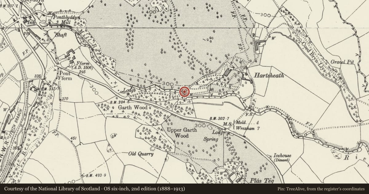
5 historical maps cover this location, the earliest the 1795 map "To Sir Watkin Williams-Wynn Bart ... the map of the six counties of North Wales is most humbly inscribed by his obedient humble servant" (Llyfrgell Genedlaethol Cymru – The National Library of Wales).
Historical maps covering this location
- 1795 · To Sir Watkin Williams-Wynn Bart ... the map of the six counties of North Wales is most… (Llyfrgell Genedlaethol Cymru – The National Library of Wales)
- 1883 · Watershed map England, Wales 3. (David Rumsey Map Collection, Stanford Libraries)
- 1898 · 108 Flint (Hills) (David Rumsey Map Collection, Stanford Libraries)
- 1898 · 108 Flint (Outline) (David Rumsey Map Collection, Stanford Libraries)
- 1901 · Sheet 9 and 10. (David Rumsey Map Collection, Stanford Libraries)
Cadw's description
Location
Spanning the River Alyn on the main drive to Hartsheath Hall, N of the A541 Mold - Wrexham Road.
History
Built in 1825 to the designs of Charles James Mathews as part of his improvements on the Hartsheath Estate for the Welsh Iron and Coal Mining Company.
Exterior
Shallow segmental arch of dressed stone; both NW and SE faces of the arch with voussoirs, flanking pilasters and keystone inscribed AD 1825. Each parapet made up of 3 delicately worked panels of pierced iron in fishscale motif. Iron work is tenoned into small piers of dressed stone with coupled piers at ends above pilasters and single piers towards centre. NW side of bridge contains separate small culvert which feeds fish ponds and former mill.
Reason for designation
Listed for group value with Hartsheath Hall.
Nearby in the register
- Bridge carrying main drive over Servants' Pathway including gate piers at HartsheathDomesticunder 1 mi
- Retaining Walls flanking sunken Servants' Pathway at HartsheathDomesticunder 1 mi
- Hartsheath HallDomesticunder 1 mi
- Ice Tunnels immediately to NE of HartsheathDomesticunder 1 mi
Other entries of the same register within about three miles of this one, by straight line.