Cof Cymru: National Historic Assets of Wales · Wales
Melin Rhosfawr
Llanfair-Mathafarn-Eithaf, Isle of Anglesey, Wales
A Grade II listed building in Brynteg, Llanfair-Mathafarn-Eithaf, Isle of Anglesey, designated on 12 May 1970.
The record
- Designation
- Listed building, Grade II
- Broad class
- Industrial
- Date of designation
- 12 May 1970
- Locality
- Brynteg
- Community
- Llanfair-Mathafarn-Eithaf
- Unitary authority
- Isle of Anglesey
- Country
- Wales
- Coordinates
- 53.32133, -4.25818
- Cadw reference
- 5378
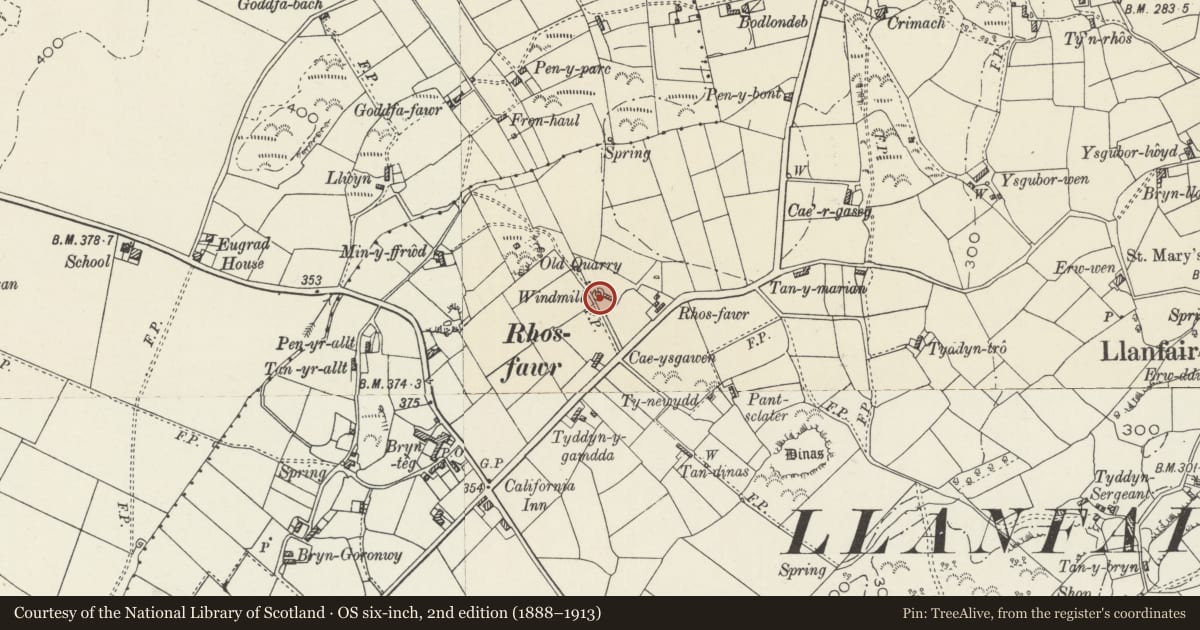
Slide toward Today to fade the historical sheet and see the modern map underneath.
David Rumsey Map Collection, Stanford LibrariesDavid Rumsey Map Collection, Stanford LibrariesDavid Rumsey Map Collection, Stanford LibrariesDavid Rumsey Map Collection, Stanford LibrariesDavid Rumsey Map Collection, Stanford Libraries
5 historical maps cover this location, the earliest the 1883 map "Watershed map England, Wales 3." (David Rumsey Map Collection, Stanford Libraries).
Historical maps covering this location
- 1883 · Watershed map England, Wales 3. (David Rumsey Map Collection, Stanford Libraries)
- 1896 · Sheet 7. Ordnance Survey of England and Wales. (David Rumsey Map Collection, Stanford Libraries)
- 1899 · 93 Holyhead (Hills) (David Rumsey Map Collection, Stanford Libraries)
- 1901 · Sheet 9 and 10. (David Rumsey Map Collection, Stanford Libraries)
- 1919 · Sheet 41. Anglesey. (David Rumsey Map Collection, Stanford Libraries)
Cadw's description
Location
Set back from the NW side of the B5110 at the NE end of the village of Brynteg.
History
Windmill tower, built in 1757. The mill is recorded in the Tithe Apportionment of the parish, 1841, as owned by John Hughes Esq and the miller is listed as Richard Owen who, according to the census returns of the same year, lived at the mill house there with his wife, 6 children and a miller's apprentice; by 1851 the mill has been taken over by Richard's son Robert.
The mill is immortalised as 'Mona Mill' in George Burrow's book - Wild Wales (1862), in his search for places connected with the Anglesey poet Goronwy Owen. On his travels he met the then miller, John Jones who ran the mill until 1877 after which it was taken over by his widow, Martha, who then continued as miller until her death in 1889. It continued to operated for a number of years, run by William Jones, but was closed down in 1910, the sails and cap taken down and the machinery sold for scrap.
Exterior
Full height windmill tower of 3-storeys. Sloping circular wall of mortared rubble masonry, partly rendered; roofless. Ground floor doorway has cambered head of voussoirs; 1st and 2nd floor window openings also have voussoirs at head.
Interior
Interior not inspected at the time of the survey.
Reason for designation
Listed as a substantially intact windmill tower, one of only 18 surviving on Anglesey. In early-mid C19 there were over 40 windmills operating on the island, grinding the large volumes of corn then being produced. The mill is of particular interest for its literary associations with George Burrow's book, Wild Wales.
Nearby in the register
- Church of St MaryReligious, Ritual and Funeraryunder 1 mi
- Parciau dovecoteDomesticunder 1 mi
- Parciau Dovecotedovecoteunder 1 mi
- Church of St. EugradReligious, Ritual and Funeraryunder 1 mi
Other entries of the same register within about three miles of this one, by straight line.