Cof Cymru: National Historic Assets of Wales · Wales
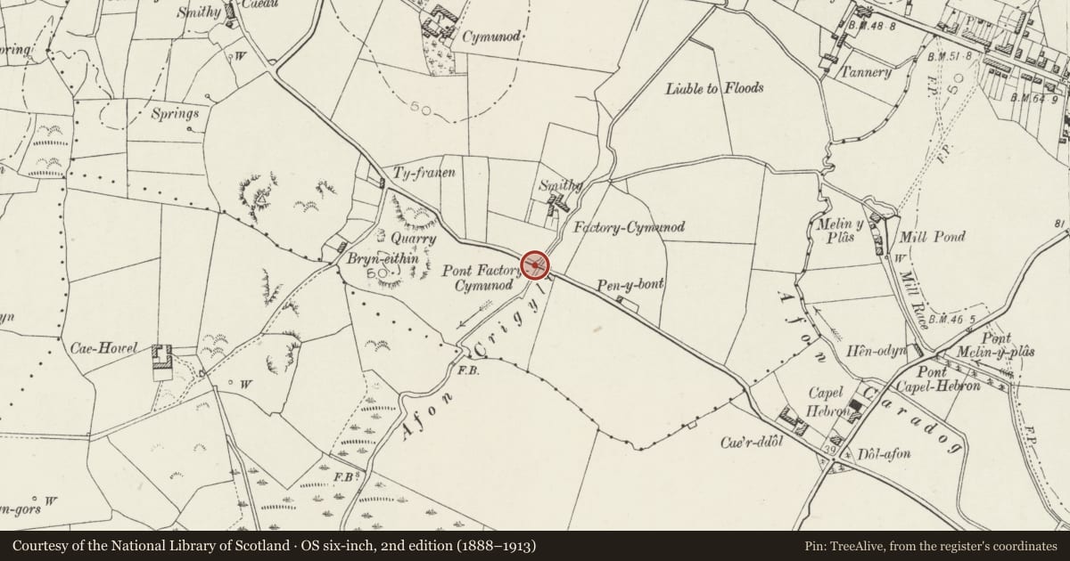
Pont Factory Cymunod, over the Afon Crigyll
Llanfair-yn-Neubwll, Isle of Anglesey, Wales
A Grade II listed building in Cymunod, Llanfair-yn-Neubwll, Isle of Anglesey, designated on 5 April 1971.
The record
- Designation
- Listed building, Grade II
- Broad class
- Transport
- Date of designation
- 5 April 1971
- Locality
- Cymunod
- Community
- Llanfair-yn-Neubwll
- Unitary authority
- Isle of Anglesey
- Country
- Wales
- Coordinates
- 53.26690, -4.49021
- Cadw reference
- 5278
Slide toward Today to fade the historical sheet and see the modern map underneath.
David Rumsey Map Collection, Stanford LibrariesDavid Rumsey Map Collection, Stanford LibrariesDavid Rumsey Map Collection, Stanford LibrariesDavid Rumsey Map Collection, Stanford LibrariesDavid Rumsey Map Collection, Stanford Libraries
5 historical maps cover this location, the earliest the 1883 map "Watershed map England, Wales 3." (David Rumsey Map Collection, Stanford Libraries).
Historical maps covering this location
- 1883 · Watershed map England, Wales 3. (David Rumsey Map Collection, Stanford Libraries)
- 1896 · Sheet 7. Ordnance Survey of England and Wales. (David Rumsey Map Collection, Stanford Libraries)
- 1899 · 93 Holyhead (Hills) (David Rumsey Map Collection, Stanford Libraries)
- 1901 · Sheet 9 and 10. (David Rumsey Map Collection, Stanford Libraries)
- 1919 · Sheet 41. Anglesey. (David Rumsey Map Collection, Stanford Libraries)
Cadw's description
Location
A bridge comprising two widely spaced arches of different dates, crossing the Afon Crugyll 200m S of Pandy Cymunod, and forming the SE corner of the community.
History
The earlier of the two bridges is that to the W, built probably in the C18, and widened when the second bridge was added to the E, probably in the C19.
Exterior
Bridge of rubble masonry with two arches rather widely separated and of different construction. The arch on W is roughhewn and rather high compared with its width. The arch to the E is segmental and with roughly squared voussoirs slightly inset below an extrados course of narrow slabs. Rough parapet.
Reason for designation
Listed as a well preserved C18 single arch bridge, extended by a second arch in the C19.
Nearby in the register
- Pont Cymunod, over the Afon CrugyllTransportunder 1 mi
- Pandy CymunodIndustrialunder 1 mi
- Telford Milestone (7)Transportunder 1 mi
- Telford Milestone (8)Transportunder 1 mi
Other entries of the same register within about three miles of this one, by straight line.