Cof Cymru: National Historic Assets of Wales · Wales
Dower House at Llwyndu
Barmouth, Gwynedd, Wales
A Grade II* listed building in Llanaber, Barmouth, Gwynedd, designated on 27 November 1986.
The record
- Designation
- Listed building, Grade II*
- Broad class
- Domestic
- Date of designation
- 27 November 1986
- Locality
- Llanaber
- Community
- Barmouth
- Unitary authority
- Gwynedd
- Country
- Wales
- Coordinates
- 52.74625, -4.07539
- Cadw reference
- 5229
Slide toward Today to fade the historical sheet and see the modern map underneath.
David Rumsey Map Collection, Stanford LibrariesDavid Rumsey Map Collection, Stanford LibrariesDavid Rumsey Map Collection, Stanford LibrariesLlyfrgell Genedlaethol Cymru – The National Library of WalesDavid Rumsey Map Collection, Stanford Libraries
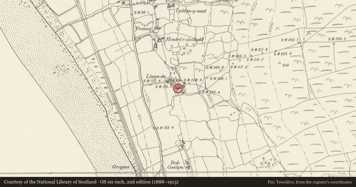
5 historical maps cover this location, the earliest the 1795 map "To Sir Watkin Williams-Wynn Bart ... the map of the six counties of North Wales is most humbly inscribed by his obedient humble servant" (Llyfrgell Genedlaethol Cymru – The National Library of Wales).
Historical maps covering this location
- 1795 · To Sir Watkin Williams-Wynn Bart ... the map of the six counties of North Wales is most… (Llyfrgell Genedlaethol Cymru – The National Library of Wales)
- 1883 · Watershed map England, Wales 3. (David Rumsey Map Collection, Stanford Libraries)
- 1896 · Sheet 7. Ordnance Survey of England and Wales. (David Rumsey Map Collection, Stanford Libraries)
- 1899 · 135 Harlech (Hills) (David Rumsey Map Collection, Stanford Libraries)
- 1901 · Sheet 9 and 10. (David Rumsey Map Collection, Stanford Libraries)
Cadw's description
Location
Immediately to the W of the main house and at right-angles with it.
History
Late C16/early C17 dwelling; this may have served as a formof dower house, or alternatively as a steward's house.
Exterior
2-storey rubble cottage with undulating slate roof andstone-coped, kneelered gable parapets; boulder foundations. Tall endstack to S gable with weather coursing and contemporary capping.Off-centre (L) doorway to E side to which one now steps down; smallsquare light below the eaves to the R. 2 projecting stones to the Sgable support the lintel of the fireplace internally and are thuscantelevered. Lean-to addition to N gable end, probably C19;overhanging eaves to rear (W). 2 square window openings and a lean-toprivy.
Interior
3-bay, formerly storeyed; pegged collar trusses with ridge beam and purlins. Large rubble chimneybreast and broad fireplace with C19 brick-lined bread oven.
Reason for designation
Included at grade II* as a scarce, largely unaltered example of a small-scale sub-medieval dower/steward's house.
Group value with other listed items at Llwyndu.
Nearby in the register
- Llwyndu Guest HouseDomesticunder 1 mi
- Long Barn Range at Llwyndu, including attached Small Range at S EndAgriculture and Subsistenceunder 1 mi
- Former Cowhouse at LlwynduAgriculture and Subsistenceunder 1 mi
- Former Watermill at LlwynduIndustrialunder 1 mi
Other entries of the same register within about three miles of this one, by straight line.