Cof Cymru: National Historic Assets of Wales · Wales
Efallon (also known as Lodge Fach)
Arthog, Gwynedd, Wales
A Grade II listed building in Arthog, Gwynedd, designated on 20 November 1989.
The record
- Designation
- Listed building, Grade II
- Broad class
- Domestic
- Date of designation
- 20 November 1989
- Locality
- Arthog
- Community
- Arthog
- Unitary authority
- Gwynedd
- Country
- Wales
- Coordinates
- 52.71176, -4.00830
- Cadw reference
- 5219
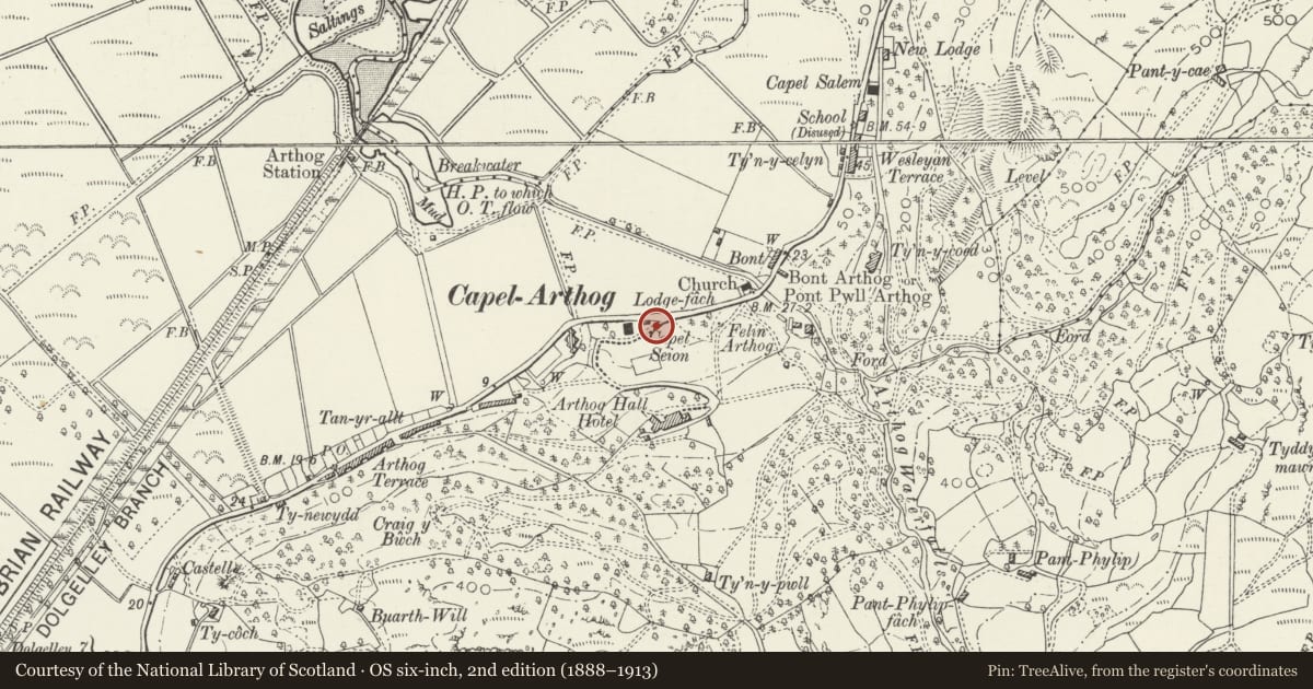
Slide toward Today to fade the historical sheet and see the modern map underneath.
David Rumsey Map Collection, Stanford LibrariesDavid Rumsey Map Collection, Stanford LibrariesDavid Rumsey Map Collection, Stanford LibrariesLlyfrgell Genedlaethol Cymru – The National Library of WalesDavid Rumsey Map Collection, Stanford Libraries
5 historical maps cover this location, the earliest the 1795 map "To Sir Watkin Williams-Wynn Bart ... the map of the six counties of North Wales is most humbly inscribed by his obedient humble servant" (Llyfrgell Genedlaethol Cymru – The National Library of Wales).
Historical maps covering this location
- 1795 · To Sir Watkin Williams-Wynn Bart ... the map of the six counties of North Wales is most… (Llyfrgell Genedlaethol Cymru – The National Library of Wales)
- 1883 · Watershed map England, Wales 3. (David Rumsey Map Collection, Stanford Libraries)
- 1896 · Sheet 7. Ordnance Survey of England and Wales. (David Rumsey Map Collection, Stanford Libraries)
- 1899 · 149 Barmouth (Hills) (David Rumsey Map Collection, Stanford Libraries)
- 1901 · Sheet 9 and 10. (David Rumsey Map Collection, Stanford Libraries)
Cadw's description
Location
Located at the side of the road, just SW of the entrance to the drive to Arthog Hall.
History
Dated 1835 and formerly known as The Old Lodge; built to serve as a lodge for Arthog Hall, built 1833.
Exterior
Single storey rubble structure with steep slate roof and high gable parapets with broad kneelers and weather coursing. Off-centre rubble chimneystack with cornice. 3-bay front (facingroad); half-glazed doorway below stack flanked by tall, narrow windows with unusual triangular heads and monolithic stone jambs reminiscent of Anglo-Saxon design. Rubble terrace to front. The tall, narrow openings are repeated at the gables on the end walls, though here they are blind. 6-pane casement window to the R gable with a curious label, inversely returned. Date plaque to L gable over a wide depressed arched opening with keystone and imposts, now infilled and with recessed Tudor arch over 12-pane sash-window; slate cill.
Modern extension to rear and to SW not included.
Interior
Open roof with tie beams and through purlins; lightly chamfered beams and low boarded doors.
Reason for designation
Listed as an unusual primitive, rustic lodge in a prominent road-side location and with historic associations with Arthog Hall.
Nearby in the register
- Glan-y-Wern (including attached Coach-House and Stables)Domesticunder 1 mi
- Attached Cottage to SW of Arthog HallDomesticunder 1 mi
- Arthog HallDomesticunder 1 mi
- St Catherine's ChurchReligious, Ritual and Funeraryunder 1 mi
Other entries of the same register within about three miles of this one, by straight line.