Cof Cymru: National Historic Assets of Wales · Wales
Haybarn at SW end of Yard at Glandwr
Barmouth, Gwynedd, Wales
A Grade II listed building in Barmouth, Gwynedd, designated on 30 June 1980.
The record
- Designation
- Listed building, Grade II
- Broad class
- Agriculture and Subsistence
- Date of designation
- 30 June 1980
- Community
- Barmouth
- Unitary authority
- Gwynedd
- Country
- Wales
- Coordinates
- 52.73588, -4.01815
- Cadw reference
- 5199
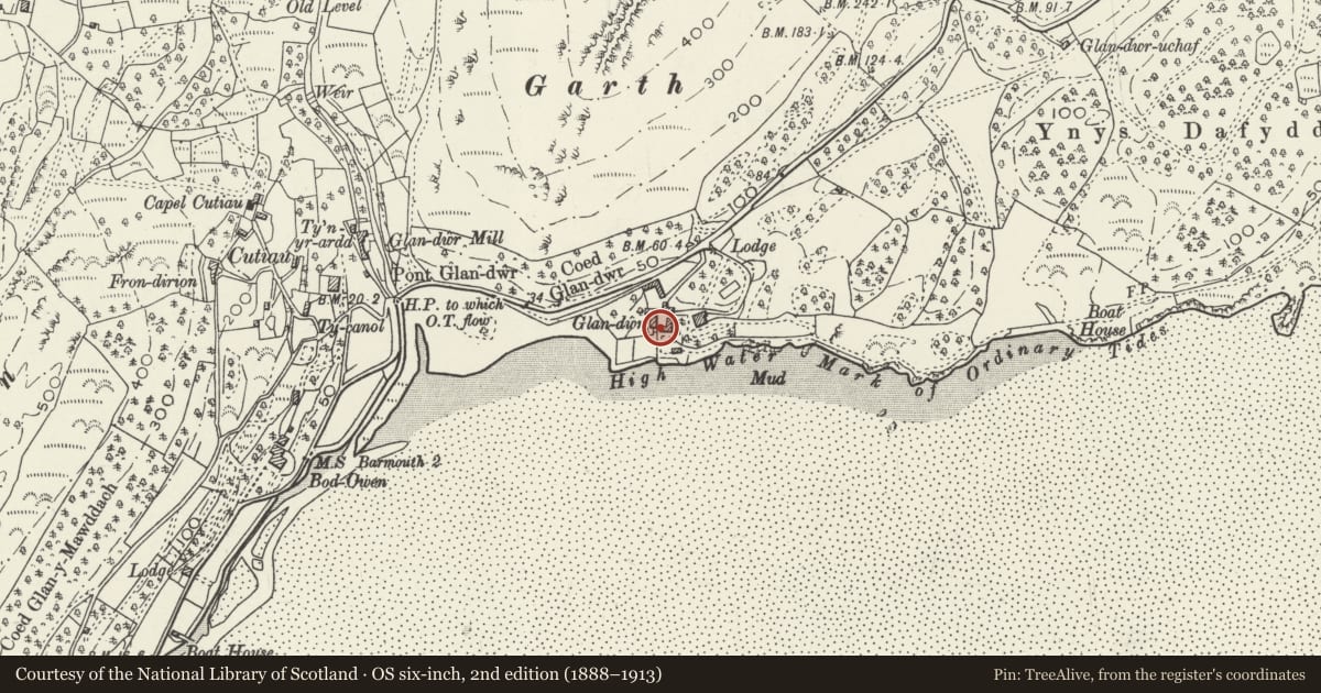
Slide toward Today to fade the historical sheet and see the modern map underneath.
David Rumsey Map Collection, Stanford LibrariesDavid Rumsey Map Collection, Stanford LibrariesLlyfrgell Genedlaethol Cymru – The National Library of WalesDavid Rumsey Map Collection, Stanford LibrariesDavid Rumsey Map Collection, Stanford Libraries
5 historical maps cover this location, the earliest the 1795 map "To Sir Watkin Williams-Wynn Bart ... the map of the six counties of North Wales is most humbly inscribed by his obedient humble servant" (Llyfrgell Genedlaethol Cymru – The National Library of Wales).
Historical maps covering this location
- 1795 · To Sir Watkin Williams-Wynn Bart ... the map of the six counties of North Wales is most… (Llyfrgell Genedlaethol Cymru – The National Library of Wales)
- 1830 · V.3:11-15:XV. Britisches Reich. A. Kon: England. b. Frstenthum Wales: Shire: 37-40 (David Rumsey Map Collection, Stanford Libraries)
- 1883 · Watershed map England, Wales 3. (David Rumsey Map Collection, Stanford Libraries)
- 1896 · Sheet 7. Ordnance Survey of England and Wales. (David Rumsey Map Collection, Stanford Libraries)
- 1901 · Sheet 9 and 10. (David Rumsey Map Collection, Stanford Libraries)
Cadw's description
Location
Alongside the former stable range on the W side of the upper yard at Glandwr.
History
Part of the home-farm for the adjacent gentry house of Glandwr. The farm appears to have been developed from the early C19, with clear evidence of improvement and enlargement in the early-mid C19. This building is part of this campaign of expansion and is probably mid C19, as not shown on the Tithe map.
Exterior
Three-bay hay barn of stone rubble construction with slate roof. Externally heavily altered so as to obscure the original layout of 3 open bays which have been infilled with windows and doorway in front elevation, and with stone-walling to rear.
Interior
Original character still discernable inside: 3 open bays of post and lintel construction. Two collar trusses to roof.
Reason for designation
Listed, notwithstanding alterations externally, as a typical Meirionydd hay-barn which is an integral part of the exceptionally complete farm group at Glandwr.
Nearby in the register
- Former Barn Range at GlandwrDomesticunder 1 mi
- Former Stable Range at GlandwrDomesticunder 1 mi
- L-shaped Cottage and Former Dairy at GlandwrDomesticunder 1 mi
- Former Cowhouse and hay-barn at GlandwrAgriculture and Subsistenceunder 1 mi
Other entries of the same register within about three miles of this one, by straight line.