Cof Cymru: National Historic Assets of Wales · Wales
Toll Booth at Penamenpool Bridge
Dolgellau, Gwynedd, Wales
A Grade II listed building in Dolgellau, Gwynedd, designated on 19 June 1990.
The record
- Designation
- Listed building, Grade II
- Broad class
- Transport
- Date of designation
- 19 June 1990
- Community
- Dolgellau
- Unitary authority
- Gwynedd
- Country
- Wales
- Coordinates
- 52.74836, -3.93488
- Cadw reference
- 5173
Slide toward Today to fade the historical sheet and see the modern map underneath.
David Rumsey Map Collection, Stanford LibrariesDavid Rumsey Map Collection, Stanford LibrariesDavid Rumsey Map Collection, Stanford LibrariesLlyfrgell Genedlaethol Cymru – The National Library of WalesDavid Rumsey Map Collection, Stanford Libraries
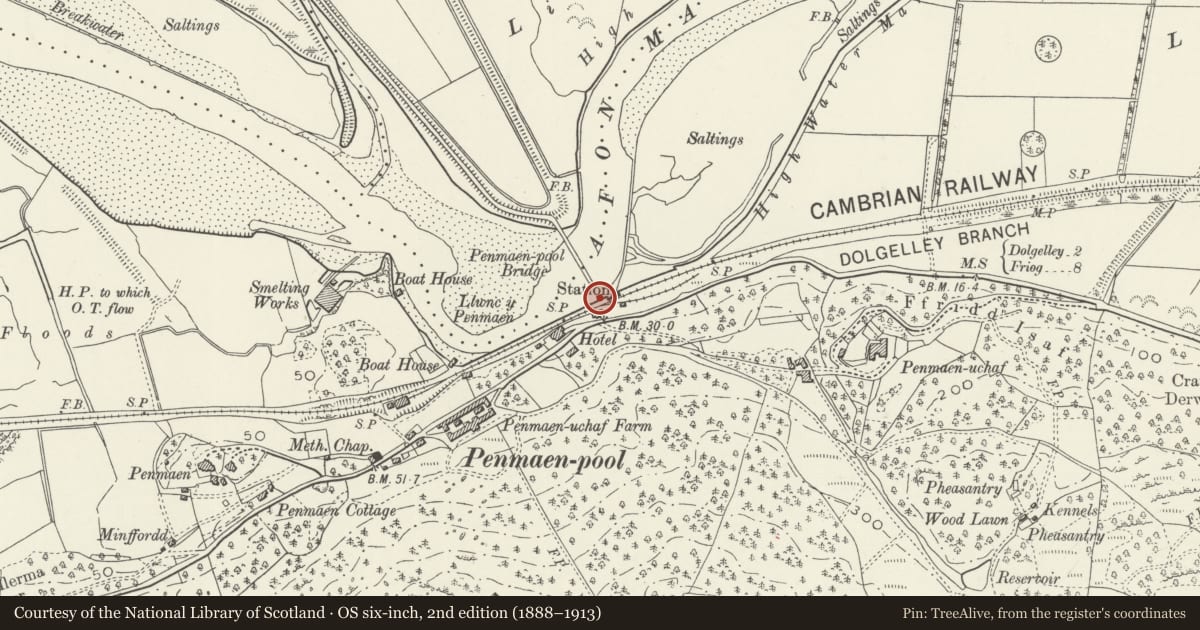
5 historical maps cover this location, the earliest the 1795 map "To Sir Watkin Williams-Wynn Bart ... the map of the six counties of North Wales is most humbly inscribed by his obedient humble servant" (Llyfrgell Genedlaethol Cymru – The National Library of Wales).
Historical maps covering this location
- 1795 · To Sir Watkin Williams-Wynn Bart ... the map of the six counties of North Wales is most… (Llyfrgell Genedlaethol Cymru – The National Library of Wales)
- 1883 · Watershed map England, Wales 3. (David Rumsey Map Collection, Stanford Libraries)
- 1896 · Sheet 7. Ordnance Survey of England and Wales. (David Rumsey Map Collection, Stanford Libraries)
- 1899 · 135 Harlech (Hills) (David Rumsey Map Collection, Stanford Libraries)
- 1901 · Sheet 9 and 10. (David Rumsey Map Collection, Stanford Libraries)
Cadw's description
Location
Situated beside the former Cambrian Railway station, linking the A493 with the A496 across the Mawddach Estuary.
History
Late Cl9, timber bridge said to date from 1879.
Exterior
Slightly ramped to centre. Timber deck carried on piers formed of 4 cross-braced timber piles. Opening span to centre originally. Plain handrails.
Gate to SW end, polygonal cast iron piers, ornamental caps. 2 wrought iron gates, "tulip" finials, lock rail, pedestrian gate inset to right.
Toll booth to E at SE end. cl900. Lap-boarded timber framed structure, on timber piers. Shallow jetties to gable ends, on brackets. Moderately pitched felted roof, finials with pendants, bargeboards, plain eaves, brackets. Raking dormer facing bridge, felted roof and cheeks, deep verge, brackets.
Canted, transomed 5 light small paned window to corner by bridge. Doorway alongside. 3 window rear elevation. 3 light, transomed to left 2 light transomed to centre, single light to right; small panes.
Modern toll booth to W side at SE end of bridge.
Nearby in the register
- Penamenpool BridgeTransportunder 1 mi
- Penmaenpool Bridge (partly in Dolgellau Community)Transportunder 1 mi
- Toll Booth at Penmaenpool Bridge (partly in Dolgellau Community)Transportunder 1 mi
- Penamen Ucha Farm, Model FarmyardAgriculture and Subsistenceunder 1 mi
Other entries of the same register within about three miles of this one, by straight line.