Cof Cymru: National Historic Assets of Wales · Wales
Brynrhug Farmhouse
Dolgellau, Gwynedd, Wales
A Grade II listed building in Dolgellau, Gwynedd, designated on 19 June 1990.
The record
- Designation
- Listed building, Grade II
- Broad class
- Domestic
- Date of designation
- 19 June 1990
- Community
- Dolgellau
- Unitary authority
- Gwynedd
- Country
- Wales
- Coordinates
- 52.72872, -3.89981
- Cadw reference
- 5142
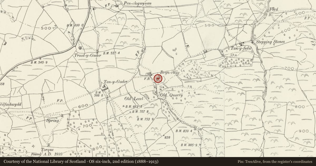
Slide toward Today to fade the historical sheet and see the modern map underneath.
David Rumsey Map Collection, Stanford LibrariesDavid Rumsey Map Collection, Stanford LibrariesDavid Rumsey Map Collection, Stanford LibrariesLlyfrgell Genedlaethol Cymru – The National Library of WalesDavid Rumsey Map Collection, Stanford Libraries
5 historical maps cover this location, the earliest the 1795 map "To Sir Watkin Williams-Wynn Bart ... the map of the six counties of North Wales is most humbly inscribed by his obedient humble servant" (Llyfrgell Genedlaethol Cymru – The National Library of Wales).
Historical maps covering this location
- 1795 · To Sir Watkin Williams-Wynn Bart ... the map of the six counties of North Wales is most… (Llyfrgell Genedlaethol Cymru – The National Library of Wales)
- 1883 · Watershed map England, Wales 3. (David Rumsey Map Collection, Stanford Libraries)
- 1896 · Sheet 7. Ordnance Survey of England and Wales. (David Rumsey Map Collection, Stanford Libraries)
- 1899 · 149 Barmouth (Hills) (David Rumsey Map Collection, Stanford Libraries)
- 1901 · Sheet 9 and 10. (David Rumsey Map Collection, Stanford Libraries)
Cadw's description
Location
Situated where the Ffridd meets the lower slopes of the mountain at the end of a long farm track some 700m E of the junction with the Cregennan road.
History
Cl7 with various Cl8 alterations.
Exterior
2 storey (eaves raised), 3 window. Coursed rubble masonry, boulder foundations. Moderately pitched quarry slate roof, plain eaves, deep verges, plain bargeboards. Tall square stone stacks, moulded caps, water tabling.
Shallow upper sashes to l2 pane windows at lst floor left and centre, deeper l2 pane sash to right, all under eaves. l6 pane sash to ground floor left and right, stone lintels. Doorway to left of centre, stone lintel. Slate hood on iron brackets, door of 2 glazed panels over 2 flush panels. Small, 4 pane fixed light window to immediate right of door, stone lintel.
Later outshots and Cl9 gabled cross wing to rear elevation set against hillside. Modern rendered stack. Modern porch to side of outshot.
Good cobbled yard set into rectangles with kerbstones to front.
Later Cl9 house with twin gabled dormers adjoins to left.
Interior
Re-ordered cl758. Stop chamfered transverse ceiling beams. Ogee stop chamfered joists. Timber bressumer, partly cut away. Cl7 plank and muntin partitions re-used to form entrance hall. (Later ?) ovolo moulded plank and muntin partitions rise alongside stairwell to lst floor. Cl8 stair, sturdy turned balusters, square newels, bipartite handrail swept up to landings. Splat balusters to top landing. Stair window partly retains leaded glazing and cross shape. 3 bay roof with 2 through purlin collared trusses, splayed feet to principals.
Nearby in the register
- Rhydwen FarmhouseDomesticunder 1 mi
- Stable to North of Rhydwen FarmhouseDomesticunder 1 mi
- Cartshed at Gellilwyd Fach FarmhouseAgriculture and Subsistenceunder 1 mi
- Gelliwyd Fach FarmhouseDomesticunder 1 mi
Other entries of the same register within about three miles of this one, by straight line.