Cof Cymru: National Historic Assets of Wales · Wales
Glanllyn
Holywell, Flintshire, Wales
A Grade II listed building in Greenfiled, Holywell, Flintshire, designated on 19 August 1991.
The record
- Designation
- Listed building, Grade II
- Broad class
- Domestic
- Date of designation
- 19 August 1991
- Locality
- Greenfiled
- Community
- Holywell
- Unitary authority
- Flintshire
- Country
- Wales
- Coordinates
- 53.28647, -3.20297
- Cadw reference
- 501
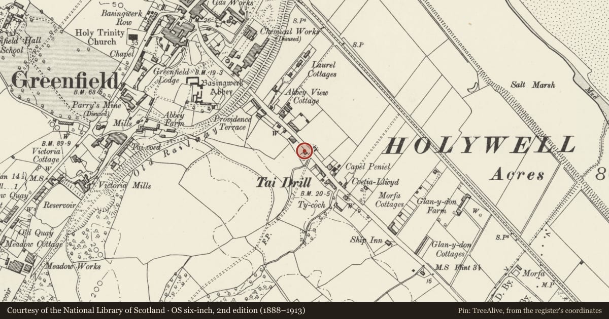
Slide toward Today to fade the historical sheet and see the modern map underneath.
David Rumsey Map Collection, Stanford LibrariesDavid Rumsey Map Collection, Stanford LibrariesDavid Rumsey Map Collection, Stanford LibrariesLlyfrgell Genedlaethol Cymru – The National Library of WalesDavid Rumsey Map Collection, Stanford Libraries
5 historical maps cover this location, the earliest the 1795 map "To Sir Watkin Williams-Wynn Bart ... the map of the six counties of North Wales is most humbly inscribed by his obedient humble servant" (Llyfrgell Genedlaethol Cymru – The National Library of Wales).
Historical maps covering this location
- 1795 · To Sir Watkin Williams-Wynn Bart ... the map of the six counties of North Wales is most… (Llyfrgell Genedlaethol Cymru – The National Library of Wales)
- 1830 · V.3:11-15:XV. Britisches Reich. A. Kon: England. b. Frstenthum Wales: Shire: 37-40 (David Rumsey Map Collection, Stanford Libraries)
- 1883 · Watershed map England, Wales 3. (David Rumsey Map Collection, Stanford Libraries)
- 1896 · 96 Liverpool (Hills) (David Rumsey Map Collection, Stanford Libraries)
- 1901 · Sheet 9 and 10. (David Rumsey Map Collection, Stanford Libraries)
Cadw's description
Location
Approximately 0.5km SE of the junction with Greenfield Road (B 5121). Set back behind small forecourt.
History
Originally two adjoining cottages built at different periods and belonging to the Talacre estate; possibly early C19 to right and mid C19 to left; see masonry break to middle.
Exterior
2-storey, 2-window rubble front with grouted slate roof and red brick chimney stacks, one to centre and another to left end. Small-pane slidding sash windows with stone voussoirs to right and brick voussoirs to left; camber-headed to ground floor; formerly shutters to ground floor. Central half-glazed door; blocked doorway to right hand cottage. Blacksmith's workshop to left and rubble right end.
Reason for designation
Listed as a good surviving former estate cottage.
Nearby in the register
- Railway Bridge Spanning the main coast road on a skewed lineTransportunder 1 mi
- Basingwerk AbbeyReligious, Ritual and Funeraryunder 1 mi
- Basingwerk AbbeyAbbeyunder 1 mi
- Abbey HouseDomesticunder 1 mi
Other entries of the same register within about three miles of this one, by straight line.