Cof Cymru: National Historic Assets of Wales · Wales
Ye Olde Bulls Head PH, Including Outbuildings Adjoining to the Rear
Bala, Gwynedd, Wales
A Grade II listed building in Bala, Gwynedd, designated on 19 October 1951.
The record
- Designation
- Listed building, Grade II
- Broad class
- Commercial
- Date of designation
- 19 October 1951
- Community
- Bala
- Unitary authority
- Gwynedd
- Country
- Wales
- Coordinates
- 52.90978, -3.59912
- Cadw reference
- 4912
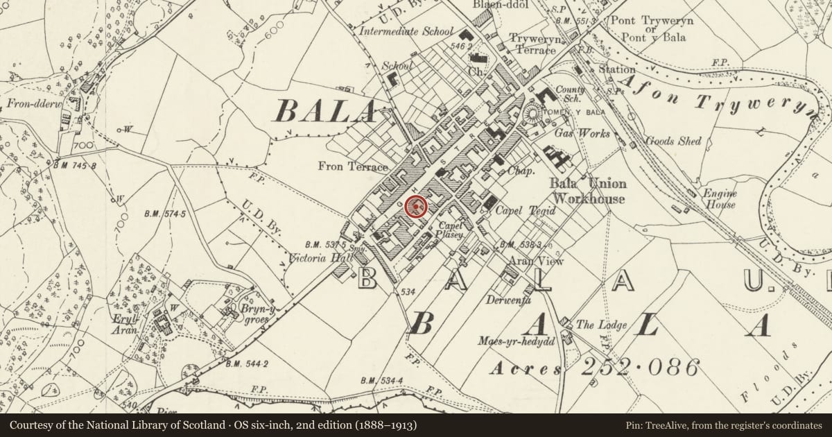
Slide toward Today to fade the historical sheet and see the modern map underneath.
David Rumsey Map Collection, Stanford LibrariesDavid Rumsey Map Collection, Stanford LibrariesLlyfrgell Genedlaethol Cymru – The National Library of WalesDavid Rumsey Map Collection, Stanford LibrariesDavid Rumsey Map Collection, Stanford Libraries
5 historical maps cover this location, the earliest the 1795 map "To Sir Watkin Williams-Wynn Bart ... the map of the six counties of North Wales is most humbly inscribed by his obedient humble servant" (Llyfrgell Genedlaethol Cymru – The National Library of Wales).
Historical maps covering this location
- 1795 · To Sir Watkin Williams-Wynn Bart ... the map of the six counties of North Wales is most… (Llyfrgell Genedlaethol Cymru – The National Library of Wales)
- 1830 · V.3:11-15:XV. Britisches Reich. A. Kon: England. b. Frstenthum Wales: Shire: 37-40 (David Rumsey Map Collection, Stanford Libraries)
- 1883 · Watershed map England, Wales 3. (David Rumsey Map Collection, Stanford Libraries)
- 1899 · 136 Bala (Hills) (David Rumsey Map Collection, Stanford Libraries)
- 1901 · Sheet 9 and 10. (David Rumsey Map Collection, Stanford Libraries)
Cadw's description
Location
On the street-line.
History
Historic inn, probably of late C17 origin; an ex-situ wooden date plaque survives within bearing the date 1692 ad the initials `T.H.E.' The inn was given a new facade probably in the late C18; the present windows are second-half C19 sashes to the first floor and modern sash simulations to the ground and second floor.
Exterior
Large inn of two-and-a-half storeys with 9-bay near-symmetrical facade. Modern render to earlier rubble stone, as revealed at the rear; slated roof, hipped at the sides, and with large rubble flanking stacks. The entrance is to the centre bay and has a modern, part-glazed door and a later slated open porch on cast-iron columns. Square-headed passage-way to the far L bay, giving access to the rear. The first floor windows retain C19 12-pane horned sashes, whilst those to the ground floor and the 5 gabled dormers are modern faux sash windows; all openings have plain stucco surrounds typical of c.1900.
To the rear are lower, later gabled additions, including (advanced to the R) a former stable block of whitened rubble. This has a slated roof with simple bargeboards and a boarded loft door to the (rendered) gable; stable entrances to the R (NE) side, with boarded windows and 3 loft openings under the eaves.
Interior
Plain modern interiors, though the left-hand bar retains some resited stoped-chamfered beams of C17 character.
Reason for designation
Listed as an historic inn with probable late C17 origins retaining good late Georgian character and rare surviving ancilliary range to the rear.
Nearby in the register
- 72 High StreetDomesticunder 1 mi
- Barclays BankCommercialunder 1 mi
- Catholic Church of Our Lady of Fatima, including the PresbyteryReligious, Ritual and Funeraryunder 1 mi
- Cwpwrdd Cornel CafeCommercialunder 1 mi
Other entries of the same register within about three miles of this one, by straight line.