Cof Cymru: National Historic Assets of Wales · Wales
Ty Maen
Llanfrothen, Gwynedd, Wales
A Grade II listed building in Garreg, Porthmadog, Llanfrothen, Gwynedd, designated on 30 November 1966.
The record
- Designation
- Listed building, Grade II
- Broad class
- Domestic
- Date of designation
- 30 November 1966
- Locality
- Garreg
- Town
- Porthmadog
- Community
- Llanfrothen
- Unitary authority
- Gwynedd
- Country
- Wales
- Coordinates
- 52.95771, -4.06491
- Cadw reference
- 4813
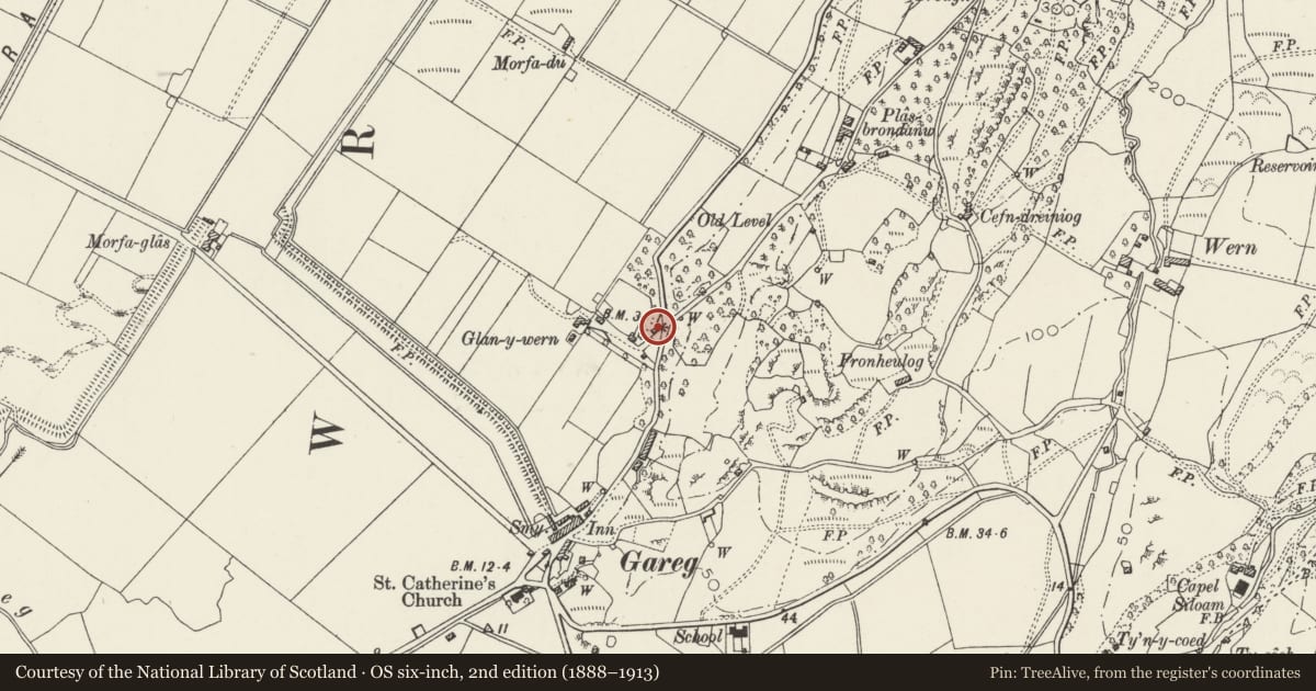
Slide toward Today to fade the historical sheet and see the modern map underneath.
David Rumsey Map Collection, Stanford LibrariesDavid Rumsey Map Collection, Stanford LibrariesDavid Rumsey Map Collection, Stanford LibrariesLlyfrgell Genedlaethol Cymru – The National Library of WalesDavid Rumsey Map Collection, Stanford Libraries
5 historical maps cover this location, the earliest the 1795 map "To Sir Watkin Williams-Wynn Bart ... the map of the six counties of North Wales is most humbly inscribed by his obedient humble servant" (Llyfrgell Genedlaethol Cymru – The National Library of Wales).
Historical maps covering this location
- 1795 · To Sir Watkin Williams-Wynn Bart ... the map of the six counties of North Wales is most… (Llyfrgell Genedlaethol Cymru – The National Library of Wales)
- 1883 · Watershed map England, Wales 3. (David Rumsey Map Collection, Stanford Libraries)
- 1896 · Sheet 7. Ordnance Survey of England and Wales. (David Rumsey Map Collection, Stanford Libraries)
- 1899 · 119 Snowdon (Hills) (David Rumsey Map Collection, Stanford Libraries)
- 1901 · Sheet 9 and 10. (David Rumsey Map Collection, Stanford Libraries)
Cadw's description
Location
Prominently situated at the junction between the A 4085 and the road leading NE to Plas Brondanw and Croesor beyond; opposite the New Lodge.
History
Single-storey vernacular cottage, probably of late C18 origin; minor alterations by Sir Clough Williams-Ellis, architect, owner of the estate from 1908 until his death in 1978.
Exterior
Single-storey vernacular cottage of whitened rubble with old slated roof and tiled ridge; squat square stack with weathercoursing and raised flaunching. Off-centre entrance (R) with boarded door, the upper section with small pane glazing. Flanking late C19 8-pane sliding sash windows in primary openings. To the far L a further, similar window, formerly an entrance. Modern wing at rear with distinctive tall, round stack; this with louvred top.
Interior
This was not inspected at the time of survey.
Reason for designation
Included for its special interest as a late C18 cottage altered by Sir Clough Williams-Ellis, architect, and for its group value with the New Lodge.
Nearby in the register
- The New LodgeDomesticunder 1 mi
- The Look Out including adjoining wallsDomesticunder 1 mi
- No 7 Cyffin TerraceDomesticunder 1 mi
- 6 Cyffin Terrace, A4085Domesticunder 1 mi
Other entries of the same register within about three miles of this one, by straight line.