Cof Cymru: National Historic Assets of Wales · Wales
Lych gate and churchyard wall at Llangelynin church
Llangelynin, Gwynedd, Wales
A Grade II listed building in Llangelynin, Gwynedd, designated on 17 June 1966.
The record
- Designation
- Listed building, Grade II
- Broad class
- Religious, Ritual and Funerary
- Date of designation
- 17 June 1966
- Locality
- Llangelynin
- Community
- Llangelynin
- Unitary authority
- Gwynedd
- Country
- Wales
- Coordinates
- 52.64373, -4.11248
- Cadw reference
- 4752
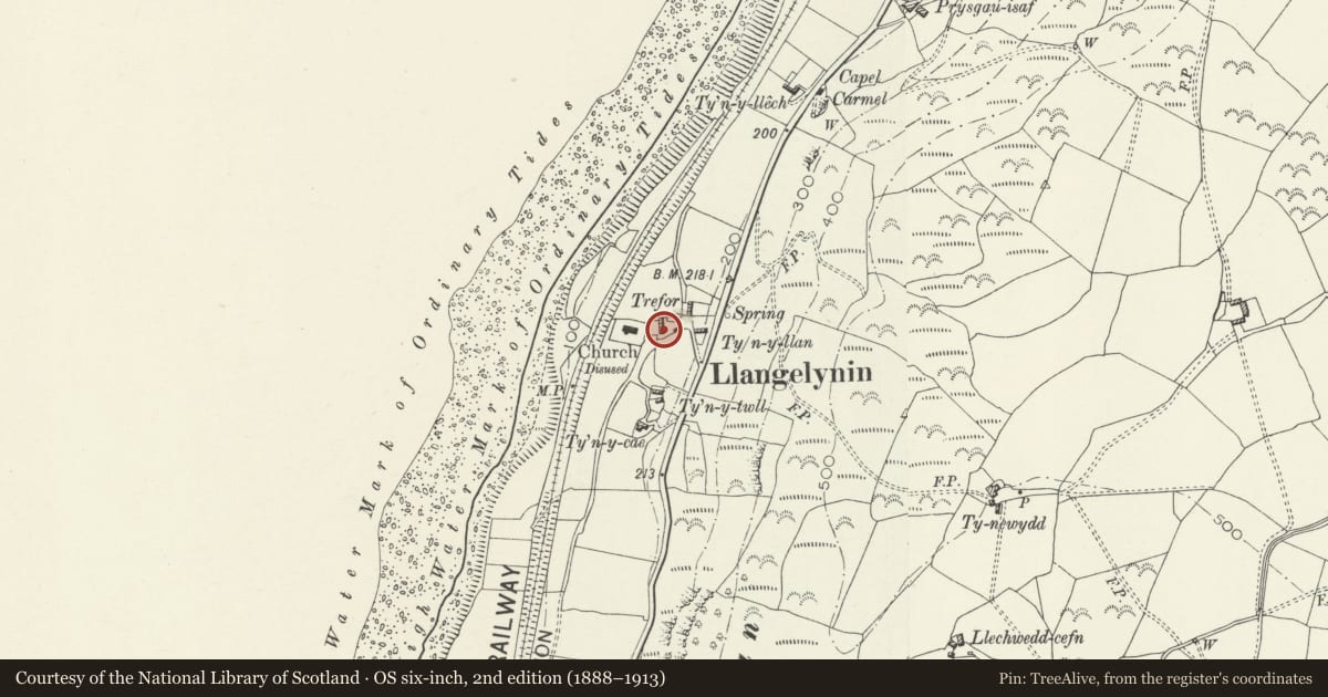
Slide toward Today to fade the historical sheet and see the modern map underneath.
David Rumsey Map Collection, Stanford LibrariesDavid Rumsey Map Collection, Stanford LibrariesLlyfrgell Genedlaethol Cymru – The National Library of WalesDavid Rumsey Map Collection, Stanford LibrariesDavid Rumsey Map Collection, Stanford Libraries
5 historical maps cover this location, the earliest the 1795 map "To Sir Watkin Williams-Wynn Bart ... the map of the six counties of North Wales is most humbly inscribed by his obedient humble servant" (Llyfrgell Genedlaethol Cymru – The National Library of Wales).
Historical maps covering this location
- 1795 · To Sir Watkin Williams-Wynn Bart ... the map of the six counties of North Wales is most… (Llyfrgell Genedlaethol Cymru – The National Library of Wales)
- 1830 · V.3:11-15:XV. Britisches Reich. A. Kon: England. b. Frstenthum Wales: Shire: 37-40 (David Rumsey Map Collection, Stanford Libraries)
- 1883 · Watershed map England, Wales 3. (David Rumsey Map Collection, Stanford Libraries)
- 1896 · Sheet 7. Ordnance Survey of England and Wales. (David Rumsey Map Collection, Stanford Libraries)
- 1901 · Sheet 9 and 10. (David Rumsey Map Collection, Stanford Libraries)
Cadw's description
Location
Enclosing a rectangular churchyard, with lych gate towards the NE corner.
History
An inscribed stone in the gable of the lych gate records the rebuilding of the walls by public subscription in 1884. The lych gate itself, however, is of earlier character and was probably only restored at this time.
Exterior
The churchyard is on a sloping site and has coped rubble walls. On the W side the wall acts as a retaining wall against the steep bank and part of its coping has fallen. The gabled lych gate is of rubble stone with slate roof behind coped gables. Entrances have lintels and on the outer side an iron gate. The interior has a simple timber roof construction, and benches built into side walls.
Reason for designation
Listed for their special historical interest as features of traditional character which are an integral part of the context of the church of St Celynin.
Nearby in the register
- Church of St CelyninReligious, Ritual and Funeraryunder 1 mi
- Milepost on A493No class recordedunder 1 mi
- Milepost on A493No class recordedunder 1 mi
- Felin FraenanNo class recordedunder 1 mi
Other entries of the same register within about three miles of this one, by straight line.