Cof Cymru: National Historic Assets of Wales · Wales
Ice-house NE of Plas Teg
Hope, Flintshire, Wales
A Grade II listed building in Plas Teg, Hope, Flintshire, designated on 8 April 1975.
The record
- Designation
- Listed building, Grade II
- Broad class
- Domestic
- Date of designation
- 8 April 1975
- Locality
- Plas Teg
- Community
- Hope
- Unitary authority
- Flintshire
- Country
- Wales
- Coordinates
- 53.13101, -3.06514
- Cadw reference
- 47
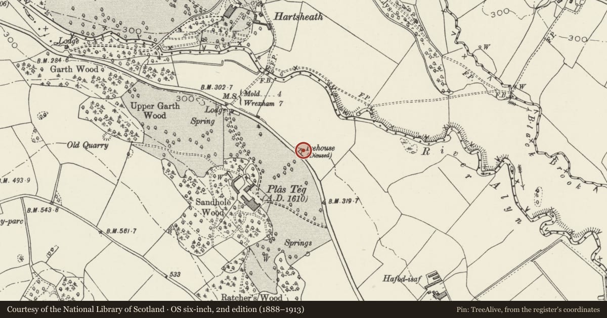
Slide toward Today to fade the historical sheet and see the modern map underneath.
David Rumsey Map Collection, Stanford LibrariesDavid Rumsey Map Collection, Stanford LibrariesDavid Rumsey Map Collection, Stanford LibrariesDavid Rumsey Map Collection, Stanford LibrariesLlyfrgell Genedlaethol Cymru – The National Library of Wales
5 historical maps cover this location, the earliest the 1795 map "To Sir Watkin Williams-Wynn Bart ... the map of the six counties of North Wales is most humbly inscribed by his obedient humble servant" (Llyfrgell Genedlaethol Cymru – The National Library of Wales).
Historical maps covering this location
- 1795 · To Sir Watkin Williams-Wynn Bart ... the map of the six counties of North Wales is most… (Llyfrgell Genedlaethol Cymru – The National Library of Wales)
- 1883 · Watershed map England, Wales 3. (David Rumsey Map Collection, Stanford Libraries)
- 1898 · 108 Flint (Hills) (David Rumsey Map Collection, Stanford Libraries)
- 1898 · 108 Flint (Outline) (David Rumsey Map Collection, Stanford Libraries)
- 1901 · Sheet 9 and 10. (David Rumsey Map Collection, Stanford Libraries)
Cadw's description
Location
Within a small mound immediately NE of, and visible from the main Mold to Wrexham road.
History
Late C18 or early C19 ice-house, built to serve neighbouring Plas Teg. It probably relates to work carried out at the house either by Lady Jane Dacre at the end of the C18, or by Arthur Blayney Trevor-Roper, who is known to have made substantial alterations and improvements to the house in the mid 1820s.
Exterior
Stone-reveted, grass-roofed embankment of irregular shape bounded by the main road on the SW. The walls are of local rubble construction with rough-dressed capping. That on the NE side rises to a central entrance with pointed brick arch; brick-lined, vaulted passage within the embankment, with stone-lined oculus to an inner brick wall at the end. This gives access to the vaulted and brick-lined ice house proper.
Reason for designation
Included for its special interest as a late C18 or early C19 ice-house.
Nearby in the register
- Gazebo at Plas TegGardens, Parks and Urban Spacesunder 1 mi
- Plas TegDomesticunder 1 mi
- Milestone at Plas TegTransportunder 1 mi
- Hartsheath HallDomesticunder 1 mi
Other entries of the same register within about three miles of this one, by straight line.